Zbarż Pond
This article contains translated text and the factual accuracy of the translation should be checked by someone fluent in Polish and English. |
| Staw Zbarski | |
|---|---|
 A view on Staw Zbarski from the south | |
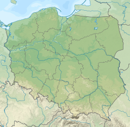
| Location | Warsaw, Poland |
| Coordinates | 52°10′48″N 20°59′00″E / 52.18000°N 20.98333°E |
| Surface area | 0.2727 ha (0.674 acres) |
| Average depth | 0.37 m (1 ft 3 in) |
| Shore length1 | 265 m (869 ft) |
| 1 Shore length is not a well-defined measure. | |
Staw Zbarski is a small pond in Warsaw in the district of Włochy.
Location
[edit]The pond is located to the left of the Vistula, in Warsaw, in the district of Włochy, in the region of osiedle Zbarż, near Wirażowa street. Located in the vicinity of Expressway S79 by an interchange that connects the road with the streets Marynarska and Sasanki.[1]
The document "Program Ochrony Środowiska dla m. st. Warszawy na lata 2009-2012 z uwzględnieniem perspektywy do 2016 r." reports that the pond is located on an eminence and has an area equal to 0.2727 hectares.[2] According to another source, it is 0,25 hectares.[1] The average depth is 0.37 m[3] and the coastline is 265 m.[4] The whole area of a small surrounding park – "Zieleniec ze Stawem Zbarskim" is 0.47 hectares.[2]
The reservoir is probably the only naturally formed on the territory of the district, is located in the relief depression. In the past, was on the territory of the former village Zbarż.[1]
Nature
[edit]On-site of the pond following plant species were detected: Phragmites, Schoenoplectus lacustris, Typha latifolia, Ceratophyllum and Elodea canadensis.[1] In the vicinity of the reservoir there are willows. In a study in 2004 on the territory of the pond and its surroundings mallards were detected.[5]
Staw Zbarski has been restored in 1998.[6]
References
[edit]- ^ a b c d Wojnarowicz, Weseła (2012). Dzielnica Włochy. Parki, zieleńce, zabytki... (PDF) (in Polish). Warszawa: Urząd Dzielnicy Włochy m.st. Warszawa. p. 19. ISBN 978-83-928365-4-4.
- ^ a b "ZAŁĄCZNIK TEKSTOWY I TABELARYCZNY DO PROGRAMU OCHRONY ŚRODOWISKA DLA MIASTA STOŁECZNEGO WARSZAWY na lata 2009–2012 z uwzględnieniem perspektywy do 2016 r." (PDF). bip.warszawa.pl. Rada m.st. Warszawy. 2010-10-21. Retrieved 2016-01-29.
- ^ "Zbiorniki wodne". Urząd Dzielnicy Włochy m. st. Warszawy - Serwis (PL). Retrieved 2016-01-29.
- ^ "Wzór umowy – prace polegające na utrzymanie zbiorników wodnych w Dzielnicy Włochy m. st. Warszawy w latach 2016 – 2017" (PDF). Urząd Dzielnicy Włochy m. st. Warszawy - Serwis (PL). Retrieved 2016-01-29.
- ^ "Opracowanie ekofizjograficzne do studium uwarunkowań i kierunków zagospodarowania przestrzennego m. st. Warszawy - Załącznik nr II.7" (PDF). Biuro Naczelnego Architekta Miasta. 2004. Retrieved 2016-01-29.
- ^ Matulka, Danuta (2009). Warszawskie Włochy. Wczoraj, dziś, jutro (PDF) (in Polish). Warszawa: Urząd Dzielnicy Włochy m.st. Warszawy. p. 27. ISBN 978-83-928365-0-6.

