Zuestoll
Appearance
| Zuestoll | |
|---|---|
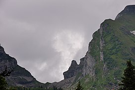
 The Zuestoll (right) seen from the north side | |
| Highest point | |
| Elevation | 2,235 m (7,333 ft) |
| Prominence | 225 m (738 ft)[1] |
| Parent peak | Brisi |
| Geography | |
Lua error in Module:Location_map at line 526: Unable to find the specified location map definition: "Module:Location map/data/Switzerland relief" does not exist.
| |
| Location | St. Gallen, Switzerland |
| Parent range | Appenzell Alps |
The Zuestoll is one of the peaks of the Churfirsten group, located in the Appenzell Alps. It lies between the valley of Toggenburg and Lake Walenstadt in the canton of St. Gallen. The summit is easily accessible by a trail on the northern side.
References
External links
