
Tehov (Prague-East District)
Tehov | |
|---|---|
 Centre of Tehov | |
.svg) Flag  Coat of arms | |
 Tehov Location in the Czech Republic | |
| Coordinates: 49°58′18″N 14°41′38″E / 49.97167°N 14.69389°E | |
| Country | |
| Region | Central Bohemian |
| District | Prague-East |
| First mentioned | 1309 |
| Area | |
| • Total | 8.19 km2 (3.16 sq mi) |
| Elevation | 437 m (1,434 ft) |
| Population (2023-01-01)[1] | |
| • Total | 1,130 |
| • Density | 140/km2 (360/sq mi) |
| Time zone | UTC+1 (CET) |
| • Summer (DST) | UTC+2 (CEST) |
| Postal code | 251 01 |
| Website | www |
Tehov is a municipality and village in Prague-East District in the Central Bohemian Region of the Czech Republic. It has about 1,100 inhabitants.
Geography[edit]
Tehov is located about 13 kilometres (8 mi) southeast of Prague. It lies in the Benešov Uplands. The highest point is at 486 m (1,594 ft) above sea level. The Říčanský Stream springs here and flows to the west.
History[edit]
The first written mention of Tehov is from 1309. There was a castle, founded in the 12th century. In 1547, the castle was already described as abandoned. the villagers gradually dismantled it into building material for their houses. Until 1919, the municipality was named Velký Tehov.[2]
Demographics[edit]
|
|
| ||||||||||||||||||||||||||||||||||||||||||||||||||||||
| Source: Censuses[3][4] | ||||||||||||||||||||||||||||||||||||||||||||||||||||||||
Sights[edit]
The landmark of Tehov is the Church of Saint John the Baptist. It is a Baroque church with the core from the second half of the 14th century. The tower was added in 1779.[5]
Gallery[edit]
-
 Church of Saint John the Baptist
 -
 View of Tehov from a nearby hill
 -
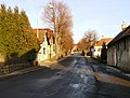 Main street


References[edit]
- ^ "Population of Municipalities – 1 January 2023". Czech Statistical Office. 2023-05-23.
- ^ "Historie a současnost" (in Czech). Obec Tehov. Retrieved 2021-06-19.
- ^ "Historický lexikon obcí České republiky 1869–2011 – Okres Praha-východ" (in Czech). Czech Statistical Office. 2015-12-21. pp. 11–12.
- ^ "Population Census 2021: Population by sex". Public Database. Czech Statistical Office. 2021-03-27.
- ^ "Kostel sv. Jana Křtitele" (in Czech). National Heritage Institute. Retrieved 2023-02-26.
External links[edit]
| Authority control databases: National |
|---|