Eastern Indonesia: Difference between revisions
Tags: Mobile edit Mobile web edit |
Tags: Mobile edit Mobile web edit |
||
| Line 126: | Line 126: | ||
| first = F.A.E. Van |
| first = F.A.E. Van |
||
| url = https://perpusbalarjogja.kemdikbud.go.id/index.php?p=show_detail&id=438 |
| url = https://perpusbalarjogja.kemdikbud.go.id/index.php?p=show_detail&id=438 |
||
| location = |
| location = Leiden |
||
| publisher = |
| publisher = Springer Netherlands |
||
| year = 1935 |
| year = 1935 |
||
| pages = |
| pages = 189 |
||
| ISBN = 9789401510769 |
|||
}} |
}} |
||
<!---->*{{cite book |
<!---->*{{cite book |
||
| Line 143: | Line 144: | ||
| pages = 306 |
| pages = 306 |
||
}} |
}} |
||
<!---->*{{cite book |
|||
| title = Maiden Voyages: Eastern Indonesian Women on the Move |
|||
| language = en |
|||
| trans-title = |
|||
| last = Williams |
|||
| first = Catharina Purwani |
|||
| url = |
|||
| location = Netherlands |
|||
| publisher = Koninklijk Instituut voor Taal-, Land- en Volkenkunde (KITLV) Press |
|||
| year = 2007 |
|||
| pages = 211 |
|||
| ISBN = 9789812303943 |
|||
}} |
|||
{{refend}} |
{{refend}} |
||
Revision as of 19:22, 4 November 2023
This article has multiple issues. Please help improve it or discuss these issues on the talk page. (Learn how and when to remove these template messages)
|
Eastern Indonesia | |
|---|---|
| Indonesia Timur (in Indonesian) | |
|
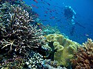
From upper-left to lower-right: Diving experience in Piaynemo Island of Raja Ampat, Clitoria ternatea (the native flower of Ternate Island), Papuan man wearing traditional Papuan attires, Papeda (the staple food of Eastern Indonesia) | |
 Eastern Region of Indonesia | |
| Largest city | Jayapura |
| Provinces | |
| Demonym | Eastern Indonesians |
| Time zone | UTC+9 (Eastern Indonesia Time) |
Eastern Indonesia (or East Indonesia)[1] is one of the three main geographical regions of Indonesia, the other two being Western Indonesia and Central Indonesia. Eastern Indonesia spanned across the Banda and Molucca in the west, Arafura and Timor Sea in the south, and Halmahera Sea in the north. It comprises the archipelagic territory of Tanimbar, Banda, Maluku, Halmahera, Raja Ampat, Biak, and western New Guinea.
It is bordering Southern Philippines in the northwest, Palau in the north, Western Papua New Guinea in the east, and Northern Australia in the south.
Administration
Administratively, the Eastern Indonesia consist of two main geographical units, namely the Maluku Islands and Papua (Western New Guinea).
| ISO 3166-2 Codes | Geographical unit | Provinces | Population (mid-2022)[2] |
Largest city | Highest point |
|---|---|---|---|---|---|
ID-ML
|
Maluku Islands | Maluku and North Maluku | 3,201,000 | Ambon | Mount Binaiya 3,027 m (9,931 ft) |
ID-PP
|
Papua | Central Papua, Highland Papua, Papua, South Papua, Southwest Papua, and West Papua | 5,601,900 | Jayapura | Puncak Jaya 4,884 m (16,024 ft) |
Economy
Growth center
The following are the 4 largest cities in Eastern Indonesia by population:
| No. | City | Province | Population | Image |
|---|---|---|---|---|
| 1. | Kupang | East Nusa Tenggara | 442.758 | 
|
| 2. | Jayapura | Papua | 398.478 | 
|
| 3. | Ambon | Maluku | 347.288 | 
|
| 4. | Sorong | Southwest Papua | 284.410 | 
|
See also
References
- ^ "President Jokowi: East Indonesia Will Be Able to Expand Rapidly, Need Supported by Infrastructure". Cabinet Secretariat of the Republic of Indonesia. 2015.
- ^ Badan Pusat Statistik, Jakarta, 2023.
- ^ Nusa Tenggara
- ^ Maluku
- ^ Western Papua
Bibliography
- Wouden, F.A.E. Van (1935). Types Of Social Structure In Eastern Indonesia (in English and Indonesian). Leiden: Springer Netherlands. p. 189. ISBN 9789401510769.
- Andaya, Leonard Y. (1993). The World of Maluku: Eastern Indonesia in the Early Modern Period. Honolulu: University of Hawaii Press. p. 306.
- Williams, Catharina Purwani (2007). Maiden Voyages: Eastern Indonesian Women on the Move. Netherlands: Koninklijk Instituut voor Taal-, Land- en Volkenkunde (KITLV) Press. p. 211. ISBN 9789812303943.
External links
- "Banda Neira, Paradise in Eastern Indonesia". Ministry of Foreign Affairs Republic of Indonesia. 2021.


