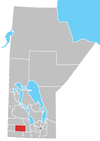
Alexander, Manitoba
For the municipality, see: the Rural Municipality of Alexander
Alexander, Manitoba is an unincorporated community recognized as a local urban district[1] on Highway 1 west of Brandon located in the Rural Municipality of Whitehead.
The post office opened on 10-10-21W as Pulteney in 1882. It became Alexander Station in 1885 and was moved to 17-10-21W and changed to Alexander in 1891. It was made a rail point on the Canadian Pacific Railway in 1882. The community was named for an early settler named Alexander Speers.
The community's closest city is Brandon and their school is part of the Brandon School Division.
Demographics
In the 2021 Census of Population conducted by Statistics Canada, Alexander had a population of 321 living in 119 of its 131 total private dwellings, a change of -3.9% from its 2016 population of 334. With a land area of 1.38 km2 (0.53 sq mi), it had a population density of 232.6/km2 (602.5/sq mi) in 2021.[2]
References
- ^ "Local Urban Districts Regulation". Government of Manitoba. April 23, 2016. Retrieved April 24, 2016.
- ^ "Population and dwelling counts: Canada and designated places". Statistics Canada. February 9, 2022. Retrieved Sep 3, 2022.
- Geographic Names of Manitoba (pg. 7) - the Millennium Bureau of Canada
- Alexander School
49°49′48″N 100°17′43″W / 49.83000°N 100.29528°W

