Berettyóújfalu
Berettyóújfalu | |
|---|---|
 Aerial view of ruins in the town | |
| Country | |
| County | Hajdú-Bihar |
| Area | |
| • Total | 170.98 km2 (66.02 sq mi) |
| Population (2014) | |
| • Total | 15,221 |
| • Density | 94/km2 (240/sq mi) |
| Time zone | UTC+1 (CET) |
| • Summer (DST) | UTC+2 (CEST) |
| Postal code | 4100 |
| Area code | 54 |
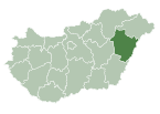
Berettyóújfalu is a town in Hajdú-Bihar county, in center of the Northern Great Plain region of eastern Hungary. It is 40 km south from Debrecen (the second largest city in Hungary), and about 35 km from Oradea (Romania). Berettyóújfalu is named after the river Berettyó.
Geography
It covers an area of 170.98 km2 (66 sq mi) and has a population of 15,221 people (2014).
History
This area has been inhabited since acient times. From the late Bronze Age artifacts found a lot of find in the town area. In the Iron Age one after the other Scythians, Sarmatians, Celts and Huns conquested this area.
After the Hungarian conquest (C.E. 9-10th century) 14-15 villages came to be in this area. In these settlements took place semi-nomad farming. The villages were built on the top of hills, because this area was a swamp. People used boats to travel between the hills. Every settlement had one port, at least.
The center of the villages was named Herpály. The first written mention of the village in the 13th century made the Regestrum Varadi. Herpály was important because a Romanesque monastery what was built in the 12th century. The village and the monastery was destroyed twice. No written records have survived about the monastery after the Mongol invasion (C.E. 1241-1242. in Hungary). But the first half of the 19th century the height of the walls was 8–12 meters (26–32 ft). Each of the two tower stood until a local landowner demolished the north tower, because it was life-threatening. The bricks were offered to the base structure of the Reformed Church's organ.
Herpály had four streets in 1418, according to degree possession of sharing. The village had three pubs: one had guestroom, the others had cellars. The estimated number of villagers less than 300 people.
At the other bank of river Berettyó was a notable village, named Berettyószentmárton. It was a custom and tow place. In 1481 King Matthias Corvinus donated right to hold markets for the settlement.
Herpály lamentable chronicle began in 1658, when Crimean Tatars burned the Berettyó-valley. The settlements was not completely destroyed, but Invasion Szejdi in 1660 certainly dispels the residents here.
Lord Gábor Báthory gave privilege for Berettyóújfalu on 23 May 1608, but it lost the privilege in that century.
International relations
Twin towns — Sister cities
Berettyóújfalu is twinned with:
 Marghita, Romania
 Porcia, Italy
 Montegrotto Terme, Italy
 Vyshny Volochyok, Russia
External links
47°13′N 21°33′E / 47.217°N 21.550°E


