
Birtara Union
Birtara Union
বীরতারা ইউনিয়ন 1238 | |
|---|---|
 Birtara Union Location of Birtara in Bangladesh | |
| Coordinates: 24°42′21″N 89°54′23″E / 24.7057°N 89.9063°E | |
| Country | Bangladesh |
| Division | Dhaka Division |
| District | Tangail District |
| Upazila | Dhanbari Upazila |
| Established on | 1984 |
| Government | |
| • Type | Union Council |
| • Chairman | Ahammad Al Farid(Bangladesh Awami League) [1] |
| Area | |
| • Total | 13.21 km2 (5.10 sq mi) |
| Elevation | 17 m (56 ft) |
| Population (2011) | |
| • Total | 18,481 |
| • Density | 1,400/km2 (3,600/sq mi) |
| Time zone | UTC+6 (BST) |
| Postal code | 1997 |
| Website | birtaraup |
Birtara Union (Bengali: বীরতারা ইউনিয়ন) is a union of Dhanbari Upazila, Tangail District, Bangladesh. It is situated 66 km north of Tangail. Birtara Union Code - 1238.
Last Updated by rafi sat,mar26 2022
Gallery
-
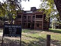
 Union Complex
 -
 Union health Complex


Demographics
According to Population Census 2011 performed by Bangladesh Bureau of Statistics, The total population of Birtara union is 18481. There are 4849 households in total.[2]
Education
There are two secondary schools in the union: Bajitpur Amir Hossain High School and Kendua High School.[3]
The literacy rate of Birtara Union is 39.9% (Male-42.7%, Female-37.3%).[4]
See also
- Birtara
- Balasoti
- Rajarhat
- Kathaliabari
- Kendua Bazar
- Kadamtali
- Patadoho
- Bajitpur
- Union Councils of Tangail District
References
- ^ http://www.newspapers71.com/167989/%E0%A6%A7%E0%A6%A8%E0%A6%AC%E0%A6%BE%E0%A7%9C%E0%A6%BF%E0%A6%A4%E0%A7%87%20%E0%A6%86.%E0%A6%B2%E0%A7%80%E0%A6%97%20%E0%A7%AA%2C%20%E0%A6%AC%E0%A6%BF%E0%A6%A6%E0%A7%8D%E0%A6%B0%E0%A7%8B%E0%A6%B9%E0%A7%80%20%E0%A7%A9%20%E0%A6%9C%E0%A7%9F%E0%A7%80
- ^ "Tangail Table C-01 : Area, Households, Population, Density by Residence and Community" (PDF). bbs.gov.bd. Archived from the original (PDF) on 2014-11-13. Retrieved 2016-03-01.
- ^ "List of Secondary Schools" (PDF). Department of Secondary and Higher Education. Retrieved 12 November 2021.
- ^ "Tangail : C06 : Distribution of Population aged 7 years and above by Literacy, Sex, Residence and Community" (PDF). bbs.gov.bd. Archived from the original (PDF) on 2014-11-13. Retrieved 2016-02-25.
This Dhaka Division location article is a stub. You can help Wikipedia by expanding it. |