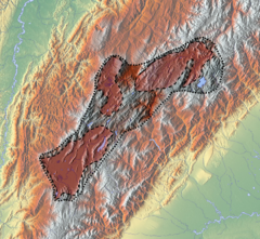
Chicamocha River
Appearance
| Chicamocha River | |
|---|---|
 Chicamocha River in its canyon | |
| Location | |
| Country | Colombia |
| Physical characteristics | |
| Source | |
| • location | Tuta, Boyacá |
| • coordinates | 5°42′N 73°14′W / 5.700°N 73.233°W |
| • elevation | 2,600 m (8,500 ft) |
| Mouth | |
• location | Sogamoso River |
• elevation | 700 m (2,300 ft) |
| Length | 400 km (250 mi) |
| Basin features | |
| Progression | Sogamoso-Magdalena-Caribbean |
| River system | Magdalena |
| Landmarks | Chicamocha Canyon |
Chicamocha River is a river of Boyacá and Santander in central-eastern Colombia. It is part of the Magdalena river system that flows into the Caribbean Sea.
Chicamocha River originates in the municipality of Tuta in the department of Boyacá, flows through the department of Santander and joins the Suárez and Fonce Rivers to form the Sogamoso River.
PANACHI national park
The Chicamocha Canyon is a national park (PANACHI; PArque NAcional de CHIcamocha) and major tourist destination in Colombia. It was preselected for the election of natural wonders of the world.[1]
Gallery
-
Alto Chicamocha; Paipa, Duitama, Sogamoso
-
Course of the Chicamocha River through its canyon
-
Chicamocha River, Panachi
See also
References
- ^ (in Spanish) «El cañón del Chicamocha fue preseleccionado en el concurso de maravillas naturales del planeta» - El Tiempo - accessed 19-04-2016
External links
- Elections 7 new natural wonders of the world
- Satellite photo of the Chicamocha Canyon, Pescadero sectorWikiMapia
- (in Spanish) Albesiano, Sofía y J. Orlando Rangel-Ch. 2003. La vegetación del cañón del río Chicamocha (Santander, Colombia). Caldasia, 25(1):73-99


