Damascus, Pennsylvania
Appearance
Damascus, Pennsylvania | |
|---|---|
| Village of Damascus | |
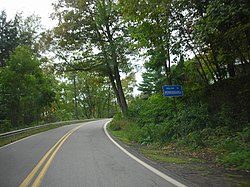
 "Welcome to Pennsylvania" sign on Pennsylvania Route 371 in Damascus. | |
| Nickname: Shields Mills[1] (historical) | |
| Coordinates: 41°42′11.3184″N 75°4′5.6064″W / 41.703144000°N 75.068224000°W | |
| Country | United States |
| State | Pennsylvania |
| County | Wayne
|
| Congressional district | PA-10 |
| School district | Wayne Highlands Region I |
| Magisterial District | 22-3-04[2] |
| Township | Damascus |
| Named for | Damascus, Syria[3] |
| Elevation | 735[4] ft (224 m) |
| Time zone | UTC-5 (Eastern (EST)) |
| • Summer (DST) | UTC-4 (Eastern Daylight (EDT)) |
| ZIP code | 18415[5] |
| Area code(s) | 570 and 272 |
| GNIS feature ID | 1172912[4] |
| FIPS code | 42-127-18104 [6] |
| Major Roads | |
| Waterways | Beaverdam Creek,[7] Delaware River |
Damascus is a village in Damascus Township, Wayne County, Pennsylvania, United States. The Damascus-Cochecton Bridge connects the town with Cochecton, New York across the Delaware River. The bridge is often used by smugglers of fireworks, legal in Pennsylvania but illegal in New York State, in the run-up to the Independence Day holiday, in which observance fireworks are used extensively.
History
[edit]The Damascus Post Office has been in operation since January 24, 1824.[8]
References
[edit]- ^ Mathews, Alfred (1886). History of Wayne, Pike, and Monroe Counties, Pennsylvania. Philadelphia: R. T. Peck & Company. p. 458. Retrieved December 4, 2014.
- ^ "District Magistrate". Wayne County, PA. Wayne County Courthouse. 2014. Archived from the original on November 27, 2014. Retrieved November 14, 2014.
- ^ Herschell, Don (September 22, 1995). "Why name your town Ninevah?". Observer-Reporter. Washington and Greene Counties, Pennsylvania. p. B5. Retrieved May 24, 2015.
- ^ a b "Damascus". Geographic Names Information System. United States Geological Survey, United States Department of the Interior. August 2, 1979. Retrieved May 24, 2015.
- ^ "Look up a ZIP Code". USPS.COM. USPS. 2015. Retrieved May 24, 2015.
- ^ "Census Demographic Profiles, Damascus Township" (PDF). U.S. Census Bureau. Census 2000. Archived (PDF) from the original on January 13, 2016. Retrieved May 24, 2015.
- ^ "Beaverdam Creek". Geographic Names Information System. United States Geological Survey. August 2, 1979. Retrieved May 24, 2015.
- ^ "Postmaster Finder Post Offices by County". United States Postal Service. USPS. 2015. Retrieved May 24, 2015.


