
Duncan, Oklahoma: Difference between revisions
m missing . |
|||
| Line 80: | Line 80: | ||
==Geography== |
==Geography== |
||
AKA HELL |
|||
Duncan is located at {{coord|34|31|0|N|97|56|58|W|city}} (34.516619, -97.949377).{{GR|1}} The town is situated approximately 30 miles East of [[Lawton, Oklahoma]] and 90 miles Southwest of [[Oklahoma City, Oklahoma]] along US Highway 81. |
Duncan is located at {{coord|34|31|0|N|97|56|58|W|city}} (34.516619, -97.949377).{{GR|1}} The town is situated approximately 30 miles East of [[Lawton, Oklahoma]] and 90 miles Southwest of [[Oklahoma City, Oklahoma]] along US Highway 81. |
||
Revision as of 18:16, 14 September 2009
Duncan, Oklahoma | |
|---|---|
 | |
 Location of Duncan, Oklahoma | |
| Country | United States |
| State | Oklahoma |
| County | Stephens |
| Area | |
| • Total | 46.0 sq mi (119.1 km2) |
| • Land | 38.8 sq mi (100.5 km2) |
| • Water | 7.2 sq mi (18.7 km2) |
| Elevation | 1,122 ft (342 m) |
| Population (2000) | |
| • Total | 22,505 |
| • Density | 580.2/sq mi (224.0/km2) |
| Time zone | UTC-6 (Central (CST)) |
| • Summer (DST) | UTC-5 (CDT) |
| ZIP codes | 73533-73599 |
| Area code | 580 |
| FIPS code | 40-21900Template:GR |
| GNIS feature ID | 1092291Template:GR |
Duncan is a city in Stephens County, Oklahoma, United States. The population was 22,505 at the 2000 census. It is the county seat of Stephens County.Template:GR
Geography
AKA HELL
Duncan is located at 34°31′0″N 97°56′58″W / 34.51667°N 97.94944°WInvalid arguments have been passed to the {{#coordinates:}} function (34.516619, -97.949377).Template:GR The town is situated approximately 30 miles East of Lawton, Oklahoma and 90 miles Southwest of Oklahoma City, Oklahoma along US Highway 81.
According to the United States Census Bureau, the city has a total area of 119.1 km² (46.0 mi²). 100.5 km² (38.8 mi²) of it is land and 18.7 km² (7.2 mi²) of it (15.67%) is water.
History

The Chisholm Trail passed to the east of Duncan prior to the town's founding. An estimated 9,800,000 Longhorn cattle were herded up the trail between Texas and Abilene, Kansas during its existence. After learning that an extension of the Chicago, Rock Island and Pacific Railroad was being built from Kansas to Texas, Scotsman William Duncan brought his wife, parents, and other relatives and created a trading post situated at the intersection of the north-south Chisholm Trail and the east-west military passage between Fort Arbuckle and Fort Sill. The first train arrived on June 27, 1892; that date is considered the official birthdate of the town.
Centrally located in Stephens County, Duncan was made the county seat in the first years of the 20th Century. As a compromise between residents of the northern and southern parts of the county, the county courthouse was located in the middle of Duncan's Main Street, half of it in the northern part of the city and county and half in the southern. Main Street made a wide circle around it on both ends.
Duncan once adopted the slogan, "The Buckle on the Oil Belt." Its main claim to fame is as the birthplace of the Halliburton Corporation. Erle P. Halliburton perfected a new method of cementing wells, making oil production much easier and more profitable, and established the New Method Oil Well Cementing Company in 1919. He died in 1957, at which time the company had 201 offices in 22 states and 20 foreign countries. Halliburton maintains seven different complexes in Duncan plus an employee recreational park, but the corporate offices relocated first to Dallas and later to Houston.
Demographics
As of the census of 2000, there were 22,505 people, 9,406 households, and 6,424 families residing in the city. The population density was 224.0/km² (580.2/mi²). There were 10,795 housing units at an average density of 107.4/km² (278.3/mi²). The racial makeup of the city was 90.48% White, 1.07% African American, 2.95% Native American, 0.47% Asian, 0.04% Pacific Islander, 2.36% from other races, and 2.63% from two or more races. Hispanic or Latino of any race were 5.99% of the population.
There were 9,406 households out of which 28.8% had children under the age of 18 living with them, 54.6% were married couples living together, 10.4% had a female householder with no husband present, and 31.7% were non-families. 28.9% of all households were made up of individuals and 14.7% had someone living alone who was 65 years of age or older. The average household size was 2.35 and the average family size was 2.88.
In the city the population was spread out with 24.1% under the age of 18, 8.3% from 18 to 24, 24.8% from 25 to 44, 22.6% from 45 to 64, and 20.2% who were 65 years of age or older. The median age was 40 years. For every 100 females there were 89.8 males. For every 100 females age 18 and over, there were 85.3 males.
The median income for a household in the city was $30,373, and the median income for a family was $37,080. Males had a median income of $31,173 versus $19,731 for females. The per capita income for the city was $17,643. About 28.7% of families and 27.4% of the population were below the poverty line, including 22.1% of those under age 18 and 42.8% of those age 65 or over. Duncan, with its neighboring towns and their distances.
Crape Myrtle Capital of Oklahoma

On February 27, 2008, Rep. Dennis Johnson, Sen. Anthony Sykes, and Lt. Gov. Jari Askins were on hand with Sec. of State Susan Savage as she signed the Senate Concurrent Resolution 44, which designated Duncan as Oklahoma’s official Crapemyrtle Capital.
Education
- Red River Technology Center is located in Duncan.
- Cameron University also has a branch in Duncan.
- Duncan Public Schools
Notable residents
- Ann Simmons Alspaugh (c1935- ) - Civic Leader
- Jari Askins (1953- ) - Oklahoma State Representative; Lt. Governor of Oklahoma
- Hoyt Axton (1938-1999) - County Music Singer-Songwriter
- Brett Flynn ( - ) - Film Producer
- Erle P. Halliburton (1892-1957) - Founder, Halliburton Oil Well Cementing Company
- Jean Speegle Howard (1927-2000) - Actress
- Ron Howard (1954- ) - Actor, Director, Producer
- Jeane Kirkpatrick (1926-2006) - United States Ambassador to the United Nations
References
External links
Municipalities and communities of Stephens County, Oklahoma, United States | ||
|---|---|---|
| Cities | 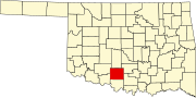 | |
| Towns | ||
| CDP | ||
| Other communities | ||
| Ghost town | ||
| Indian reservation | ||
| Footnotes | ‡This populated place also has portions in an adjacent county or counties | |