
Fair Play, South Carolina
Fair Play | |
|---|---|
 Location in Oconee County and the state of South Carolina. | |
| Coordinates: 34°30′40″N 82°59′08″W / 34.51111°N 82.98556°W | |
| Country | United States |
| State | South Carolina |
| County | Oconee, Anderson |
| Area | |
| • Total | 6.79 sq mi (17.59 km2) |
| • Land | 6.77 sq mi (17.53 km2) |
| • Water | 0.02 sq mi (0.06 km2) |
| Elevation | 781 ft (238 m) |
| Population | |
| • Total | 704 |
| • Density | 104.02/sq mi (40.16/km2) |
| Time zone | UTC-5 (Eastern (EST)) |
| • Summer (DST) | UTC-4 (EDT) |
| ZIP codes | 29643 |
| FIPS code | 45-24730 |
| GNIS feature ID | 2584531[2] |
Fair Play is a census-designated place located in Oconee County in the U.S. state of South Carolina. A small portion of the CDP extends into Anderson County. As of the 2020 census, the population of Fair Play was 704.[4]
According to tradition, the name stems from an incident in which a bystander implored two brawling pioneers to "play fair".[5]
Geography[edit]
Fair Play is located in the southern corner of Oconee County, which occupies the northwestern corner of South Carolina. The CDP extends from the town center south to Lake Hartwell, a large reservoir on the South Carolina–Georgia line. Interstate 85 passes through the CDP, with access via exits 2 and 4. Greenville, South Carolina, is 44 miles (71 km) to the northeast, and Atlanta, Georgia, is 100 miles (160 km) to the southwest.
Demographics[edit]
As of the 2020 US Census, the population of the area is 704.
References[edit]
- ^ "ArcGIS REST Services Directory". United States Census Bureau. Retrieved October 15, 2022.
- ^ a b U.S. Geological Survey Geographic Names Information System: Fair Play, South Carolina
- ^ "Census Population API". United States Census Bureau. Retrieved October 15, 2022.
- ^ "Geographic Identifiers: 2010 Demographic Profile Data (G001): Fair Play CDP, South Carolina". U.S. Census Bureau, American Factfinder. Archived from the original on February 12, 2020. Retrieved August 8, 2013.
- ^ Moyer, Armond; Moyer, Winifred (1958). The origins of unusual place-names. Keystone Pub. Associates. p. 48.
Municipalities and communities of Oconee County, South Carolina, United States | ||
|---|---|---|
| Cities |  | |
| Towns | ||
| CDPs | ||
| Other communities | ||
| Ghost towns | ||
Municipalities and communities of Anderson County, South Carolina, United States | ||
|---|---|---|
| Cities | 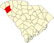 | |
| Towns | ||
| CDPs | ||
| Other communities | ||
| Footnotes | ‡This populated place also has portions in an adjacent county or counties | |
This South Carolina state location article is a stub. You can help Wikipedia by expanding it. |