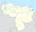
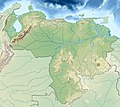
File:Venezuela relief location map (+claimed).jpg
Appearance

Size of this preview: 747 × 600 pixels. Other resolutions: 299 × 240 pixels | 598 × 480 pixels | 957 × 768 pixels | 1,276 × 1,024 pixels | 1,861 × 1,494 pixels.
Original file (1,861 × 1,494 pixels, file size: 538 KB, MIME type: image/jpeg)
File history
Click on a date/time to view the file as it appeared at that time.
| Date/Time | Thumbnail | Dimensions | User | Comment | |
|---|---|---|---|---|---|
| current | 11:42, 27 July 2013 |  | 1,861 × 1,494 (538 KB) | Milenioscuro | User created page with UploadWizard |
File usage
More than 100 pages use this file. The following list shows the first 100 pages that use this file only. A full list is available.
- "Cochranella" duidaeana
- "Cochranella" riveroi
- 1812 Caracas earthquake
- 1967 Caracas earthquake
- 1997 Cariaco earthquake
- Amacuro River
- Angel Falls
- Anomaloglossus breweri
- Anomaloglossus parkerae
- Anomaloglossus rufulus
- Anomaloglossus tamacuarensis
- Anomaloglossus triunfo
- Anomaloglossus wothuja
- Apón Formation
- Apón River
- Arauca River
- Aroa River (Venezuela)
- Atelopus vogli
- Auyán-tepui
- Barima River
- Canaima National Park
- Capanaparo River
- Caracas
- Cariaco Basin
- Caruachi Dam
- Carúpano
- Castillo Formation, Venezuela
- Caura River (Venezuela)
- Caño Manamo
- Cerro Marahuaca
- Cerro Pintado
- Cerro Tristeza
- Cerro de la Neblina
- Ceuthomantis cavernibardus
- Coche Island
- Coro Synagogue
- Cueva de la Quebrada del Toro
- Cueva del Guácharo National Park
- Cunucunuma River
- Dischidodactylus colonnelloi
- Dischidodactylus duidensis
- El Ávila National Park
- Escalante River (Venezuela)
- Gran Roque
- Guayana Region, Venezuela
- Guri Dam
- Henri Pittier National Park
- Hueque River
- Imataka Mountains
- Kettle Mucubají
- Kukenán-tepui
- La Guaira Bank
- La Quinta Formation
- Lake Maracaibo
- Lake Valencia (Venezuela)
- Llano del Hato National Astronomical Observatory
- Los Roques Archipelago
- Macagua Dam
- Maracaibo Basin
- Meta River
- Mochima National Park
- Monte Duida tree frog
- Morrocoy National Park
- Motatán River
- Mount Roraima
- Médanos de Coro National Park
- Orinoco
- Padamo River
- Palmar River
- Paragua River
- Parima Tapirapecó National Park
- Pico Bolívar
- Pico El Águila
- Pico Naiguatá
- Piedra del Cocuy
- Pristimantis avius
- Pristimantis cantitans
- Pristimantis memorans
- Pristimantis pruinatus
- Pristimantis yaviensis
- San Esteban National Park
- San Tomé Airport
- Santa Bárbara Airlines Flight 518
- Sierra Nevada National Park (Venezuela)
- Simón Bolívar International Airport (Venezuela)
- Stefania breweri
- Stefania riae
- Stefania tamacuarina
- Tetas de María Guevara
- Tocoma Dam
- Tocuyo River
- Unare River
- University City of Caracas
- Upuigma-tepui
- Uribante River
- Venezuela Open
- Ventuari River
- Williamson's marsupial frog
- Template:Infobox waterfall
- Template:Infobox waterfall/doc
View more links to this file.
Global file usage
The following other wikis use this file:
- Usage on ar.wikipedia.org
- Usage on ast.wikipedia.org
- Usage on ban.wikipedia.org
- Usage on bg.wikipedia.org
- Ориноко
- Анхел
- Каракас
- Маракайбо (езеро)
- Маракайбо
- Маргарита (остров)
- Валенсия (Венецуела)
- Баркисимето
- Мерида (Венецуела)
- Маракай
- Сан Кристобал (Тачира)
- Баринас
- Барселона (Венецуела)
- Матурин
- Тепуи
- Шаблон:ПК Венецуела
- Сиудад Гуаяна
- Сиудад Боливар
- Сиера Пакарайма
- Иматака
- Канайма (парк)
- Турмеро
- Сера до Имери
- Лос Текес
- Кумана
- Пуерто Ла Крус
- Кабимас
- Гуатире
- Куа
- Гуаренас
- Сабанета
- Генерал Рафаел Урданета (мост)
- Чараяве
- Боливар (връх)
- Майкетия
- Кордилера де ла Коста (Венецуела)
- Гуайра
- Кордилера де Мерида
- Каура (река)
- Апуре (река)
- Араука (река)
- Касикияре
- Валенсия (езеро)
- Парагуана
- Пария (полуостров)
View more global usage of this file.


