Jump to content

Flags of Istria

From Wikipedia, the free encyclopedia

This is an old revision of this page, as edited by WikiCleanerBot (talk | contribs) at 09:22, 3 January 2022 (v2.04b - Bot T19 CW#25 - Fix errors for CW project (Heading hierarchy)). The present address (URL) is a permanent link to this revision, which may differ significantly from the current revision.

Flag of Istria County since 2002

Istria is the largest peninsula within the Adriatic Sea. The peninsula is located at the head of the Adriatic between the Gulf of Trieste and the Kvarner Gulf. It is shared by three countries: Croatia, Slovenia, and Italy. Croatia encapsulates most of the Istrian peninsula with its Istria County.

Historical flags

Flag Date Use Description
1994 – 2002 Flag of Istria County Never used
1849 – 1918 Flag of Margraviate of Istria Three equal horizontal fields, yellow on the top, red in the middle and blue on the bottom.

Yugoslav period

Flag Date Use
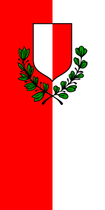
1969 – 1993 Flag of Pula Municipality
1976 – 1993 Flag of Buje Municipality

Flags of cities and municipalities

Cities in Croatian Istria

Flag Date Use County
1993 – present Flag of Buje - Buie Istria County
1993 – present Flag of Buzet Istria County
1995 – present Flag of Novigrad - Cittanova Istria County
1993 – present Flag of Labin Istria County
1998 – present Flag of Opatija Primorje-Gorski Kotar County
1993 – present Flag of Poreč - Parenzo Istria County
1994 – present Flag of Pazin Istria County
1993 – present Flag of Pula - Pola Istria County
1996 – present Flag of Rovinj - Rovigno Istria County
1993 – present Flag of Umag - Umago Istria County
1995 – present Flag of Vodnjan - Dignano Istria County

Slovenia

Flag Date Use Region
1997 - present Flag of Koper Slovene Istria

Italy

Flag Date Use Region
Unknown Flag of Muggia Friuli-Venezia Giulia

References