
Iola, Kansas
City of Iola | |
|---|---|
 Location of Iola in Kansas | |
| Country | United States |
| State | Kansas |
| County | Allen |
| Area | |
| • Total | 4.2 sq mi (10.9 km2) |
| • Land | 4.2 sq mi (10.9 km2) |
| • Water | 0.0 sq mi (0.0 km2) |
| Elevation | 971 ft (296 m) |
| Population (2006) | |
| • Total | 5,966 |
| • Density | 1,417/sq mi (547.2/km2) |
| Time zone | UTC-6 (Central (CST)) |
| • Summer (DST) | UTC-5 (CDT) |
| ZIP code | 66749 |
| Area code | 620 |
| FIPS code | 20-34300 Template:GR |
| GNIS feature ID | 0474498 Template:GR |
Iola is a city situated along the Neosho River in the northwestern part of Allen County, located in southeast Kansas, in the Central United States. The population was 6,302 at the 2000 census, and it was estimated to be 5,966 in the year 2006.[1] Iola is the county seat and most populous city of Allen County. It is named in honor of Iola Colborn.
Iola is famous for its very large courthouse square.
History
The history of Iola begins with the year 1859. After the location of the county seat at Humboldt, by the legislature of 1858, there was a great deal of dissatisfaction among the residents of the central and northern parts of the county, and a number of citizens selected the present site of Iola, with the intention of ultimately securing the county capital. On January 1, 1859, a large meeting was held at the Deer Creek schoolhouse. It was determined to organize a town company, which was immediately done, and a constitution was then adopted and officers elected. The officers of the company after due consideration of different points selected a site for the proposed town, about two miles north of Cofachique, at the confluence of Elm Creek and the Neosho River. The site was owned in part by J.F. Colborn and W.H. Cochrane. The claims on two quarter-sections were bought, and were soon after surveyed into lots.
The town company worked hard to get the town started. A meeting was held to choose a name. Several were proposed, and the choice was determined by ballot. Some one had proposed the name Iola, which was the Christian name of the wife of J.F. Colborn. As a result of the vote, this name was chosen. Meetings of the company were held every week during the first year and efforts made to induce settlement. By the close of the year a number of lots had been disposed of, several buildings erected, and other improvements made, as all who bought lots were required to make some improvements at once. The residents of Cofachique despairing of making their town a success, joined with Iola, and most of them moved to the new site, all working together in the endeavor to secure the location of the county seat at once.
The first building on the town site was a small log cabin owned by D.B. Bayne. He, afterwards, late in 1859, built a frame house addition to it. The first building erected after the town was surveyed was a dwelling completed early in June, 1859, by J.F. Colborn, who had lived on the claim of which the town site formed a part, since 1857. On the completion of the house, Colborn and his family moved into it, thus being the first settlers in the town of Iola. The first birth in Iola was that of Luella E. Colborn.
During the year 1859, two stores were established by Aaron Case and James Faulkner, who had moved their buildings and goods from the old town of Cofachique, and the first hotel was opened. The post office for the neighborhood had previously been at Cofachique, and Aaron Case was Postmaster, but in October 1859, the office was removed to Iola, Case still being Postmaster, though James Faulkner attended to it, as his deputy, until he was appointed to the office a short time after. In 1860, a number of buildings were erected, and the population increased to about 150. Two more stores were opened—a dry goods store, by D.B. Bayne, and a grocery, by J.M. Cowan.
On March 26, 1860, an election was held on the re-location of the county seat, but the majority of votes were cast to keep the county seat in Humboldt. People were still dissatisfied, and for several years thereafter the county seat question entered largely into every political campaign. Much strife and bitterness of feeling was thus engendered between the two sections of the county, and harsh accusations and recriminations were the order of the day. After the strife had been kept up for a number of years, an election was again ordered, to take place on May 19, 1865. Having secured a majority of the votes, Iola was declared the county seat, and the records and county offices removed there at once, since which time it has remained.
City improvements in 1860 were nearly all made in the spring and early summer. In the latter part of the year the effects of the drought were so badly felt, in addition to failing to secure the county seat, that business became very dull, and for a time all of the citizens were much discouraged. In 1861 the war broke out, and as nearly every able-bodied man in Iola, as well as the county, had entered the army there was no chance for improvement; and until the close of the war, in 1865, the town grew to be no larger than it was in 1860. In 1865, after the return of the citizens from the army at the close of the war, the town began to improve steadily, and so continued until the year 1870, at which time (in March) it was incorporated as a city of the third class, and having secured the Leavenworth, Lawrence and Galveston Railroad, rapid strides were made for the next two years in the improvement of the town. Several manufacturing establishments were in project, and some of them were built.
Among other heavy institutions at that time, was the King Bridge Manufacturing Company, which located the Bridge shops at Iola, in 1871. For some time large numbers of men were employed, and a heavy business was done. But with the monetary panic of 1873, the value of bonds so depreciated that the company failed, and removed their machinery. They received bonds in payment, generally, for their bridges and work, and for this reason the "crash" ruined them. The buildings and several acres of land on which they were located were sold at Sheriff's sale for $1,100, being purchased by several citizens of Iola. The early journal of the city disappeared during the trouble with the King Iron Bridge Company, relative to the payment of the city bonds voted to that company, which caused some trouble regarding the legality of some of the ordinances and acts said to have been enacted by the first City Council. During a period, from 1873 to 1876, business in all branches was very dull, and little improvement in the town was made.
The Allen County Courant was the first paper published at Iola, and was established January 5, 1867, by W.H. Johnson. July 27, 1868, Messrs. Talcott & Acers purchased it, and the name of the paper was changed to the Neosho Valley Register. In the following years the ownership of the paper changed five times and was briefly renamed Kansas State Register—between August 24 and December 10, 1870. On January 1, 1875, W.G. Allison & H.W. Perkins took charge and changed the paper's name to the Iola Register. The paper remained Republican under each of these different names and proprietorships.
When the county seat was located at Iola, the town company donated 100 lots to the county, to aid in the construction of public buildings. In July, 1866, bonds were voted to help raise the necessary funds, and not long after a building was purchased of George J. Eldridge, and used for county offices and all court house purposes. In 1877 a new court house, built of stone, was purchased for $1,800, and the old one was sold to the school district to use for a schoolhouse, for $500. The school was kept in two buildings, one the large two-story stone structure erected in 1868, and having an imposing appearance with its twin towers. The other building was a two-story frame, and situated just south of the stone schoolhouse.
The jail, a strong stone structure, was built at a cost of $10,000, in county bonds, which were voted in August, 1868. The next year the building was erected by White & Hays, at a contract price of $8,400.
In November, 1871, a tax of $5,000 was voted, to purchase and fit up a poor-farm. On February 12, 1872, a tract of land comprising 175 acres was purchased of David Funkhouser, for $26 per acre, and J.W. Driscoll was appointed keeper of the poor-farm.
An economic boom from natural gas began around 1895 and resulted in a surge in population and industry. In 1910, the population was 9,032.
Geography
Iola is located at 37°55′22″N 95°24′1″W / 37.92278°N 95.40028°WInvalid arguments have been passed to the {{#coordinates:}} function (37.922651, -95.400367).Template:GR The city is situated along the eastern bank of the Neosho River between Deer Creek, to the north, and Rock Creek, to the south, with Coon Creek flowing through the city. Important natural gas fields are in the vicinity. U.S. Route 54 passes through Iola along Madison Street and interchanges with U.S. Route 169 which passes by the east side of the city. The smaller cities of Gas and La Harpe are a few miles to the east (along US-54). The tiny city of Bassett lies adjacent to Iola's southern border, and the city of Humboldt is about 7 miles to the south (along US-169).
According to the United States Census Bureau, the city has a total area of 4.2 square miles (10.9 km²), of which only 0.17% is water.Template:GR
Demographics
Iola's population was estimated to be 5,966 in the year 2006, a decrease of 330, or -5.2%, over the previous six years.[1]
As of the U.S. Census in 2000,Template:GR there were 6,302 people, 2,590 households, and 1,590 families residing in the city. The population density was 1,497.0 people per square mile (578.0/km²). There were 2,885 housing units at an average density of 685.3/sq mi (264.6/km²). The racial makeup of the city was 93.72% White, 2.82% African American, 0.70% Native American, 0.22% Asian, 0.73% from other races, and 1.81% from two or more races. Hispanic or Latino of any race were 1.81% of the population.
There were 2,590 households out of which 29.5% had children under the age of 18 living with them, 45.3% were married couples living together, 11.8% had a female householder with no husband present, and 38.6% were non-families. 33.5% of all households were made up of individuals and 16.1% had someone living alone who was 65 years of age or older. The average household size was 2.33 and the average family size was 2.96.
In the city the population was spread out with 25.5% under the age of 18, 12.2% from 18 to 24, 23.9% from 25 to 44, 20.4% from 45 to 64, and 18.1% who were 65 years of age or older. The median age was 36 years. For every 100 females there were 88.4 males. For every 100 females age 18 and over, there were 83.2 males.
The median income for a household in the city was $29,219, and the median income for a family was $37,795. Males had a median income of $26,407 versus $19,407 for females. The per capita income for the city was $14,741. About 14.0% of families and 18.6% of the population were below the poverty line, including 26.1% of those under age 18 and 12.0% of those age 65 or over.
Education
Unified school districts
- Iola USD 257 (Web site), home of the 2006 Kansas 4A Girls State Basketball Champions.
Colleges and universities
See also
Information on this and other cities in Kansas
Other information for Kansas
- List of counties in Kansas
- List of unified school districts in Kansas
- List of colleges and universities in Kansas
References
- ^ a b "Population Estimates". U.S. Census Bureau, Population Division.
{{cite web}}: Cite has empty unknown parameter:|1=(help) Annual estimates of the population to 2006-07-01. Released 2007-06-28. Population change is from 2000-07-01 to 2006-07-01.
Further reading
- Cutler, William G. "Allen County". History of the State of Kansas. Chicago, IL: A.T. Andreas. Retrieved 2007-11-10.
{{cite book}}: Cite has empty unknown parameter:|1=(help); External link in|chapterurl=|chapterurl=ignored (|chapter-url=suggested) (help) Main source of this town's history.
External links
- City of Iola
- Iola information
- The Iola Register Interactive
- KIKS-KALN Radio Stations
- Nautilus Commercial Data Systems, local ISP: Iola information
- Official website of the Iola Area Chamber of Commerce
Municipalities and communities of Allen County, Kansas, United States | ||
|---|---|---|
| Cities | 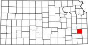 | |
| Unincorporated communities | ||
| Ghost towns | ||
| Townships | ||
| Footnotes | †This community is designated a Census-Designated Place (CDP) by the United States Census Bureau. ‡This community also has portions in an adjacent county or counties. | |