
Itsukushima

Itsukushima (厳島) is an island in the western part of the Inland Sea of Japan, located in the northwest of Hiroshima Bay. It is popularly known as Miyajima (宮島), the Shrine Island. The island is one of Hayashi Razan's (林羅山) Three Views of Japan (日本三景, Nihon Sankei). Itsukushima is part of the city of Hatsukaichi in Hiroshima Prefecture. The island was the town of Miyajima prior to the 2005 merger with Hatsukaichi.
Itsukushima is famous for the Itsukushima Shrine, a UNESCO World Heritage Site. According to records, the shrine was established in the time of Empress Suiko. The warrior-courtier Taira no Kiyomori gave the shrine its present form. In 1555, Mōri Motonari defeated Sue Harukata at the Battle of Miyajima. Toyotomi Hideyoshi built a large building, the Senjō-kaku, on a hill above the shrine.
The island of Itsukushima, including the waters around it (part of Seto Inland Sea), and are within Setonaikai National Park. This sea is affected by strong tides. At low tide, the bottom of the sea is exposed past the island's Torii. At high tide, the sea covers all the previously-exposed mud and fills areas underneath the Shrine.
Itsukushima is mountainous and sparsely settled. It does have an elementary school and a middle school. There are no traffic signals.
Frequent ferry services, operated by JR West (JR Miyajima ferry) and by Miyajima Matsudai Tourist Ship, carry traffic between the island and the mainland. The trip takes about ten minutes. There is an hourly express passenger ferry to Hiroshima harbour.
Miyajima's maple trees are renowned throughout Japan, and blanket the island in crimson in the autumn. Momiji manjū, pastries filled with azuki jam or custard, are popular souvenirs, and carry maple-leaf emblems. Many other varieties such as chocolate and cheese are also available. Because the island is seen as sacred, trees may not be cut for lumber. Deer and monkeys roam freely. Deer are thought of as sacred in the native Shinto religion because they are considered messengers of the gods.
A style of wooden spoon used to serve cooked rice, without impairing the taste, is said to have been invented by a monk who lived on the island. This style of spoon is a popular souvenir and there are some outsized examples around the shopping district.
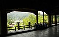
The peak of Mount Misen, at 535 m, is the highest point on the island. Miyajima Ropeway carries visitors to within a 30-minute hike to the top. There are several sites related to the historical Buddhist priest and founder of Shingon Buddhism, Kōbō Daishi (弘法大師) (774–835), including Daishō-in, near the top. The island also contains the Miyajima Natural Botanical Garden (宮島自然植物実験所, Miyajima Shizen Shokubutsu Jikkensho) on its north coast.
There are many shrines and temples on the island. It is rural and mountainous, only 30.39 square kilometres (11.73 sq mi), and has a population of about 2000. There are no cities, only small towns with simple houses and privately-owned shops. The islanders work hard to preserve the forests and respect nature. People often take the ten-minute ferry ride from mainland Japan to pray at Miyajima’s shrines and to marvel at the beauty of its forests.
Gallery
-
 Toyotomi Hideyoshi's Senjō-kaku overlooks Taira no Kiyomori's Itsukushima Shrine
 -
 Katsuyama Castle once stood on this site
 -
 Goju-no-to Pagoda from Senjō-kaku Temple
 -


See also
- List of Special Places of Scenic Beauty, Special Historic Sites and Special Natural Monuments
- Itsukushima Shrine
- World Heritage Site
- Setonaikai National Park
- Three Views of Japan
- Taira no Kiyomori
- Miyao Castle
- Mount Misen
- Momijidani Park
- Daishō-in
- Marine Plaza Miyajima
- Miyajima, Hiroshima
- Tourism in Japan
- Battle of Miyajima
External links
| Three Views of Japan | |
| Amanohashidate – Matsushima – Itsukushima | |
 – – | |
| Ferries and boats for Miyajima (Itsukushima Shrine) | |
| JR Miyajima Ferry – Miyajima Matsudai Kisen – First Beach – Aqua Net Hiroshima | |