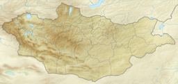
Khar-Us Lake (Uvs)
| Khar-Us Lake | |
|---|---|
 | |
| Location | Uvs Province, Mongolia |
| Coordinates | 49°6′0″N 91°52′0″E / 49.10000°N 91.86667°E |
| Basin countries | Mongolia |
| Max. length | 19 km (12 mi) |
| Max. width | 7.8 km (4.8 mi) |
| Surface area | 63 km2 (24 sq mi) |
| Average depth | 5.2 m (17 ft) |
| Max. depth | 8.2 m (27 ft) |
| Water volume | 0.3265 km3 (264,700 acre⋅ft) |
| Surface elevation | 1,574 m (5,164 ft) |
Khar-Us Lake (Mongolian: Хар-Ус нуур, ᠬᠠᠷᠠᠤᠰᠤᠨᠠᠭᠤᠷ, lit. "black water lake", Chinese: 哈尔乌斯湖, 黑水湖) is a lake located in western Mongolia in the Uvs Province between the districts of Ömnögovi and Ölgii. Khar-Us Lake is located south of the city of Ulaangom and about 80 km (50 mi) north of the homonymous and larger Khar-Us Lake in the Khovd Province.
Climate[edit]
The climate is cold.[1] The average temperature is 1 °C. The warmest month is July, at 21 °C, and the coldest is January, at -22 °C.[2] The average rainfall is 420 millimeters per year. The wettest month is June, with 103 millimeters of rain, and the driest is March, with 2 millimeters.[3]
References[edit]
- ^ Peel, M C; Finlayson, B L (2007). "Updated world map of the Köppen-Geiger climate classification". Hydrology and Earth System Sciences. 11 (5): 1633–1644. doi:10.5194/hess-11-1633-2007. Retrieved 30 January 2016.
- ^ "NASA Earth Observations Data Set Index". NASA. Archived from the original on 7 April 2019. Retrieved 30 January 2016.
- ^ "NASA Earth Observations: Rainfall (1 month - TRMM)". NASA/Tropical Rainfall Monitoring Mission. Archived from the original on 12 May 2021. Retrieved 30 January 2016.

