Kostobobriv
Kostobobriv
Костобобрів Костобобров | |
|---|---|
Village | |
| Kostobobriv | |
 The Saint Daniel's Church | |
| Coordinates: 52°14′23″N 32°56′14″E / 52.23972°N 32.93722°E | |
| Country | Ukraine |
| Oblast | Chernihiv Oblast |
| Raion | Novhorod-Siverskyi Raion |
| Founded | 1200 |
| Government | |
| • Mayor | Lubov Ruban |
| Area | |
• Total | 263 km2 (102 sq mi) |
| Elevation | 176 m (577 ft) |
| Postal code | 15443 |
| Website | s. Kostobobriv Chernihivska oblast, Semenivka raion Verkhovna Rada website |
 | |
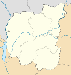
Kostobobriv (Ukrainian: Костобобрів; Russian: Костобобров) is a village in Novhorod-Siverskyi Raion (district) of Chernihiv Oblast (province) in northern Ukraine. It belongs to Semenivka urban hromada, one of the hromadas of Ukraine.[1]
Description
[edit]The village is located on Kosta River, a left tributary of Revna 5 km (3.1 mi) south from the Russia–Ukraine border.
Kostobobriv was first founded in 1200. It is located near the Ugli Railroad Station, the second railroad station in the entire district.
Until 18 July 2020, Kostobobriv belonged to Semenivka Raion. The raion was abolished in July 2020 as part of the administrative reform of Ukraine, which reduced the number of raions of Chernihiv Oblast to five. The area of Semenivka Raion was merged into Novhorod-Siverskyi Raion.[2][3]
See also
[edit]References
[edit]- ^ "Семеновская громада" (in Russian). Портал об'єднаних громад України.
- ^ "Про утворення та ліквідацію районів. Постанова Верховної Ради України № 807-ІХ". Голос України (in Ukrainian). 18 July 2020. Retrieved 3 October 2020.
- ^ "Нові райони: карти + склад" (in Ukrainian). Міністерство розвитку громад та територій України.
External links
[edit] Media related to Category:Kostobobrovo at Wikimedia Commons


