Nyons
Nyons | |
|---|---|
Subprefecture and commune | |
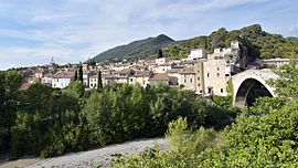
 A general view of Nyons | |
| Coordinates: 44°21′37″N 5°08′23″E / 44.3603°N 5.1397°E | |
| Country | France |
| Region | Auvergne-Rhône-Alpes |
| Department | Drôme |
| Arrondissement | Nyons |
| Canton | Nyons et Baronnies |
| Government | |
| • Mayor (2020–2026) | Pierre Combes[1] |
| Area 1 | 23.45 km2 (9.05 sq mi) |
| Population (2021)[2] | 6,771 |
| • Density | 290/km2 (750/sq mi) |
| Time zone | UTC+01:00 (CET) |
| • Summer (DST) | UTC+02:00 (CEST) |
| INSEE/Postal code | 26220 /26110 |
| Elevation | 234–940 m (768–3,084 ft) (avg. 270 m or 890 ft) |
| 1 French Land Register data, which excludes lakes, ponds, glaciers > 1 km2 (0.386 sq mi or 247 acres) and river estuaries. | |
Nyons (French pronunciation: [njɔ̃s]; Occitan: Nioun, Niom[3]) is a commune in the Drôme department in southeastern France.
History

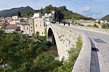
Nyons was settled in the 6th century BC as Nyrax by a Gallic tribe, probably the Segusiavi or the Sequani. Hecataeus of Miletus mentioned Nyrax around 500 BC when writing about the Celts. It is situated next to the river Aigues or Eygues, which is crossed by an ancient bridge.
Nyons has a very mild microclimate, which makes it a good place for people suffering from respiratory problems, for which there is a special clinic. It is famed for its olives (which have PDO status[4]).
Nyons is a sub-prefecture of the department. It features two collèges and a lycée; as well as important shopping facilities and touristic attractions. Villages that are facilitated by Nyons are situated within an area of about 20 to 30 km (19 mi), such as Les Pilles, Aubres, Venterol and Mirabel-aux-Baronnies.
Geography
Nyons is approximately 120 km from Marseille and is located close to the boundary of the Vaucluse department.

Population
|
| ||||||||||||||||||||||||||||||||||||||||||||||||||||||||||||||||||||||||||||||||||||||||||||||||||||||||||||||||||
| Source: EHESS[5] and INSEE (1968-2017)[6] | |||||||||||||||||||||||||||||||||||||||||||||||||||||||||||||||||||||||||||||||||||||||||||||||||||||||||||||||||||
Sights
International relations
Nyons is twinned with:[citation needed]
 Manciano, Tuscany, Italy
 Mechernich, North Rhine-Westphalia, Germany
 Nyon, Vaud, Switzerland
 Nules, Castellón, Spain
 Borca, Neamț, Romania
See also
References
- ^ "Répertoire national des élus: les maires" (in French). data.gouv.fr, Plateforme ouverte des données publiques françaises. 13 September 2022.
- ^ "Populations légales 2021" (in French). The National Institute of Statistics and Economic Studies. 28 December 2023.
- ^ See mistralian norm, and classical norm of Provençal.
- ^ Olives noires de Nyons - Profile, EU PDO/PGI Database (Accessed 27 July 2010)
- ^ Des villages de Cassini aux communes d'aujourd'hui: Commune data sheet Nyons, EHESS (in French).
- ^ Population en historique depuis 1968, INSEE
External links


