Pidie Jaya Regency
Pidie Jaya Regency
Kabupaten Pidie Jaya | |
|---|---|
 Location within Aceh | |
| Coordinates: 5°07′N 96°12′E / 5.117°N 96.200°E | |
| Country | |
| Region | Sumatra |
| Province | |
| Established | 2007 |
| Regency seat | Meureudu |
| Government | |
| • Regent | Teungkub Aiyub Ben Abbas |
| • Vice Regent | Said Mulyadi |
| Area | |
• Total | 952.11 km2 (367.61 sq mi) |
| Population (mid 2021 estimate)[1] | |
• Total | 160,327 |
| • Density | 170/km2 (440/sq mi) |
| Time zone | UTC+7 (IWST) |
| Area code | (+62) 653 |
| Website | pidiejayakab.go.id |
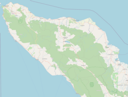
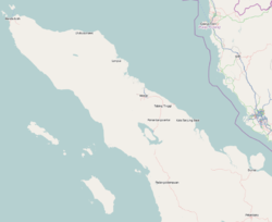
Pidie Jaya Regency (Template:Lang-id) is a regency in the Aceh Special region of Indonesia. It is located on the island of Sumatra. The regency was created out of part of Pidie Regency in 2007. The seat of the regency government is at Meureudu. The regency covers an area of 952.11 square kilometres and had a population of 132,956 people at the 2010 Census[2] and 158,397 at the 2020 Census;[3] the official estimate as at mid 2021 was 160,327.[4]
Administrative divisions
The regency is divided administratively into eight districts (kecamatan), listed below with their areas and their populations at the 2010 Census[5] and the 2020 Census,[6] together with the official estimates as at mid 2021.[7] The table also includes the locations of the district administrative centres, the number of administrative villages (rural desa and urban kelurahan) in each district, and its post code.
| Name | Area in km2[8] |
Pop'n Census 2010[9] |
Pop'n Census 2020 |
Pop'n Estimate mid 2021 |
Administrative centre |
No. of villages |
Post code |
|---|---|---|---|---|---|---|---|
| Meureudu | 124.79 | 18,387 | 22,226 | 22,528 | Kota Meureudu | 30 | 24186 |
| Meurah Dua | 287.07 | 10,090 | 12,507 | 12,708 | Meunasah Bie | 19 | 24186 |
| Bandar Dua | 174.32 | 23,656 | 28,060 | 28,389 | Ulee Gle | 45 | 24188 |
| Jangka Buya | 9.35 | 8,714 | 10,174 | 10,278 | Keude Jangka Buya | 18 | 24186 |
| Ulim | 41.75 | 13,338 | 16,242 | 16,475 | Keude Ulim | 30 | 24187 |
| Trienggadeng | 79.37 | 19,901 | 23,509 | 23,776 | Keude Trienggadeng | 27 | 24185 |
| Panteraja | 15.00 | 7,533 | 8,968 | 9,076 | Keude Panteraja | 10 | 24185 |
| Bandar Baru | 220.47 | 31,337 | 36,711 | 37,097 | Keude Leung Putu | 43 | 24184 |
| Totals | 952.11 | 132,956 | 158,397 | 160,327 | Kota Meureudu | 222 |
| District (kecamatan) | Land area (Km2) | Sea area 4 Mil (Km2) | Total area (Km2) | Percentage (%) | District divisions | Villages |
|---|---|---|---|---|---|---|
| Bandar Dua | 176.26 | - | 176.26 | 14.99 | 5 | 45 |
| Bandar Baru | 223.64 | 57.60 | 281.24 | 24.19 | 8 | 43 |
| Jangka Buya | 7.88 | 21.76 | 29.64 | 2.55 | 2 | 18 |
| Meurah Dua | 276.20 | 16.00 | 292.20 | 25.13 | 3 | 19 |
| Meureudu | 139.14 | 17.60 | 156.74 | 13.48 | 7 | 30 |
| Panteraja | 13.80 | 26.24 | 40.04 | 3.44 | 2 | 10 |
| Trienggadeng | 76.19 | 51.81 | 128.00 | 11.01 | 5 | 27 |
| Ulim | 40.89 | 19.84 | 60.73 | 5.22 | 5 | 30 |
See also
References
- ^ Badan Pusat Statistik, Jakarta, 2022.
- ^ Biro Pusat Statistik, Jakarta, 2011.
- ^ Badan Pusat Statistik, Jakarta, 2021.
- ^ Badan Pusat Statistik, Jakarta, 2022.
- ^ Biro Pusat Statistik, Jakarta, 2011.
- ^ Badan Pusat Statistik, Jakarta, 2021.
- ^ Badan Pusat Statistik, Jakarta, 2022.
- ^ Badan Pusat Statistik, Jakarta, 2021.
- ^ Biro Pusat Statistik, Jakarta, 2011.
External links
5°07′N 96°12′E / 5.117°N 96.200°E


