
Qusar District
This article needs additional citations for verification. (July 2010) |
Qusar | |
|---|---|
.svg) Map of Azerbaijan showing Qusar Rayon | |
| Country | |
| Villages | 92 |
| Capital | Qusar |
| Government | |
| • Executive power | Şair Alxasov |
| Area | |
| • Total | 1,542 km2 (595 sq mi) |
| Population (2011) | |
| • Total | 90,438 |
| • Density | 59/km2 (150/sq mi) |
| Time zone | UTC+4 (AZT) |
| • Summer (DST) | UTC+5 (AZT) |
| Postal code | 3800 |
| Telephone code | (+994) 23[2] |
| Website | www |
Qusar Rayon (Azerbaijani: Qusar rayonu, Lezgian: КцIар район) is an administrative unit in the northern part of Azerbaijan and its administrative center is Qusar city.[3][4][5]
The rayon borders upon Quba and Khachmaz rayons of the republic and Dagestan (Russia). A distance from Baku - the capital of Azerbaijan is 180 kilometers.
Geography
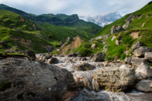
Qusar is located in Eurasian continent, in the north-eastern inclination of the main Caucasus Mountain ridge. It is located between 41°11’ - 41°45’ latitude North and 47°52’ - 48°41’ longitude East. Mountains, among which is also Shahdagh Mount, take the great part of the rayon. Territory of the rayon occupies the north-eastern part of Azerbaijan. Qusar is a unique gate of the republic. Even in the ancient times the territory of the rayon took a good position on a junction of the main trade roads. It is 179 kilometers from Qusar to Baku.
Qusar rayon is located far from sea routes. The most nearest seas to it are – the Caspian Sea (15 km) and the Black Sea (550 km). Area of the rayon consists of 1542 km2 and occupies 1,7% area of Azerbaijan. For size of its territory Qusar takes the 14th place among the other rayons of Azerbaijan. Length of the rayon from West to East is 84 km, but from North to South it is 35 km.
Extreme points of the rayon are:
Length of the rayons borders is 225 km. Extension of the borders in kilometers:
1.Dagestan Republic (with Akhtin, Dokuzpara and Mahammadkend rayons) 95 km.
2.Qabala Rayon 25 km.
3.Quba Rayon 70 km.
4.Khachmaz Rayon 65 km.
Population
According to data of 2007, population of the rayon consists of 85 899 people and 89,67% are Lezgins and 9,86% are the Azerbaijanis.[6]
History
The rayon was originated in 1930, and called Gil Rayon with a center in Gil village. In 1934, the center of the rayon was moved to Qusar, and in 1938 it was renamed to Qusar Rayon.
Administrative structure:
- Qullar Village
- Urva Village
Sightseeing
Shaykh Junayd Mausoleum in Yargun (Hazra) village.
Religion
- Muslims 98%
Sports and Tourism

Qusar is home of Shahdag Mountain Resort one of the biggest ski resorts in Caucasus and Azerbaijan's first and largest winter resort.
References
- ^ Äliyev, redaksiya heyätinin sädri, Ilham Heydär oğlu (2007). Azärbaycan : Azärbaycan milli ensiklopediyası. Bakı: "Azärbaycan Milli Ensiklopediyası" Elmi märkäzi. ISBN 9789952441017.
{{cite book}}: CS1 maint: multiple names: authors list (link) - ^ "Şəhərlərarası telefon kodları". Aztelekom MMC. Aztelekom İB. Retrieved 19 August 2015. Template:Az
- ^ "Qusar".
- ^ "Кусарский район".
- ^ "Gusar". discoverazerbaijan.az.
- ^ "Qusar rayonu". The State Statistical Committee of the Republic of Azerbaijan.
External links

| International | |
|---|---|
| National | |
This Qusar Rayon location article is a stub. You can help Wikipedia by expanding it. |