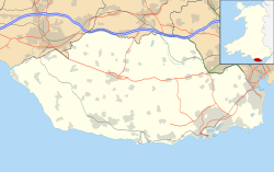
RAF Rhoose
Appearance
This article needs additional citations for verification. (February 2013) |
| RAF Rhoose | |||||||||
|---|---|---|---|---|---|---|---|---|---|
| Rhoose, Vale of Glamorgan in Wales | |||||||||
| Coordinates | 51°23′48″N 003°20′36″W / 51.39667°N 3.34333°W | ||||||||
| Type | Satellite station | ||||||||
| Code | RH | ||||||||
| Site information | |||||||||
| Owner | Air Ministry | ||||||||
| Operator | Royal Air Force | ||||||||
| Controlled by | RAF Fighter Command 1942-44 RAF Flying Training Command 1944 RAF Maintenance Command 1944 | ||||||||
| Site history | |||||||||
| Built | 1941/42 | ||||||||
| In use | April 1942 - 1946 | ||||||||
| Battles/wars | European theatre of World War II | ||||||||
| Airfield information | |||||||||
| Elevation | 85 metres (279 ft)[1] AMSL | ||||||||
| |||||||||
Royal Air Force Rhoose or more simply RAF Rhoose is a former Royal Air Force satellite station located near Rhoose, a few miles west of Cardiff, Wales.
History
It opened on 7 April 1942 as an RAF training base for Supermarine Spitfire pilots.
No. 53 Operational Training Unit Llandow was the parent station, and Rhoose was a satellite landing ground.
Other units included:[2]
See also
- Cardiff Airport, which now occupies the site
- MOD St Athan, a separate but close-by RAF station
References
Citations
- ^ Falconer 1998, p. 77.
- ^ "Rhoose (Cardiff) (Glamorgan) (Wales)". Airfields of Britain Conservation Trust. Retrieved 11 October 2013.
- ^ Lake 1999, p. 113.
Bibliography
- Falconer, J (1998). RAF Fighter Airfields of World War 2. UK: Ian Allan Publishing. ISBN 0-7110-2175-9.
- Lake, A (1999). Flying units of the RAF. Shrewsbury: Airlife. ISBN 1-84037-086-6.


