
Stafford, Virginia
Stafford, Virginia | |
|---|---|
 Aerial view of Stafford | |
 Location in Stafford County and the state of Virginia. | |
| Coordinates: 38°25′19″N 77°24′30″W / 38.42194°N 77.40833°W | |
| Country | United States |
| State | Virginia |
| County | Stafford |
| Area | |
| • Total | 4.27 sq mi (11.07 km2) |
| Population (2020) | |
| • Total | 5,370 |
| • Density | 1,300/sq mi (490/km2) |
| Time zone | UTC−5 (Eastern (EST)) |
| • Summer (DST) | UTC−4 (EDT) |
| ZIP codes | 22554, 22556 |
| Area code | 540 |
Stafford, also known as Stafford Courthouse, is a census-designated place in and the county seat of Stafford County, Virginia, United States.[1] The population was 5,370 as of the 2020 census.[2] It lies 10 miles (16 km) north of Fredericksburg, approximately 40 miles (64 km) south of Washington, D.C., and about 60 miles (97 km) north of Richmond, the state capital. Marine Corps Base Quantico is located north of the community. Stafford Courthouse is located at the intersections of U.S. Route 1 and Courthouse Road.
History
[edit]English sea captain Samuel Argall abducted Pocahontas near this area in April 1613 in an attempt to secure release of some English prisoners held by her father. She married English colonist John Rolfe in 1614. They sailed in 1616 to England where Pocahontas died in 1617.[3][4]
It was a stop on the Richmond, Fredericksburg and Potomac Railroad in the nineteenth Century; CSX Transportation is the RF&P's successor today.
Accokeek Furnace Archeological Site, Aquia Church, Public Quarry at Government Island, Redoubt No. 2, and Stafford Training School are listed on the National Register of Historic Places.[5]
Notable people
[edit]- Traci Hunter Abramson, novelist
- Erin Cahill, actress
- Palmer Hayden, American Painter
- Gary Jennings Jr., NFL Wide Receiver
- Pocahontas, Native American woman belonging to the Powhatan people, notable for her association with the colonial settlement at Jamestown[6][7]
- Joey Slye, American football kicker for the Washington Commanders
- Raymond Terczak Jr., racing driver
References
[edit]- ^ "Stafford County, VA". National Association of Counties. Retrieved January 10, 2013.
- ^ "Stafford, Virginia Population". U.S. Census. Retrieved May 21, 2023.
- ^ John Rolfe Highway Marker
- ^ Kidnapping of Pocahontas Highway Marker or Pocahontas Highway Marker
- ^ "National Register Information System". National Register of Historic Places. National Park Service. July 9, 2010.
- ^ "Stafford County Museum - Kidnapping of Pocahontas".
- ^ "History".
External links
[edit] Stafford (Virginia) travel guide from Wikivoyage
- Virginia Residents Question Whether Their Neighbor Was A Russian Informant
Municipalities and communities of Stafford County, Virginia, United States | ||
|---|---|---|
| CDPs | 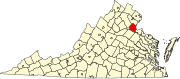 | |
| Unincorporated communities |
| |
| Footnotes | ‡This populated place also has portions in an adjacent county or counties | |
| Authority control databases: Geographic |
|---|
This Stafford County, Virginia state location article is a stub. You can help Wikipedia by expanding it. |