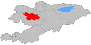
Toktogul District
Appearance
Toktogul | |
|---|---|
 | |
| Country | Kyrgyzstan |
| Region | Jalal-Abad Region |
| Area | |
| • Total | 7,815 km2 (3,017 sq mi) |
| Population (2009) | |
| • Total | 86,306 |
| • Density | 11/km2 (29/sq mi) |
| Time zone | UTC+5 (GMT +5) |
Toktogul is a raion (district) of Jalal-Abad Region in western Kyrgyzstan. The capital lies at Toktogul.[1] Its area is 7,815 square kilometres (3,017 sq mi), and its resident population was 86,306 in 2009.[2]
The town and district are named after its most famous son - the musician Toktogul Satilganov. The Toktogul reservoir is a geographical feature of the district and the capital lies on the north shore.
Urban-type settlements, rural communities and villages
In total, Toktogul District includes 1 city and 44 settlements in 10 rural communities (aiyl okmotus). Each rural community can consist of one or several villages. The rural communities and settlements in the Toktogul District are:[3][4]
- city Toktogul
- Bel-Aldy aiyl okmotu (3: center - village: Sary-Sögöt; and also villages Bel-Aldy and Korgon)
- Jany-Jol aiyl okmotu (6: center - village: Jany-Jol; and also villages Aral, Kara-Suu, Komsomol, Imeni Kuybysheva and Kyzyl-Tuu)
- Kyzyl-Ozgeryush aiyl okmotu (11: center - village: Kyzyl-Özgörüsh; and also villages An-Aryk, Bel Kara-Suu, Buurakan, Kamysh-Bashi, Konur-Ogyuz, Kök-Tash, Orto-Jon, Chech-Debe, Shayyk and Ak-Jar)
- Nichke-Say aiyl okmotu (2: center - village: Nichke-Say; and also village Chorgochu)
- Ketmen-Debe aiyl okmotu (3: center - village: Terek-Suu; and also villages Chong-Aryk and Eshsay)
- Sary-Kamysh aiyl okmotu (2: center - village: Birlik; and also village Keterme)
- Uch-Terek aiyl okmotu (4: center - village: Uch-Terek; and also villages Jetigen, Kyzyl-Uraan and Sargata)
- Aralbay aiyl okmotu (4: center - village: Toluk; and also villages Almaluu, Noot and Char-Tash)
- Abdy-Suerkulov aiyl okmotu (3: center - village: Torkent; and also villages Keterme and Kara-Jygach)
- Cholpon-Ata aiyl okmotu (6: center - village: Cholpon-Ata; and also villages Ak-Tektir, Balykty, Kara-Küngöy, Kushchu-Suu and Mazar-Suu)
References
- ^ Enrin.grida.no
- ^ "2009 population census of the Kyrgyz Republic: Jalal-Abad Region" (PDF). Archived from the original (PDF) on 10 August 2011. Retrieved 2011-08-10.
- ^ List of rural communities of Kyrgyzstan Archived 2010-02-09 at the Wayback Machine
- ^ 2012 Law on the transformation of individual urban settlements of the Kyrgyz Republic and relating them to the category of village or city
41°52′11″N 72°56′43″E / 41.869711°N 72.945194°E


