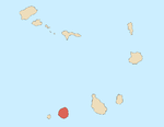
Vale de Cavaleiros
Appearance
| Vale de Cavaleiros | |
|---|---|
 The port of Fogo | |
 Click on the map for a fullscreen view | |
| Location | |
| Country | Cape Verde |
| Location | São FIlipe, Fogo |
| Coordinates | 14°55′13″N 24°30′13″W / 14.92036°N 24.50363°W |
| Details | |
| Owned by | ENAPOR |
| Type of harbour | Artificial |
Vale de Caveiros is the port of the island of Fogo, Cape Verde. It is situated 3 km north of the city of São Filipe. The port is managed by the national port authority ENAPOR. The port was reconstructed and expanded in 2013.[1]

See also
References
Wikimedia Commons has media related to Porto de Vale de Cavaleiros.
- ^ "Information about the port" (in Portuguese). ENAPOR. Retrieved 9 August 2018.

