
Wanette, Oklahoma
Wanette, Oklahoma | |
|---|---|
 Location of Wanette, Oklahoma | |
| Country | United States |
| State | Oklahoma |
| County | Pottawatomie |
| Area | |
| • Total | 0.4 sq mi (1.1 km2) |
| • Land | 0.4 sq mi (1.1 km2) |
| • Water | 0.0 sq mi (0.0 km2) |
| Elevation | 1,027 ft (313 m) |
| Population (2000) | |
| • Total | 402 |
| • Density | 978.8/sq mi (377.9/km2) |
| Time zone | UTC-6 (Central (CST)) |
| • Summer (DST) | UTC-5 (CDT) |
| ZIP code | 74878 |
| Area code | 405 |
| FIPS code | 40-78200Template:GR |
| GNIS feature ID | 1099348Template:GR |
Wanette is a town in Pottawatomie County, Oklahoma, United States. The population was 402 at the 2000 census. Wanette is part of the Purcell-Lexington retail trade area, and is within the Greater Oklahoma City Metropolitan Area
Wanette High School
Wanette High School has an average graduating class of 16. The percentage of children on Individualized Education Programs is well over 30%. Wanette High School is also the largest business in the town. The current superintendent is Rick Riggs. The school board consist of Curtis Compton, Bryan Richards, Eddie Williamson, Linda Fullingim and Rick Middleton. Wanette High School is home of the tigers.
Geography
Wanette is located at 34°57′46″N 97°1′52″W / 34.96278°N 97.03111°WInvalid arguments have been passed to the {{#coordinates:}} function (34.962707, -97.031170)Template:GR. According to the United States Census Bureau, the town has a total area of 0.4 square miles (1.1 km²), all of it land.
Demographics
As of the censusTemplate:GR of 2000, there were 402 people, 147 households, and 108 families residing in the town. The population density was 978.8 people per square mile (378.6/km²). There were 168 housing units at an average density of 409.0/sq mi (158.2/km²). The racial makeup of the town was 88.31% White, 8.71% Native American, and 2.99% from two or more races. Hispanic or Latino of any race were 0.50% of the population.
There were 147 households out of which 39.5% had children under the age of 18 living with them, 51.0% were married couples living together, 17.7% had a female householder with no husband present, and 25.9% were non-families. 24.5% of all households were made up of individuals and 15.0% had someone living alone who was 65 years of age or older. The average household size was 2.73 and the average family size was 3.18.
In the town the population was spread out with 30.3% under the age of 18, 13.7% from 18 to 24, 23.1% from 25 to 44, 19.7% from 45 to 64, and 13.2% who were 65 years of age or older. The median age was 29 years. For every 100 females there were 100.0 males. For every 100 females age 18 and over, there were 89.2 males.
The median income for a household in the town was $21,818, and the median income for a family was $23,000. Males had a median income of $21,731 versus $14,583 for females. The per capita income for the town was $10,740. About 20.2% of families and 21.0% of the population were below the poverty line, including 14.4% of those under age 18 and 30.6% of those age 65 or over.
References
External links
Municipalities and communities of Pottawatomie County, Oklahoma, United States | ||
|---|---|---|
| Cities | 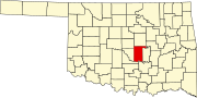 | |
| Towns | ||
| CDP | ||
| Other communities | ||
| Ghost towns | ||
| Footnotes | ‡This populated place also has portions in an adjacent county or counties | |
American Gunfighters Firearms Training Concealed Carry Firearms Training www.Iwant2carryagun.com