
Wanroij
Wanroij | |
|---|---|
 Wind mill De Hamse molen | |
 Wanroij Location in the province of North Brabant in the Netherlands  Wanroij Wanroij (Netherlands) | |
| Coordinates: 51°39′22″N 5°49′12″E / 51.65611°N 5.82000°E | |
| Country | Netherlands |
| Province | North Brabant |
| Municipality | Land van Cuijk |
| Area | |
| • Total | 20.56 km2 (7.94 sq mi) |
| Elevation | 14 m (46 ft) |
| Population (2021)[1] | |
| • Total | 2,940 |
| • Density | 140/km2 (370/sq mi) |
| Time zone | UTC+1 (CET) |
| • Summer (DST) | UTC+2 (CEST) |
| Postal code | 5446[1] |
| Dialing code | 0485 |
Wanroij is a village in the Dutch province of North Brabant. It is located in the former municipality of Sint Anthonis, about 9 km west of the town of Boxmeer.
Wanroij was a separate municipality until 1994, when it became part of Sint Anthonis.[3]
Since 2022 it has been part of the new municipality of Land van Cuijk.
History[edit]
The name Wanroij was found first in 1265. A person called Bertradis van Wanrode signed, together with son Johan, a certificate.
From the French period on Wanroij was an individual municipality. In 1942 it was expanded with the villages Rijkevoort and Landhorst. In 1994 the area became part of a larger municipality, the municipality of Sint Anthonis. Rijkevoort then became part of the municipality of Boxmeer.
The church in Wanroij was named after the Pope Cornelius. Until 1994 Cornelius was represented in the flag of the municipality.
For a long period of time Wanroij was very isolated. Around 1850 the infrastructure developed a lot. The first street lanterns were placed in 1922. The first road which was not just a path to other villages was made in 1922, going from Wanroij to Haps.
Gallery[edit]
-
 Storage shed
 -
 Sculpture in the square
 -
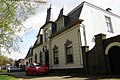 Clergy house


References[edit]
- ^ a b c "Kerncijfers wijken en buurten 2021". Central Bureau of Statistics. Retrieved 17 April 2022.
- ^ "Postcodetool for 5446AA". Actueel Hoogtebestand Nederland (in Dutch). Het Waterschapshuis. Retrieved 17 April 2022.
- ^ Ad van der Meer and Onno Boonstra, Repertorium van Nederlandse gemeenten, KNAW, 2011.