Mayne Island: Difference between revisions
m wl |
No edit summary |
||
| Line 5: | Line 5: | ||
In [[1794]] Captain [[George Vancouver]] camped on Georgina Point where his crew left a coin and a knife found over a century later by early settlers. |
In [[1794]] Captain [[George Vancouver]] camped on Georgina Point where his crew left a coin and a knife found over a century later by early settlers. |
||
Captain [[George Henry Richards|George Richards]] of the Royal Navy surveyed the area aboard his vessel [[HMS Plumper]] in [[1857]], naming the island after his lieutenant, Richard Charles Mayne. |
Captain [[George Henry Richards|George Richards]] of the Royal Navy surveyed the area aboard his vessel [[HMS Plumper]] in [[1857]], naming the island after his lieutenant, [[Richard Charles Mayne]]. |
||
During the Cariboo and Fraser River [[Gold Rush]] of the mid-[[1800s]], Vancouver Island miners gathered on Mayne Island before rowing across [[Georgia Strait]] to the mainland of BC in search of their fortunes. The earliest homesteaders registered land claims in the Miners Bay area in [[1859]]. |
During the Cariboo and Fraser River [[Gold Rush]] of the mid-[[1800s]], Vancouver Island miners gathered on Mayne Island before rowing across [[Georgia Strait]] to the mainland of BC in search of their fortunes. The earliest homesteaders registered land claims in the Miners Bay area in [[1859]]. |
||
Revision as of 20:28, 25 April 2007


Mayne Island is a rustic 21-square-kilometre island in the southern Gulf Islands chain of British Columbia. It is situated midway between the lower mainland of BC and Vancouver Island, and has a population of around nine hundred. One well-known resident is children's entertainer Raffi.
In 1794 Captain George Vancouver camped on Georgina Point where his crew left a coin and a knife found over a century later by early settlers.
Captain George Richards of the Royal Navy surveyed the area aboard his vessel HMS Plumper in 1857, naming the island after his lieutenant, Richard Charles Mayne.
During the Cariboo and Fraser River Gold Rush of the mid-1800s, Vancouver Island miners gathered on Mayne Island before rowing across Georgia Strait to the mainland of BC in search of their fortunes. The earliest homesteaders registered land claims in the Miners Bay area in 1859.
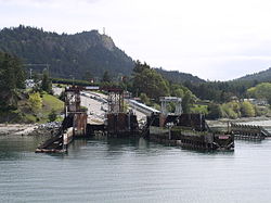
During the late 1800s Mayne Island was both the commercial and social centre of the Gulf Islands. The port at Miners Bay was always busy due to the steady stream of marine traffic travelling through Active Pass. The historic village at Miners Bay is still the commercial centre of the island, with the annual Fall Fair still being held at the old Agricultural Hall like so many years before. Nearby Active Pass still throbs with a steady stream of marine traffic, a bustling contrast to the island's quiet interior byways. Village Bay, with its BC Ferries terminal, has several late 1800s to 1930s buildings. Active Pass is named after the American survey ship USS Active, the first steam vessel to navigate the pass.
BC Ferries operates a vehicle and passenger scheduled ferry service from Tsawwassen (Vancouver) on the mainland and Swartz Bay (Victoria) on Vancouver Island.
For more info go to Mayne Island
