
Nathalie, Virginia: Difference between revisions
removed Category:Halifax County, Virginia; added Category:Populated places in Halifax County, Virginia using HotCat |
No edit summary |
||
| Line 81: | Line 81: | ||
}} |
}} |
||
'''Nathalie''' is |
'''Nathalie''' is a [[census-designated place]] (CDP) in [[Halifax County, Virginia|Halifax County]], [[Virginia]], [[United States]], in the south central region of the state.<ref name=rand>Rand McNally. ''The Road Atlas '09.'' [[Chicago]]: [[Rand McNally]], 2009, p. 106.</ref> The population as of the [[United States Census, 2010|2010 Census]] was 183.<ref>[http://mcdc.missouri.edu/webrepts/pl94trends/Virginia_stplace2.html Virginia Trend Report 2: State and Complete Places (Sub-state 2010 Census Data).] Missouri Census Data Center. Accessed 2011-06-08.</ref> Located at {{coord|36|56|6|N|78|56|50|W|city}} (36.9348619, -78.9472347), at an altitude of 554 feet (169 m),<ref>{{gnis|1497035}}</ref> it lies along Road 603 north of the town of [[Halifax, Virginia|Halifax]], the [[county seat]] of Halifax County.<ref name=rand /> It received its name in 1890 or 1891, being named after Natalie Otey (not ''Nathalie''), daughter of Mrs. Rebecca Wimbish, an important local landowner.<ref>[http://www.oldhalifax.com/county/NathalieKoontz.htm ''Nathalie - Largest Rural Mail Route in the U.S.''] from 1974 article in the ''Gazette-Virginian'' by Hugh D. Koontz, II.</ref> Prior to that time, the village at this location was considered to be a part of the Nathaniel Barksdale plantation. It had included a church since 1773 (the first Catawba Baptist Church) and a [[post office]] since 1828.<ref>[http://www.oldhalifax.com/county/Nathalie.htm History of Nathalie, Virginia], based on information from ''History of Halifax'' (2 vols.), 1978, by Pocahontas Edmunds, ASIN: B0007AN8NO</ref> This post office continues to operate today with the [[ZIP code]] of 24577.<ref>[http://www.zipinfo.com/cgi-local/zipsrch.exe?cnty=cnty&zip=24577 Zip Code Lookup]</ref> The population of the [[ZIP Code Tabulation Area|ZCTA]] for ZIP code 24577 was 5,529 at the [[2000 United States Census|2000 census]].{{GR|2}} |
||
== References == |
== References == |
||
Revision as of 03:38, 10 June 2011
Nathalie, Virginia | |
|---|---|
 Location of Nathalie, Virginia: the red dot | |
| Country | United States |
| State | Virginia |
| County | Halifax |
| Elevation | 169 ft (554 m) |
| Time zone | UTC-5 (Eastern (EST)) |
| • Summer (DST) | UTC-4 (EDT) |
| ZIP code | 24577 |
| Area code | 434 |
Nathalie is a census-designated place (CDP) in Halifax County, Virginia, United States, in the south central region of the state.[1] The population as of the 2010 Census was 183.[2] Located at 36°56′6″N 78°56′50″W / 36.93500°N 78.94722°WInvalid arguments have been passed to the {{#coordinates:}} function (36.9348619, -78.9472347), at an altitude of 554 feet (169 m),[3] it lies along Road 603 north of the town of Halifax, the county seat of Halifax County.[1] It received its name in 1890 or 1891, being named after Natalie Otey (not Nathalie), daughter of Mrs. Rebecca Wimbish, an important local landowner.[4] Prior to that time, the village at this location was considered to be a part of the Nathaniel Barksdale plantation. It had included a church since 1773 (the first Catawba Baptist Church) and a post office since 1828.[5] This post office continues to operate today with the ZIP code of 24577.[6] The population of the ZCTA for ZIP code 24577 was 5,529 at the 2000 census.Template:GR
References
- ^ a b Rand McNally. The Road Atlas '09. Chicago: Rand McNally, 2009, p. 106.
- ^ Virginia Trend Report 2: State and Complete Places (Sub-state 2010 Census Data). Missouri Census Data Center. Accessed 2011-06-08.
- ^ U.S. Geological Survey Geographic Names Information System: Nathalie, Virginia
- ^ Nathalie - Largest Rural Mail Route in the U.S. from 1974 article in the Gazette-Virginian by Hugh D. Koontz, II.
- ^ History of Nathalie, Virginia, based on information from History of Halifax (2 vols.), 1978, by Pocahontas Edmunds, ASIN: B0007AN8NO
- ^ Zip Code Lookup
Municipalities and communities of Halifax County, Virginia, United States | ||
|---|---|---|
| Towns | 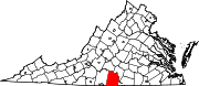 | |
| CDPs | ||
| Unincorporated communities | ||
| Footnotes | ‡This populated place also has portions in an adjacent county or counties | |