Draft:Sjenica Lake: Difference between revisions
Chaotic Enby (talk | contribs) m Chaotic Enby moved page Sjenica Lake to Draft:Sjenica Lake: Not ready for mainspace, incubate in draftspace. Reason/s: no sources |
Chaotic Enby (talk | contribs) AFC draft |
||
| Line 1: | Line 1: | ||
{{AfC submission|t||ts=20240609215716|u=AirWolf|ns=118|demo=}} |
|||
{{unreferenced|date=June 2024}} |
{{unreferenced|date=June 2024}} |
||
{{Infobox lake |
{{Infobox lake |
||
| Line 44: | Line 45: | ||
{{reflist}} |
{{reflist}} |
||
{{Draft categories| |
|||
[[Category:Lakes of Serbia]] |
[[Category:Lakes of Serbia]] |
||
}} |
|||
{{Serbia-geo-stub}} |
{{Serbia-geo-stub}} |
||
{{Drafts moved from mainspace |date=June 2024}} |
|||
Latest revision as of 21:57, 9 June 2024
 | Draft article not currently submitted for review.
This is a draft Articles for creation (AfC) submission. It is not currently pending review. While there are no deadlines, abandoned drafts may be deleted after six months. To edit the draft click on the "Edit" tab at the top of the window. To be accepted, a draft should:
It is strongly discouraged to write about yourself, your business or employer. If you do so, you must declare it. Where to get help
How to improve a draft
You can also browse Wikipedia:Featured articles and Wikipedia:Good articles to find examples of Wikipedia's best writing on topics similar to your proposed article. Improving your odds of a speedy review To improve your odds of a faster review, tag your draft with relevant WikiProject tags using the button below. This will let reviewers know a new draft has been submitted in their area of interest. For instance, if you wrote about a female astronomer, you would want to add the Biography, Astronomy, and Women scientists tags. Editor resources
Last edited by Chaotic Enby (talk | contribs) 17 days ago. (Update) |
| Sjenica Lake | |
|---|---|
 Meanders of Uvac River near the Sjenica Lake | |
| Location | Southwest Serbia |
| Coordinates | 43°22′30″N 19°47′48″E / 43.3748967°N 19.7965875°E |
| Lake type | Reservoir |
| Primary inflows | Uvac, Vapa |
| Basin countries | Serbia |
| Surface area | 5 km2 (1.9 sq mi) |
| Max. depth | 35 m (115 ft) |
| Water volume | 212 million cubic metres (7.5×10⁹ cu ft) |
| Surface elevation | 985 m (3,232 ft) |
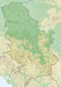
Sjenica Lake (Сјеничко језеро) is an artificial lake located in the Pešter plateau near the town of Sjenica. The lake was created in the 1979 after the construction of a dam on the Uvac river, and covers an area of 5 square kilometers and reaches a maximum depth of 35 meters.
The region has a continental-Mediterranean climate and is an attractive destination for holidays and recreation; Water-sports. The lake rests 985 meters above sea level.
See also[edit]
References[edit]

