Madera Canyon, Arizona: Difference between revisions
Appearance
Content deleted Content added
Hushpuckena (talk | contribs) copy edit, added/piped links |
Warpflyght (talk | contribs) Noted that the populated place is within Madera Canyon (Arizona) (which has a lot more detail about the area), citing a 1996 USGS topo map showing both the place name and the landform name. |
||
| Line 73: | Line 73: | ||
}} |
}} |
||
'''Madera Canyon''' is a [[Unincorporated area|populated place]] situated in [[Santa Cruz County, Arizona|Santa Cruz County]], [[Arizona]], United States.<ref>{{cite web | url=http://arizona.hometownlocator.com/az/santa-cruz/madera-canyon.cfm | publisher=AZ Hometown Locator| title=Madera Canyon (in Santa Cruz County, AZ) Populated Place Profile | accessdate=December 21, 2016}}</ref> It has an estimated elevation of {{convert|4911|ft|m}} above sea level.<ref name=GNIS /> |
'''Madera Canyon''' is a [[Unincorporated area|populated place]] situated in the [[Santa Rita Mountains]] of [[Santa Cruz County, Arizona|Santa Cruz County]], [[Arizona]], United States.<ref>{{cite web | url=http://arizona.hometownlocator.com/az/santa-cruz/madera-canyon.cfm | publisher=AZ Hometown Locator| title=Madera Canyon (in Santa Cruz County, AZ) Populated Place Profile | accessdate=December 21, 2016}}</ref> It has an estimated elevation of {{convert|4911|ft|m}} above sea level.<ref name=GNIS /> It is located within a canyon of the same name, [[Madera Canyon (Arizona)|Madera Canyon]], in [[Coronado National Forest]].<ref name="USGS Topo Mount Hopkins">{{cite map|author=United States Geological Survey|author-link=United States Geological Survey|year=1996|title=Mount Hopkins, AZ|url=https://store.usgs.gov/product/41400|format=PDF|type=Topographic map|series=7.5 Minute Series|scale=1:24,000|publisher=United States Geological Survey|access-date=9 September 2021}}</ref> |
||
==References== |
==References== |
||
Revision as of 07:53, 9 September 2021
Madera Canyon, Arizona | |
|---|---|
| Coordinates: 31°43′30″N 110°52′48″W / 31.72500°N 110.88000°W | |
| Country | United States |
| State | Arizona |
| County | Santa Cruz |
| Elevation | 4,911 ft (1,497 m) |
| Time zone | UTC-7 (Mountain (MST)) |
| • Summer (DST) | UTC-7 (MST) |
| Area code | 520 |
| FIPS code | 04-43710 |
| GNIS feature ID | 36713 |
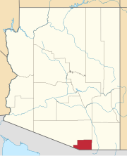
Madera Canyon is a populated place situated in the Santa Rita Mountains of Santa Cruz County, Arizona, United States.[2] It has an estimated elevation of 4,911 feet (1,497 m) above sea level.[1] It is located within a canyon of the same name, Madera Canyon, in Coronado National Forest.[3]
References
- ^ a b "Feature Detail Report for: Madera Canyon". Geographic Names Information System. United States Geological Survey, United States Department of the Interior.
- ^ "Madera Canyon (in Santa Cruz County, AZ) Populated Place Profile". AZ Hometown Locator. Retrieved December 21, 2016.
- ^ United States Geological Survey (1996). Mount Hopkins, AZ (PDF) (Topographic map). 1:24,000. 7.5 Minute Series. United States Geological Survey. Retrieved 9 September 2021.


