Sankhavaram: Difference between revisions
Appearance
Content deleted Content added
Arjunaraoc (talk | contribs) m adding osm map to infobox |
population (2011) |
||
| Line 34: | Line 34: | ||
| elevation_footnotes = |
| elevation_footnotes = |
||
| elevation_m = |
| elevation_m = |
||
| population_total = |
| population_total = 11039 |
||
| population_as_of = |
| population_as_of = 2011 |
||
| population_rank = |
| population_rank = |
||
| population_density_km2 = auto |
| population_density_km2 = auto |
||
Latest revision as of 07:20, 29 April 2024
Sankhavaram | |
|---|---|
village | |
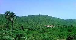
 Landscape view at Tuni-Sankhavaram Road | |
 Dynamic map | |
| Coordinates: 17°16′13″N 82°20′40″E / 17.27039°N 82.34454°E | |
| Country | |
| State | Andhra Pradesh |
| District | Kakinada |
| Founded by | chandu vara |
| Talukas | Sankhavaram |
| Population (2011) | |
| • Total | 11,039 |
| Languages | |
| • Official | Telugu |
| Time zone | UTC+5:30 (IST) |
| PIN | 533446 |
| Telephone code | 08868 |
| Vehicle Registration | AP05 (Former) AP39 (from 30 January 2019)[1] |
Sankhavaram is a village in Kakinada district in the state of Andhra Pradesh in India.[2]
References
[edit]- ^ "New 'AP 39' code to register vehicles in Andhra Pradesh launched". The New Indian Express. Vijayawada. 31 January 2019. Archived from the original on 3 February 2019. Retrieved 9 June 2019.
- ^ "Mandal wise list of villages in East Godavari district" (PDF). Chief Commissioner of Land Administration. National Informatics Centre. Archived from the original (PDF) on 21 January 2015. Retrieved 7 March 2016.


