Arjuni-Morgaon taluka: Difference between revisions
Appearance
Content deleted Content added
correct disambiguation |
Sushant852 (talk | contribs) mNo edit summary |
||
| Line 8: | Line 8: | ||
| native_name = |
| native_name = |
||
| native_name_lang = |
| native_name_lang = |
||
| settlement_type = [[ |
| settlement_type = [[Taluka]] |
||
|| image_map = {{maplink |frame=yes |
|||
|frame-width=250 |frame-height=250|frame-align=center |
|||
|text= '''Arjuni-Morgaon Taluka''' |
|||
|type=shape |id=Q24912643 |
|||
|stroke-colour=#C60C30 |
|||
|stroke-width=2 |
|||
|title= Arjuni-Morgaon Taluka of Gondia district |
|||
|type2=line|id2=Q1917227|stroke-width2=1|stroke-colour2=#0000ff|title2=Gondia district |
|||
}} |
|||
| image_skyline = Arjuni.jpg |
| image_skyline = Arjuni.jpg |
||
| image_size = |
| image_size = |
||
| Line 19: | Line 28: | ||
| motto = |
| motto = |
||
| map_alt = |
| map_alt = |
||
| map_caption = |
| map_caption = Location in [[Gondia district]] ([[Maharashtra|MH]]), [[India]] |
||
| subdivision_type = Country |
| subdivision_type = Country |
||
| subdivision_name = {{IND}} |
| subdivision_name = {{IND}} |
||
| Line 29: | Line 38: | ||
| subdivision_type3 = [[District]] |
| subdivision_type3 = [[District]] |
||
| subdivision_name3 = [[Gondia District]] |
| subdivision_name3 = [[Gondia District]] |
||
| subdivision_type4 = [[Subdivision (India)|Subdivision]] |
|||
| subdivision_name4 = [[Arjuni Morgaon]] |
|||
| subdivision_type5 = [[Taluka]] |
|||
| subdivision_name5 = [[Arjuni Morgaon]] |
|||
| established_title = |
| established_title = |
||
| established_date = |
| established_date = |
||
| founder = |
| founder = |
||
| seat_type = Headquarters |
| seat_type = Headquarters |
||
| seat = [[Arjuni Morgaon]] |
| seat = [[Arjuni Morgaon]] Town |
||
| leader_party = SDM |
| leader_party = SDM |
||
leader_title = SDM |
leader_title = SDM |
||
| Line 78: | Line 83: | ||
}} |
}} |
||
'''Arjuni-Morgaon''' is a [[taluka]] in Arjuni Morgaon Subdivision in [[Maharashtra]], India.<ref name=Pande>{{cite book|author1=Pratibha Pande|author2=Neema Pathak|title=National Parks and Sanctuaries in Maharashtra: A state profile|url=https://books.google.com/books?id=iw_bAAAAMAAJ|year=2019|publisher=Bombay Natural History Society|isbn=978-81-902647-1-6}}</ref><ref name="RoyGuruswamy2019">{{cite book|author1=T. k. Roy|author2=M. Guruswamy|author3=P. Arokiasamy|title=Population, Health, and Development in India: Changing Perspectives|url=https://books.google.com/books?id=gPjrAAAAMAAJ|date=1 January 2019|publisher=Rawat Publications|isbn=978-81-7033-882-6}}</ref> |
'''Arjuni-Morgaon''' is a [[taluka]] in Arjuni Morgaon Subdivision in [[Maharashtra]], India.<ref name=Pande>{{cite book|author1=Pratibha Pande|author2=Neema Pathak|title=National Parks and Sanctuaries in Maharashtra: A state profile|url=https://books.google.com/books?id=iw_bAAAAMAAJ|year=2019|publisher=Bombay Natural History Society|isbn=978-81-902647-1-6}}</ref><ref name="RoyGuruswamy2019">{{cite book|author1=T. k. Roy|author2=M. Guruswamy|author3=P. Arokiasamy|title=Population, Health, and Development in India: Changing Perspectives|url=https://books.google.com/books?id=gPjrAAAAMAAJ|date=1 January 2019|publisher=Rawat Publications|isbn=978-81-7033-882-6}}</ref> |
||
==Geographic Boundaries== |
|||
{{Geographic location |
|||
|Centre = Arjuni-Morgaon taluka |
|||
|North = [[Sakoli taluka]], [[Bhandara district]] and [[Sadak-Arjuni taluka]] |
|||
|Northeast = |
|||
|East = [[Deori taluka]] |
|||
|Southeast = [[Korchi taluka]], [[Gadchiroli district]] |
|||
|South = [[Desaiganj (Wadsa) taluka]] and [[Kurkheda taluka]], [[Gadchiroli district]] |
|||
|Southwest = |
|||
|West = [[Lakhandur taluka]], [[Bhandara district]] |
|||
|Northwest = |
|||
}} |
|||
==References== |
==References== |
||
{{reflist}} |
{{reflist}} |
||
Latest revision as of 14:27, 18 May 2024
21°26′07″N 79°07′25″E / 21.4351735°N 79.1235352°E
Arjuni Morgaon taluka | |
|---|---|
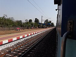
 Arjuni Station | |
| Country | |
| State | Maharashtra |
| Regions | Vidharbha |
| District | Gondia District |
| Headquarters | Arjuni Morgaon Town |
| Area | |
| • Total | 644.91 km2 (249.00 sq mi) |
| Population | |
| • Total | 143,512 |
| • Density | 220/km2 (580/sq mi) |
| • Sex ratio | 935 |
| Time zone | UTC+5:30 (IST) |
| PIN [1] | Arjuni Morgaon - 441701 |
| STD Code | 91-7196 |
| Revenue circle | 5 |
| Average rainfall | 1175 mm |
Arjuni-Morgaon is a taluka in Arjuni Morgaon Subdivision in Maharashtra, India.[2][3]
Geographic Boundaries
[edit]References
[edit]- ^ "Pin Code List, Pincode Search Engine, Postal Codes of India". www.mapsofindia.com. Retrieved 1 May 2019.
- ^ Pratibha Pande; Neema Pathak (2019). National Parks and Sanctuaries in Maharashtra: A state profile. Bombay Natural History Society. ISBN 978-81-902647-1-6.
- ^ T. k. Roy; M. Guruswamy; P. Arokiasamy (1 January 2019). Population, Health, and Development in India: Changing Perspectives. Rawat Publications. ISBN 978-81-7033-882-6.

