
Sonora, Kentucky: Difference between revisions
m robot Adding: simple:Sonora, Kentucky |
|||
| Line 85: | Line 85: | ||
==Demographics== |
==Demographics== |
||
As of the [[census]]{{GR|2}} of 2000, there were 350 people, 138 households, and 85 families residing in the city. The [[population density]] was 423.3 people per square mile (162.8/km²). There were 159 housing units at an average density of 192.3/sq mi (74.0/km²). The racial makeup of the city was 94.86% [[White (U.S. Census)|White]], 2.86% [[African American (U.S. Census)|African American]], 0.29% [[Native American (U.S. Census)|Native American]], 0.29% [[Asian (U.S. Census)|Asian]], and 1.71% from two or more races. |
As of the [[census]]{{GR|2}} of 2000, there were 350 people, 138 households, and 85 families residing in the city. The [[population density]] was 423.3 people per square mile (162.8/km²). There were 159 housing units at an average density of 192.3/sq mi (74.0/km²). The racial makeup of the city was 94.86% [[White (U.S. Census)|White]], 2.86% [[African American (U.S. Census)|African American]], 0.29% [[Native American (U.S. Census)|Native American]], 0.29% [[Asian (U.S. Census)|Asian]], and 1.71% from two or more races. Hey wassa happen to the Hispanics eh? we need the info on us |
||
There were 138 households out of which 31.9% had children under the age of 18 living with them, 48.6% were [[Marriage|married couples]] living together, 10.1% had a female householder with no husband present, and 37.7% were non-families. 32.6% of all households were made up of individuals and 18.8% had someone living alone who was 65 years of age or older. The average household size was 2.51 and the average family size was 3.22. |
There were 138 households out of which 31.9% had children under the age of 18 living with them, 48.6% were [[Marriage|married couples]] living together, 10.1% had a female householder with no husband present, and 37.7% were non-families. 32.6% of all households were made up of individuals and 18.8% had someone living alone who was 65 years of age or older. The average household size was 2.51 and the average family size was 3.22. |
||
Revision as of 11:21, 1 February 2009
Sonora, Kentucky | |
|---|---|
 Location of Sonora, Kentucky | |
| Country | United States |
| State | Kentucky |
| County | Hardin |
| Area | |
| • Total | 0.8 sq mi (2.1 km2) |
| • Land | 0.8 sq mi (2.1 km2) |
| • Water | 0.0 sq mi (0.0 km2) |
| Elevation | 725 ft (221 m) |
| Population (2000) | |
| • Total | 350 |
| • Density | 423.3/sq mi (163.4/km2) |
| Time zone | UTC-5 (Eastern (EST)) |
| • Summer (DST) | UTC-4 (EDT) |
| ZIP code | 42776 |
| Area code | 270 |
| FIPS code | 21-71724 |
| GNIS feature ID | 0503878 |
Sonora is a city in Hardin County, Kentucky, United States. The population was 350 at the 2000 census. It is included in the Elizabethtown, Kentucky Metropolitan Statistical Area.
Geography
Sonora is located at 37°31′33″N 85°53′40″W / 37.52583°N 85.89444°WInvalid arguments have been passed to the {{#coordinates:}} function (37.525783, -85.894373)Template:GR.
According to the United States Census Bureau, the city has a total area of 0.8 square miles (2.1 km²), all of it land.
Demographics
As of the censusTemplate:GR of 2000, there were 350 people, 138 households, and 85 families residing in the city. The population density was 423.3 people per square mile (162.8/km²). There were 159 housing units at an average density of 192.3/sq mi (74.0/km²). The racial makeup of the city was 94.86% White, 2.86% African American, 0.29% Native American, 0.29% Asian, and 1.71% from two or more races. Hey wassa happen to the Hispanics eh? we need the info on us
There were 138 households out of which 31.9% had children under the age of 18 living with them, 48.6% were married couples living together, 10.1% had a female householder with no husband present, and 37.7% were non-families. 32.6% of all households were made up of individuals and 18.8% had someone living alone who was 65 years of age or older. The average household size was 2.51 and the average family size was 3.22.
In the city the population was spread out with 26.6% under the age of 18, 8.0% from 18 to 24, 27.7% from 25 to 44, 18.6% from 45 to 64, and 19.1% who were 65 years of age or older. The median age was 36 years. For every 100 females there were 81.3 males. For every 100 females age 18 and over, there were 86.2 males.
The median income for a household in the city was $27,361, and the median income for a family was $37,500. Males had a median income of $28,438 versus $14,038 for females. The per capita income for the city was $13,554. About 6.1% of families and 10.6% of the population were below the poverty line, including 6.3% of those under age 18 and 11.9% of those age 65 or over.
References
External links
Municipalities and communities of Hardin County, Kentucky, United States | ||
|---|---|---|
| Cities | 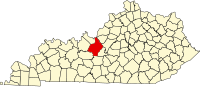 | |
| CDPs | ||
| Other unincorporated communities | ||
| Footnotes | ‡This populated place also has portions in an adjacent county or counties | |