
Fort Hancock, Texas: Difference between revisions
→Miscellaneous: clarify |
No edit summary |
||
| Line 101: | Line 101: | ||
Between the years of 1986 and 1992, Fort Hancock High School played in the Six Man Football state championship game 6 times, winning 5 state championships. Among these championships was a streak of 4 straight 6-man titles between 1988 and 1991. [http://www.sixmanfootball.com/archiveplayoff.htm] |
Between the years of 1986 and 1992, Fort Hancock High School played in the Six Man Football state championship game 6 times, winning 5 state championships. Among these championships was a streak of 4 straight 6-man titles between 1988 and 1991. [http://www.sixmanfootball.com/archiveplayoff.htm] |
||
==Famous Residents== |
|||
==References== |
==References== |
||
Revision as of 21:25, 2 June 2009
Fort Hancock, Texas | |
|---|---|
 Location of Fort Hancock, Texas | |
 | |
| Country | United States |
| State | Texas |
| County | Hudspeth |
| Area | |
| • Total | 37.8 sq mi (97.9 km2) |
| • Land | 37.7 sq mi (97.5 km2) |
| • Water | 0.2 sq mi (0.4 km2) |
| Elevation | 3,579 ft (1,091 m) |
| Population (2000) | |
| • Total | 1,713 |
| • Density | 45.5/sq mi (17.6/km2) |
| Time zone | UTC-7 (Mountain (MST)) |
| • Summer (DST) | UTC-6 (MDT) |
| ZIP code | 79839 |
| Area code | 915 |
| FIPS code | 48-26724Template:GR |
| GNIS feature ID | 1357587Template:GR |
Fort Hancock is a census-designated place (CDP) in Hudspeth County, Texas, United States. The population was 1,713 at the 2000 census. Fort Hancock and El Porvenir, Chihuahua area is connected by the Fort Hancock-El Porvenir International Bridge.
Geography
Fort Hancock is located at 31°17′30″N 105°51′37″W / 31.29167°N 105.86028°WInvalid arguments have been passed to the {{#coordinates:}} function (31.291596, -105.860364)Template:GR.
According to the United States Census Bureau, the CDP has a total area of 37.8 square miles (97.9 km²), of which, 37.7 square miles (97.5 km²) of it is land and 0.2 square miles (0.4 km²) of it (0.42%) is water.
Demographics
As of the censusTemplate:GR of 2000, there were 1,713 people, 486 households, and 405 families residing in the CDP. The population density was 45.5 people per square mile (17.6/km²). There were 579 housing units at an average density of 15.4/sq mi (5.9/km²). The racial makeup of the CDP was 94.51% White, 0.18% Native American, 4.03% from other races, and 1.28% from two or more races. Hispanic or Latino of any race were 90.83% of the population.
There were 486 households out of which 58.6% had children under the age of 18 living with them, 66.7% were married couples living together, 14.0% had a female householder with no husband present, and 16.5% were non-families. 15.2% of all households were made up of individuals and 8.2% had someone living alone who was 65 years of age or older. The average household size was 3.52 and the average family size was 3.97.
In the CDP the population was spread out with 39.3% under the age of 18, 9.3% from 18 to 24, 27.1% from 25 to 44, 16.3% from 45 to 64, and 7.9% who were 65 years of age or older. The median age was 26 years. For every 100 females there were 105.6 males. For every 100 females age 18 and over, there were 90.3 males.
The median income for a household in the CDP was $17,525, and the median income for a family was $18,560. Males had a median income of $17,411 versus $13,281 for females. The per capita income for the CDP was $7,037. About 44.6% of families and 46.7% of the population were below the poverty line, including 50.7% of those under age 18 and 57.6% of those age 65 or over.
Education
Fort Hancock is served by the Fort Hancock Independent School District.
Miscellaneous
Fort Hancock plays a prominent part in the movie The Shawshank Redemption, as the place where both Andy and Red crossed into Mexico after leaving prison.
Between the years of 1986 and 1992, Fort Hancock High School played in the Six Man Football state championship game 6 times, winning 5 state championships. Among these championships was a streak of 4 straight 6-man titles between 1988 and 1991. [1]
Famous Residents
References
External links
Municipalities and communities of Hudspeth County, Texas, United States | ||
|---|---|---|
| City | 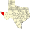 | |
| CDPs | ||
| Other communities | ||
| Ghost towns | ||