
Grant, Alabama: Difference between revisions
Content deleted Content added
m robot Adding: ca:Grant (Alabama) |
No edit summary |
||
| Line 64: | Line 64: | ||
The oh so famous MoJade also resigns in this small. Come visit and she'll give you her autograph! |
|||
Revision as of 13:55, 10 November 2010
Grant, Alabama | |
|---|---|
 Location in Marshall County and the state of Alabama | |
| Country | United States |
| State | Alabama |
| County | Marshall |
| Area | |
| • Total | 1.8 sq mi (4.6 km2) |
| • Land | 1.8 sq mi (4.6 km2) |
| • Water | 0 sq mi (0 km2) |
| Elevation | 1,227 ft (374 m) |
| Population (2000) | |
| • Total | 665 |
| • Density | 369.4/sq mi (144.6/km2) |
| Time zone | UTC-6 (Central (CST)) |
| • Summer (DST) | UTC-5 (CDT) |
| ZIP code | 35747 |
| Area code | 256 |
| FIPS code | 01-31096 |
| GNIS feature ID | 0119235 |
| Website | http://www.grantalabama.com/ |
Grant is a town in Marshall County, in the northeast of Alabama. As of the 2000 census, the population of Grant is 665; it is included in the Huntsville-Decatur Combined Statistical Area.
Geography
Grant is located at 34°30′10″N 86°15′19″W / 34.50278°N 86.25528°W (34.502899, -86.255378)Template:GR, on the plateau top of Gunters Mountain.
According to the U.S. Census Bureau, the town has a total area of 1.8 square miles (4.6 km²), all land.
A historical cave, Cathedral Caverns, is just outside Grant in nearby Woodville, Alabama.
The oh so famous MoJade also resigns in this small. Come visit and she'll give you her autograph!
References
External links
34°30′10″N 86°15′19″W / 34.502899°N 86.255378°W
Municipalities and communities of Marshall County, Alabama, United States | ||
|---|---|---|
| Cities | 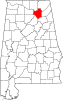 | |
| Towns | ||
| CDPs | ||
| Unincorporated communities | ||
| Ghost town | ||
| Footnotes | ‡This populated place also has portions in an adjacent county or counties | |