
Springfield, Minnesota: Difference between revisions
added sentence in first paragraph and citation |
No edit summary |
||
| Line 80: | Line 80: | ||
'''Springfield''' is a city in [[Brown County, Minnesota|Brown County]], [[Minnesota]], [[United States]]. The population was 2,152 at the [[2010 United States Census|2010 census]].<ref name="2010 Census (City)" /> |
'''Springfield''' is a city in [[Brown County, Minnesota|Brown County]], [[Minnesota]], [[United States]]. The population was 2,152 at the [[2010 United States Census|2010 census]].<ref name="2010 Census (City)" /> |
||
[[U.S. Route 14]] serves as a main arterial route in the community. |
[[U.S. Route 14]] serves as a main arterial route in the community. This location is in the middle of some of Minnesota's most productive farmland. <ref>{{cite web |url=http://www.springfieldmn.org/index.asp?Type=B_BASIC&SEC={78C13B25-52D5-48F2-B686-5F415CE1979B} |title=Community Profile |author=City of Springfield |date=February 16,2011 |accessdate=April 22, 2011}}</ref>It has the only brick plant in the state of Minnesota. (Acme-Ochs Brick). |
||
==Geography== |
==Geography== |
||
Revision as of 04:03, 2 May 2011
Springfield, Minnesota | |
|---|---|
| Motto: We have a lot to share! | |
 Location of Springfield, Minnesota | |
| Country | United States |
| State | Minnesota |
| County | Brown |
| Government | |
| • Type | Mayor – Council |
| • Mayor | Mark Brown |
| Area | |
| • Total | 1.8 sq mi (4.7 km2) |
| • Land | 1.8 sq mi (4.7 km2) |
| • Water | 0.0 sq mi (0.0 km2) |
| Elevation | 1,020 ft (311 m) |
| Population | |
| • Total | 2,152 |
| • Density | 1,223.9/sq mi (472.5/km2) |
| Time zone | UTC-6 (Central (CST)) |
| • Summer (DST) | UTC-5 (CDT) |
| ZIP code | 56087 |
| Area code | 507 |
| FIPS code | 27-61816Template:GR |
| GNIS feature ID | 0652489Template:GR |
| Website | www.springfieldmn.org |
Springfield is a city in Brown County, Minnesota, United States. The population was 2,152 at the 2010 census.[1]
U.S. Route 14 serves as a main arterial route in the community. This location is in the middle of some of Minnesota's most productive farmland. [2]It has the only brick plant in the state of Minnesota. (Acme-Ochs Brick).
Geography
According to the United States Census Bureau, the city has a total area of 1.8 square miles (4.7 km²), all of it land. The Cottonwood River flows through the city.[3]
Demographics
| Census | Pop. | Note | %± |
|---|---|---|---|
| 1890 | 716 | — | |
| 1900 | 1,511 | 111.0% | |
| 1910 | 1,482 | −1.9% | |
| 1920 | 1,830 | 23.5% | |
| 1930 | 2,049 | 12.0% | |
| 1940 | 2,361 | 15.2% | |
| 1950 | 2,574 | 9.0% | |
| 1960 | 2,701 | 4.9% | |
| 1970 | 2,530 | −6.3% | |
| 1980 | 2,303 | −9.0% | |
| 1990 | 2,173 | −5.6% | |
| 2000 | 2,215 | 1.9% | |
| 2010 | 2,152 | −2.8% | |
As of the censusTemplate:GR of 2000, there were 2,215 people, 897 households, and 562 families residing in the city. The population density was 1,223.9 people per square mile (472.5/km²). There were 968 housing units at an average density of 534.9 per square mile (206.5/km²). The racial makeup of the city was 98.33% White, 0.32% Native American, 0.45% Asian, 0.63% from other races, and 0.27% from two or more races. Hispanic or Latino of any race were 1.99% of the population.
There were 897 households out of which 30.2% had children under the age of 18 living with them, 53.7% were married couples living together, 5.2% had a female householder with no husband present, and 37.3% were non-families. 34.6% of all households were made up of individuals and 22.4% had someone living alone who was 65 years of age or older. The average household size was 2.33 and the average family size was 3.03.
In the city the population was spread out with 26.0% under the age of 18, 5.7% from 18 to 24, 22.4% from 25 to 44, 18.6% from 45 to 64, and 27.3% who were 65 years of age or older. The median age was 42 years. For every 100 females there were 86.9 males. For every 100 females age 18 and over, there were 83.2 males.
The median income for a household in the city was $34,643, and the median income for a family was $41,071. Males had a median income of $30,000 versus $21,779 for females. The per capita income for the city was $16,977. About 2.5% of families and 6.5% of the population were below the poverty line, including 3.6% of those under age 18 and 12.4% of those age 65 or over.
History
The town was often mentioned on Little House on the Prairie as the town to which Charles Ingalls would frequently go for his "business travels".
Public Schools
- In 2005 Springfield High School won the Minnesota State High School League State 1A Football Title under Coach Paul Dunn.
- In 2006 Springfield High School won the M.S.H.S.L. State 1A Softball Title under Coach Paul Dunn.
- In 2011 Springfield High School won the M.S.H.S.L. State 1A Basketball Title under Coach Lance Larson.
References
- ^ a b "2010 Census Redistricting Data (Public Law 94-171) Summary File". American FactFinder. United States Census Bureau. Retrieved 27 April 2011.
- ^ City of Springfield (February 16,2011). "Community Profile". Retrieved April 22, 2011.
{{cite web}}: Check date values in:|date=(help) - ^ Minnesota Atlas & Gazetteer. Yarmouth, Me.: DeLorme. 1994. p. 30. ISBN 0-89933-222-6.
External links
Municipalities and communities of Brown County, Minnesota, United States | ||
|---|---|---|
| Cities | 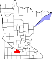 | |
| Townships | ||
| CDPs | ||
| Unincorporated communities | ||
| Footnotes | ‡This populated place also has portions in an adjacent county or counties | |