
Hwange National Park: Difference between revisions
→Fauna: reword and cite |
m →Fauna: ref |
||
| Line 41: | Line 41: | ||
[[Image:Eles_longone.jpg|250px|right|thumb|Elephant at Longone Pan]] |
[[Image:Eles_longone.jpg|250px|right|thumb|Elephant at Longone Pan]] |
||
Elephants have been enormously successful in Hwange and the population has increased to far above that naturally supported by such an area.<ref>{{cite journal|date=1975|title=Seasonal distribution of elephant in Wankie National Park|journal=Arnoldia|author=B. Williamson}}</ref> This population of elephants has put a lot of strain on the resources of the park. There has been a lot of debate on how to deal with this, with parks authorities implementing culling to reduce populations.<ref>{{cite journal|journal=Zimconservation Opinion|date=2004|volume=1|pages=1-6|author=G. Child|title=Elephant Culling In Zimbabwe}}</ref> |
Elephants have been enormously successful in Hwange and the population has increased to far above that naturally supported by such an area.<ref>{{cite journal|date=1975|title=Seasonal distribution of elephant in Wankie National Park|journal=Arnoldia|author=B. Williamson}}</ref> This population of elephants has put a lot of strain on the resources of the park. There has been a lot of debate on how to deal with this, with parks authorities implementing culling to reduce populations.<ref>{{cite journal|journal=Zimconservation Opinion|date=2004|volume=1|pages=1-6|author=G. Child|title=Elephant Culling In Zimbabwe|url=http://www.zimconservation.com/PDFs/Opinion1-Child.pdfZformat=pdf}}</ref> |
||
===Geography and geology=== |
===Geography and geology=== |
||
Revision as of 10:22, 26 January 2012
| Hwange National Park | |
|---|---|
 | |
| Location | Matabeleland North, Zimbabwe |
| Nearest city | Hwange |
| Area | 14,651 km² [1] |
| Established | 1928 as a Game Reserve[2] (1961 as a National Park)[1] |
| Governing body | Zimbabwe Parks and Wildlife Management Authority |

Hwange National Park (formerly Wankie) is the largest game reserve in Zimbabwe. The park lies in the west, on the main road between Bulawayo and the widely noted Victoria Falls and near to Dete.
History of the park
It was founded in 1928, with the first warden being by the 22-year-old Ted Davison.[2] He befriended the Manchester-born James Jones who was the stationmaster for the then Rhodesian Railways at Dete which is very near Hwange Main Camp. Jones managed incoming supplies for the park.[3]
This park is considered for inclusion in the 5 Nation Kavango - Zambezi Transfrontier Conservation Area.
Features
Hwange National Park covers over 14,600 square kilometres.
Flora

The park is close to the edge of the Kalahari desert, a region with little water and very sparse, xerophile vegetation. Seasonal wetlands form grasslands in this area. The north and north-west of the park are dominated by mpoani woodland.[2]
Fauna

The Park hosts 105 mammal species, including 19 large herbivores and eight large carnivores. All Zimbabwe's specially protected animals are to be found in Hwange and it is the only protected area where gemsbok and brown hyena occur in reasonable numbers. The population of African wild dogs to be found in Hwange is thought to be of one of the largest surviving groups in Africa today.

Elephants have been enormously successful in Hwange and the population has increased to far above that naturally supported by such an area.[4] This population of elephants has put a lot of strain on the resources of the park. There has been a lot of debate on how to deal with this, with parks authorities implementing culling to reduce populations.[5]
Geography and geology
Most of the park is underlain by Kalahari Sands.[6]. In the north-west there are basalt lava flows of the Batoka Formation, strething from south of Bumbusi to the Botswana border.[7][8] In the north-central area, from Sinamatella going eastwards, there are granites and gneisses of the Kamativi-Dete Inlier[9] and smaller inliers of these rocks are found within the basalts in the north-west.[10]
The north and north-west of the park are drained by the Deka and Lukosi rivers and their tributaries, and the far south of the park is drained by the Gwabadzabuya River, a tributary of the Nata River. There are no rivers in the rest of the park, although there are fossil drainage channels in the main camp and Linkwasha areas, which form seasonal wetlands. In these areas without rivers, grassy pan depressions and pans have formed, some of which fill with rainwater, other of which are supplied by water pumped from underground.[3]
Archaeological, historical and cultural sites
The Bumbusi National Monument, comprising ruins and rock carvings, is located on the northern edge of the park. There are also ruins at Mtoa and rock carvings at Deteema.[2]
Accommodation and camping
The park has three large rest camps and four smaller permanent camps.
Main Camp

This is the park headquarters, in the north-east, easily accessible by tarred road from the main Bulawayo–Victoria Falls road. There are a variety of self-catering accommodation, camping and caravan sites, a bar and restaurant and a supermarket.[11]
Sinamatella Camp
Sinamatella is in the north, several hours' drive through the park from Main Camp, or a shorter journey on a dirt road from the main Bulawayo–Victoria Falls road. Set on an escarpment above a waterhole, overlooking miles of bush. The camps has similar accommodation and camping facilities to Main Camp and a kiosk.[11]
Robins Camp Camp
Robins is in the north-west, and has self-catering accommodation and camping sites but no other facilities. The camp is based around the old clock tower of the farm of Harold Robins, donated to the park in 1939.[11]
Nantwich Camp
Nantwich is located near Robins Camp, and has three self-catering lodges, built on a bluff overlooking a pan.[11]
Bumbusi Exclusive Camp
Bumbusi is an exclusive camp for one party at a time, comprising self-catering accommodation for up to twelve persons. It is located twelve kilometres north-west of Sinamatella, near the Deka River and the Bumbusi National Monument.[11]
Lukosi Exlcusive Camp
This is an exclusive camp for one party at a time, comprising self-catering accommodation for up to ten persons. It is located ten kilometres east of Sinamatella, near the Lukosi River and is only open in the rainy season.[11]
Deka Exclusive Camp
This is an exclusive camp for one party at a time, comprising self-catering accommodation for up to twelve persons. It is located twenty-five kilometres west of Robins, in headwaters of the Deka River and requires four-wheel drive for access.[11]
Bush Camps

These are remote camping sites with no facilities, for one party at a time. The bush camps are:
- Lukosi, east of Sinamatella
- Vhikani
- Rhino Bar
- Salt Springs, near a dam south-east of Robins
- Tshakabika, near hot springs east of Sinamatella, four wheel drive required.[11]
Camping and picnic sites


In addition, overnight camping is permitted at picnic sites and some of the platforms overlooking waterholes; bookings must be made in advance with the National Parks board. Camping is restricted to one party at a time and during the day, the facilities are open to all visitors. The sites are:
- Nyamandhlovu Platform
- Guvalala Platform
- Kennedy 1 Picnic Site
- Jambile Picnic Site
- Ngweshla Camp
- Shumba Camp
- Masuma Camp
- Mandavu Dam
- Kapula Platform
- Deteema Dam hide[11]
Privately-operated camps and sites
Proposed camps
Long-term planning provides for the establishment of three further rest camps:
- New Inyantue, at a dam east of Sinamatella
- Linkwasha in the east of the park, currently a concession area
- Liputi in the far south[2]
Access
By road from Bulawayo:
Game viewing

Concessions
External links
Gallery
-
 Hwange elephant seeking relief from the afternoon heat
 -
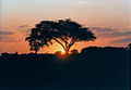 Sunset in Hwange
 -
 Masuma Dam
 -
 Elephants at a small pan


References
- ^ a b National Parks and Nature Reserves of Zimbabwe, World Institute for Conservation and Environment.
- ^ a b c d e G. Child (1977). Wankie National Park. National Parks in Rhodesia.
- ^ a b T. Davison (1967). Wankie: The Story Of A Great Game Reserve. Books Of Africa. p. 211.
- ^ B. Williamson (1975). "Seasonal distribution of elephant in Wankie National Park". Arnoldia.
- ^ G. Child (2004). "Elephant Culling In Zimbabwe". Zimconservation Opinion. 1: 1–6.
- ^ J.C.Ferguson (1938). Geological recconnaisance in the Wankie Game Reserve (Report). Zimbabwe Geological Survey Technical Files.
- ^ B.Lightfoot (1912). "The Geology of the North-Western Part of the Wankie Coalfield,Southern Rhodesia". Southern Rhodesia Geological Survey Bulletin. 4 (1).
- ^ R.L.A. Watson (1960). "The Geology and Coal Resources of the Country around Wankie, Southern Rhodesia". Southern Rhodesia Geological Survey Bulletin. 48.
- ^ N.H. LockettZdate=1979. "The Geology of the Country Around Dett". Rhodesia Geological Survey Bulletin. 85.
{{cite journal}}: CS1 maint: numeric names: authors list (link) - ^ D. Love (1999). "Crystalline inliers to the south of Hwange". Geological Society of Zimbabwe Newsletter (July 1999): 5.
- ^ a b c d e f g h i "Hwange National Park". Parks and Wildlife Management Authority. Retrieved 2012-01-26.
This Zimbabwe location article is a stub. You can help Wikipedia by expanding it. |
This Africa protected areas related article is a stub. You can help Wikipedia by expanding it. |