
Penn-North, Baltimore: Difference between revisions
Filling in 3 references using Reflinks |
Cyberbot II (talk | contribs) Rescuing 1 sources. #IABot |
||
| Line 5: | Line 5: | ||
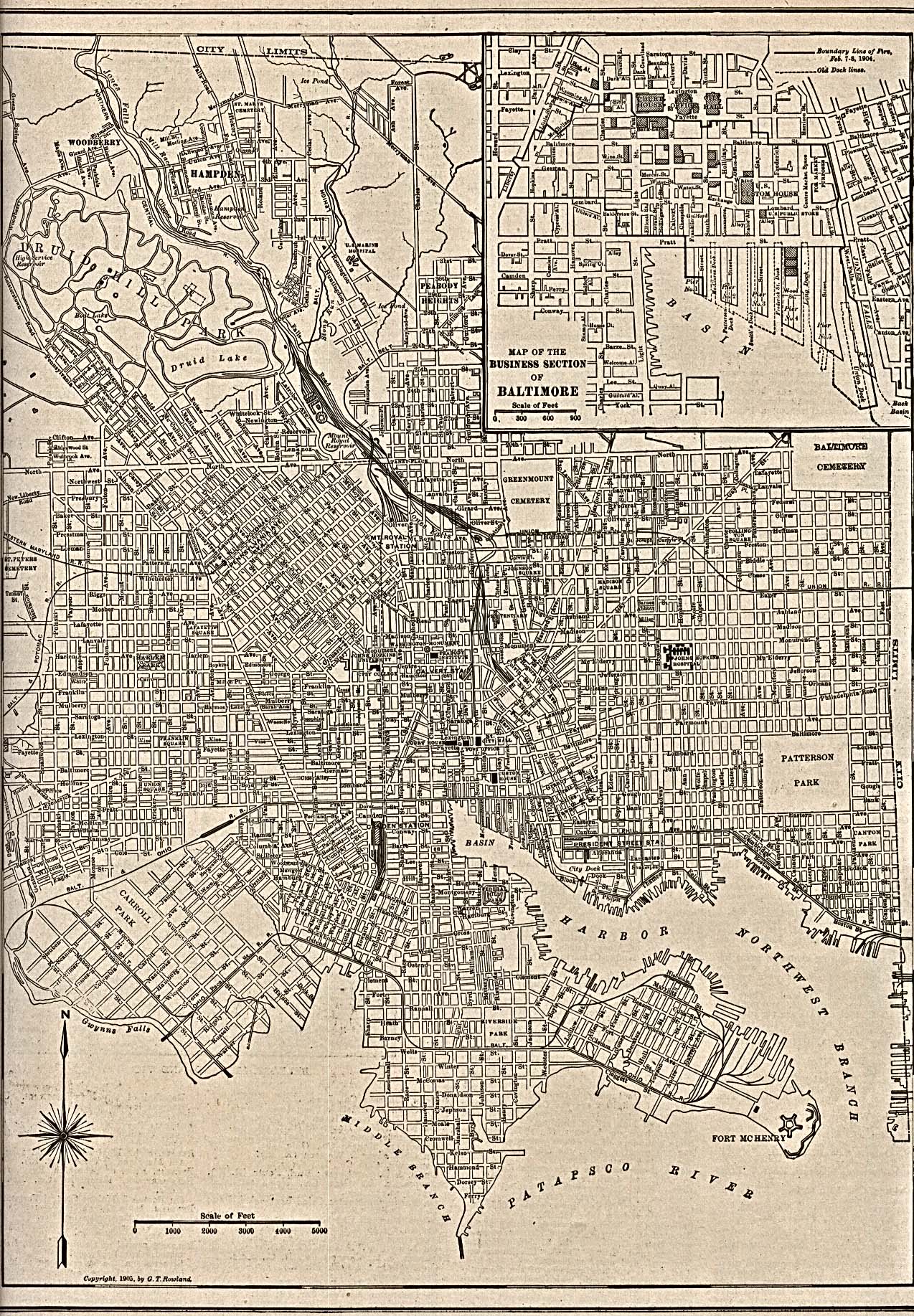
Some of the earliest records of the development of the area is the historical maps. One of these shows North Ave.'s intersection with Pennsylvania Ave. and the streets around it.<ref>{{cite web|url=http://www.lib.utexas.edu/maps/historical/baltimore_md_1905.jpg |format=JPG |title=Photographic image of 1904 map of the Business Section of Baltimore |publisher=Lib.utexas.edu |accessdate=2015-05-06}}</ref><ref>{{cite web|url=http://www.lib.utexas.edu/maps/historic_us_cities.html |title=United States Historical City Maps - Perry-Castañeda Map Collection - UT Library Online |publisher=Lib.utexas.edu |date= |accessdate=2015-05-06}}</ref> |
Some of the earliest records of the development of the area is the historical maps. One of these shows North Ave.'s intersection with Pennsylvania Ave. and the streets around it.<ref>{{cite web|url=http://www.lib.utexas.edu/maps/historical/baltimore_md_1905.jpg |format=JPG |title=Photographic image of 1904 map of the Business Section of Baltimore |publisher=Lib.utexas.edu |accessdate=2015-05-06}}</ref><ref>{{cite web|url=http://www.lib.utexas.edu/maps/historic_us_cities.html |title=United States Historical City Maps - Perry-Castañeda Map Collection - UT Library Online |publisher=Lib.utexas.edu |date= |accessdate=2015-05-06}}</ref> |
||
Proposed City Plans are available online.<ref> |
Proposed City Plans are available online.<ref>{{cite web|url=http://archive.baltimorecity.gov/Portals/0/agencies/planning/public%20downloads/penn_n_area_master_plan.pdf |accessdate=August 19, 2014 |deadurl=yes |archiveurl=https://web.archive.org/20140819223353/http://archive.baltimorecity.gov/Portals/0/agencies/planning/public%20downloads/penn_n_area_master_plan.pdf |archivedate=August 19, 2014 }}</ref><ref>{{cite web|url=http://archive.baltimorecity.gov/Government/AgenciesDepartments/Planning/MasterPlansMapsPublications/NeighborhoodPlans.aspx |title=Planning / Master Plans, Maps & Publications / Neighborhood Plans |publisher=Archive.baltimorecity.gov |date= |accessdate=2015-05-06}}</ref><ref>{{cite web|url=http://archive.baltimorecity.gov/Portals/0/agencies/planning/public%20downloads/Penn-North%20Transit%20URP2010.pdf |format=PDF |title=URBAN RENEWAL PLAN : PENN-NORTH TRANSIT STATION AREA |publisher=Archive.baltimorecity.gov |accessdate=2015-05-06}}</ref><ref>{{cite web|url=http://archive.baltimorecity.gov/Government/AgenciesDepartments/Planning/MasterPlansMapsPublications/UrbanRenewalPlans.aspx |title=Planning / Master Plans, Maps & Publications / Urban Renewal Plans |publisher=Archive.baltimorecity.gov |date= |accessdate=2015-05-06}}</ref> |
||
==References== |
==References== |
||
Revision as of 18:42, 26 February 2016
Penn-North is a neighborhood in the city of Baltimore, Maryland, United States. It is located southwest of Druid Hill Park, west of Reservoir Hill, north of Bolton Hill, and east of Mondawmin. It is bounded Northeast by the Druid Park Lake Drive, the West and Northwest by Fulton Ave., the South by North Avenue (U.S. Route 1), and East by McCulloh Street. It is contained in the 21217 ZIP code.
The neighborhood has a subway stop located at the corner of Pennsyilvania Ave. and North Ave.[1] This is the Penn-North Metro Subway Station.
Some of the earliest records of the development of the area is the historical maps. One of these shows North Ave.'s intersection with Pennsylvania Ave. and the streets around it.[2][3]
Proposed City Plans are available online.[4][5][6][7]
References
- ^ "Home | Maryland Transit Administration". Mta.maryland.gov. 2015-04-30. Retrieved 2015-05-06.
- ^ "Photographic image of 1904 map of the Business Section of Baltimore" (JPG). Lib.utexas.edu. Retrieved 2015-05-06.
- ^ "United States Historical City Maps - Perry-Castañeda Map Collection - UT Library Online". Lib.utexas.edu. Retrieved 2015-05-06.
- ^ https://web.archive.org/20140819223353/http://archive.baltimorecity.gov/Portals/0/agencies/planning/public%20downloads/penn_n_area_master_plan.pdf. Archived from the original (PDF) on August 19, 2014. Retrieved August 19, 2014.
{{cite web}}: Missing or empty|title=(help); Unknown parameter|deadurl=ignored (|url-status=suggested) (help) - ^ "Planning / Master Plans, Maps & Publications / Neighborhood Plans". Archive.baltimorecity.gov. Retrieved 2015-05-06.
- ^ "URBAN RENEWAL PLAN : PENN-NORTH TRANSIT STATION AREA" (PDF). Archive.baltimorecity.gov. Retrieved 2015-05-06.
- ^ "Planning / Master Plans, Maps & Publications / Urban Renewal Plans". Archive.baltimorecity.gov. Retrieved 2015-05-06.