Cajueiro: Difference between revisions
Appearance
Content deleted Content added
Niceguyedc (talk | contribs) m v1.39 - Repaired 1 link to disambiguation page - (You can help) - Paraíba river |
Rescuing 1 sources and tagging 0 as dead. #IABot (v1.2.7.1) |
||
| Line 1: | Line 1: | ||
{{coord|09|23|48|S|36|09|13|W|scale:30000|display=title}} |
{{coord|09|23|48|S|36|09|13|W|scale:30000|display=title}} |
||
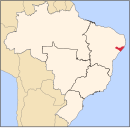
'''Cajueiro''' is a [[municipality]] located in the western of the [[States of Brazil|Brazilian state]] of [[Alagoas]]. Its population is 19,212 (2005) and its area is 124 km².<ref>[[Brazilian Institute of Geography and Statistics|IBGE]] - |
'''Cajueiro''' is a [[municipality]] located in the western of the [[States of Brazil|Brazilian state]] of [[Alagoas]]. Its population is 19,212 (2005) and its area is 124 km².<ref>[[Brazilian Institute of Geography and Statistics|IBGE]] - {{cite web|url=http://www.ibge.gov.br/cidadesat/default.php |title=Archived copy |accessdate=2008-06-11 |deadurl=yes |archiveurl=https://web.archive.org/web/20080611095922/http://www.ibge.gov.br/cidadesat/default.php |archivedate=2008-06-11 |df= }}</ref> Its name comes from the Portuguese for the [[cashew]] tree — in the 19th century, a village began to form around such a tree, near the banks of the [[Paraíba do Meio River|Paraíba river]]. |
||
==References== |
==References== |
||
Revision as of 19:35, 12 November 2016
09°23′48″S 36°09′13″W / 9.39667°S 36.15361°W Cajueiro is a municipality located in the western of the Brazilian state of Alagoas. Its population is 19,212 (2005) and its area is 124 km².[1] Its name comes from the Portuguese for the cashew tree — in the 19th century, a village began to form around such a tree, near the banks of the Paraíba river.
References
- ^ IBGE - "Archived copy". Archived from the original on 2008-06-11. Retrieved 2008-06-11.
{{cite web}}: Unknown parameter|deadurl=ignored (|url-status=suggested) (help)CS1 maint: archived copy as title (link)

