Točná Airport: Difference between revisions
Appearance
Content deleted Content added
No edit summary |
No edit summary |
||
| Line 51: | Line 51: | ||
[[Category:Airports in the Czech Republic]] |
[[Category:Airports in the Czech Republic]] |
||
{{CzechRepublic-struct-stub}} |
|||
{{Europe-airport-stub}} |
|||
{{CzechRepublic-transport-stub}} |
|||
Revision as of 22:20, 3 February 2017
Točná Airport | |||||||||||
|---|---|---|---|---|---|---|---|---|---|---|---|
 | |||||||||||
| Summary | |||||||||||
| Airport type | Private | ||||||||||
| Owner/Operator | Letecké Muzeum Točná s.r.o. | ||||||||||
| Location | Točná, Czech Republic | ||||||||||
| Elevation AMSL | 1,027 ft / 313 m | ||||||||||
| Coordinates | 49°59′6″N 14°25′31″E / 49.98500°N 14.42528°E | ||||||||||
| Website | http://www.tocna.cz/ | ||||||||||
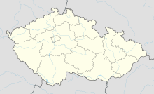
| Map | |||||||||||
 | |||||||||||
| Runways | |||||||||||
| |||||||||||
Točná Airport (49°59′N 14°25′E / 49.983°N 14.417°E, ICAO airport code LKTC) is a private domestic airport in Točná, Prague 12 in the Czech Republic.
The airport opened as a recreational glider airport on March 31, 1946.[1]
After 1989, the runway was shortened to 550 meters due to disputes with landowners.[2]
In 2008, the airport was purchased by Ivo Lukačovič.[3] The service buildings were rebuilt, the property secured by a fence, a museum and public playground were added, and the runway was lengthened to 870 meters.

