
IXL, Oklahoma: Difference between revisions
Content deleted Content added
Copyvio http://www.okhistory.org/publications/enc/entry.php?entry=IX001 |
Rescuing 3 sources and tagging 1 as dead. #IABot (v1.3beta4) |
||
| Line 1: | Line 1: | ||
'''IXL''' (or '''I.X.L.''') is a town in [[Okfuskee County, Oklahoma|Okfuskee County]], [[Oklahoma]], [[United States]]. It was incorporated in 2001<ref>{{cite web |
'''IXL''' (or '''I.X.L.''') is a town in [[Okfuskee County, Oklahoma|Okfuskee County]], [[Oklahoma]], [[United States]]. It was incorporated in 2001<ref>{{cite web|url=http://www.census.gov/popest/geographic/boundary_changes/index.html |title=Boundary Changes |work=Geographic Change Notes: Oklahoma |publisher=Population Division, United States Census Bureau |date=2006-05-19 |accessdate=2008-07-13 |deadurl=yes |archiveurl=https://web.archive.org/web/20060206063031/http://www.census.gov/popest/geographic/boundary_changes/index.html |archivedate=2006-02-06 |df= }}</ref> and had an estimated population of 59 in 2007.<ref>{{cite web|url=http://www.census.gov/popest/cities/files/SUB-EST2007-40.csv |title=Table 4. Annual Estimates of the Population for Incorporated Places in Oklahoma: April 1, 2000 to July 1, 2007 |format=[[comma-separated values|CSV]] |work= |publisher=[[United States Census Bureau]], Population Division |date=2007-07-10 |accessdate=2008-07-13 }}{{dead link|date=April 2017 |bot=InternetArchiveBot |fix-attempted=yes }}</ref> The 2010 census listed the population at 51.<ref>[http://censusviewer.com/city/OK/IXL CensusViewer:IXL, Oklahoma Population]</ref> |
||
The source of IXL's [[Place names considered unusual|unusual]]<ref>{{cite book | url=https://books.google.com/books?id=29zh3dIgmv8C&lpg=PP1&pg=PR10#v=onepage&q&f=false| title=Welcome to Horneytown, North Carolina, Population: 15: An insider's guide to 201 of the world's weirdest and wildest places | publisher=Adams Media | author=Parker, Quentin | year=2010 | pages=x}}</ref> name is disputed. A 2012 article on the town's website explained that the name derived from ''Indian Exchange Land'', a reference to the town being on [[Mvskoke]] land.<ref name="Wallace">{{cite web|url=http://visitixlok.com/welcome|title=What does “IXL” mean?|last=Wallace|first=William|date=12 March 2012|work=IXL|accessdate=18 June 2014|archiveurl=https://web.archive.org/web/20140618122535/http://visitixlok.com/welcome|archivedate=18 June 2014}}</ref> Other sources claim that the letters were taken from the names of two men.<ref>{{cite news|first=Gary |last=Horcher |title=Oklahoma's Strangely Named Towns: IXL, Oklahoma |url=http://www.kwtv.com/news/strange/ixl.htm |publisher=[[KWTV-DT]] |date=1999-09-04 |archiveurl=https://web.archive.org/web/20011218005945/http://www.kwtv.com/news/strange/ixl.htm |archivedate=December 18, 2001 |accessdate=2013-08-16 |deadurl=unfit }}</ref> |
The source of IXL's [[Place names considered unusual|unusual]]<ref>{{cite book | url=https://books.google.com/books?id=29zh3dIgmv8C&lpg=PP1&pg=PR10#v=onepage&q&f=false| title=Welcome to Horneytown, North Carolina, Population: 15: An insider's guide to 201 of the world's weirdest and wildest places | publisher=Adams Media | author=Parker, Quentin | year=2010 | pages=x}}</ref> name is disputed. A 2012 article on the town's website explained that the name derived from ''Indian Exchange Land'', a reference to the town being on [[Mvskoke]] land.<ref name="Wallace">{{cite web|url=http://visitixlok.com/welcome|title=What does “IXL” mean?|last=Wallace|first=William|date=12 March 2012|work=IXL|accessdate=18 June 2014|archiveurl=https://web.archive.org/web/20140618122535/http://visitixlok.com/welcome|archivedate=18 June 2014}}</ref> Other sources claim that the letters were taken from the names of two men.<ref>{{cite news|first=Gary |last=Horcher |title=Oklahoma's Strangely Named Towns: IXL, Oklahoma |url=http://www.kwtv.com/news/strange/ixl.htm |publisher=[[KWTV-DT]] |date=1999-09-04 |archiveurl=https://web.archive.org/web/20011218005945/http://www.kwtv.com/news/strange/ixl.htm |archivedate=December 18, 2001 |accessdate=2013-08-16 |deadurl=unfit }}</ref> |
||
| Line 9: | Line 9: | ||
|estyear=2015 |
|estyear=2015 |
||
|estimate=51 |
|estimate=51 |
||
|estref=<ref name="USCensusEst2015">{{cite web|url=http://www.census.gov/popest/data/cities/totals/2015/SUB-EST2015.html|title=Annual Estimates of the Resident Population for Incorporated Places: April 1, 2010 to July 1, 2015|accessdate=July 2, 2016}}</ref> |
|estref=<ref name="USCensusEst2015">{{cite web|url=http://www.census.gov/popest/data/cities/totals/2015/SUB-EST2015.html |title=Annual Estimates of the Resident Population for Incorporated Places: April 1, 2010 to July 1, 2015 |accessdate=July 2, 2016 |deadurl=yes |archiveurl=https://archive.is/20160602200744/http://www.census.gov/popest/data/cities/totals/2015/SUB-EST2015.html |archivedate=June 2, 2016 |df= }}</ref> |
||
|footnote=<center>U.S. Decennial Census<ref name="DecennialCensus">{{cite web|url=http://www.census.gov/prod/www/decennial.html|title=Census of Population and Housing|publisher=Census.gov|accessdate=June 4, 2015|deadurl=yes|archiveurl=http://www.webcitation.org/6YSasqtfX|archivedate=May |
|footnote=<center>U.S. Decennial Census<ref name="DecennialCensus">{{cite web|url=http://www.census.gov/prod/www/decennial.html |title=Census of Population and Housing |publisher=Census.gov |accessdate=June 4, 2015 |deadurl=yes |archiveurl=http://www.webcitation.org/6YSasqtfX?url=http://www.census.gov/prod/www/decennial.html |archivedate=May 12, 2015 |df= }}</ref></center> |
||
}} |
}} |
||
Revision as of 04:32, 8 April 2017
IXL (or I.X.L.) is a town in Okfuskee County, Oklahoma, United States. It was incorporated in 2001[1] and had an estimated population of 59 in 2007.[2] The 2010 census listed the population at 51.[3]
The source of IXL's unusual[4] name is disputed. A 2012 article on the town's website explained that the name derived from Indian Exchange Land, a reference to the town being on Mvskoke land.[5] Other sources claim that the letters were taken from the names of two men.[6]
Demographics
This section needs expansion. You can help by adding to it. (July 2015) |
| Census | Pop. | Note | %± |
|---|---|---|---|
| 2010 | 51 | — | |
| 2015 (est.) | 51 | [7] | 0.0% |
References
- ^ "Boundary Changes". Geographic Change Notes: Oklahoma. Population Division, United States Census Bureau. 2006-05-19. Archived from the original on 2006-02-06. Retrieved 2008-07-13.
{{cite web}}: Unknown parameter|deadurl=ignored (|url-status=suggested) (help) - ^ "Table 4. Annual Estimates of the Population for Incorporated Places in Oklahoma: April 1, 2000 to July 1, 2007" (CSV). United States Census Bureau, Population Division. 2007-07-10. Retrieved 2008-07-13.[permanent dead link]
- ^ CensusViewer:IXL, Oklahoma Population
- ^ Parker, Quentin (2010). Welcome to Horneytown, North Carolina, Population: 15: An insider's guide to 201 of the world's weirdest and wildest places. Adams Media. pp. x.
- ^ Wallace, William (12 March 2012). "What does "IXL" mean?". IXL. Archived from the original on 18 June 2014. Retrieved 18 June 2014.
- ^ Horcher, Gary (1999-09-04). "Oklahoma's Strangely Named Towns: IXL, Oklahoma". KWTV-DT. Archived from the original on December 18, 2001. Retrieved 2013-08-16.
{{cite news}}: Unknown parameter|deadurl=ignored (|url-status=suggested) (help) - ^ "Annual Estimates of the Resident Population for Incorporated Places: April 1, 2010 to July 1, 2015". Archived from the original on June 2, 2016. Retrieved July 2, 2016.
{{cite web}}: Unknown parameter|deadurl=ignored (|url-status=suggested) (help) - ^ "Census of Population and Housing". Census.gov. Archived from the original on May 12, 2015. Retrieved June 4, 2015.
{{cite web}}: Unknown parameter|deadurl=ignored (|url-status=suggested) (help)
Municipalities and communities of Okfuskee County, Oklahoma, United States | ||
|---|---|---|
| City | 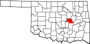 | |
| Towns | ||
| CDP | ||
| Other communities | ||
| Indian reservation | ||
| Footnotes | ‡This populated place also has portions in an adjacent county or counties | |
35°31′21″N 96°23′18″W / 35.52250°N 96.38833°W
This Oklahoma state location article is a stub. You can help Wikipedia by expanding it. |