Grade II* listed buildings in Taunton Deane: Difference between revisions
m (GR) File renamed: File:Oake church.jpg → File:St Bartholomew's Church, Oake, Somerset.jpg To change from an ambiguous name |
Rescuing 1 sources and tagging 0 as dead. #IABot (v1.3) (Rodw) |
||
| Line 1: | Line 1: | ||
[[File:Taunton Deane UK locator map.svg|thumb|Taunton Deane shown within the county of Somerset]] |
[[File:Taunton Deane UK locator map.svg|thumb|Taunton Deane shown within the county of Somerset]] |
||
[[Taunton Deane]] is a [[Non-metropolitan district|local government district]] with [[borough]] status in the English county of [[Somerset]]. In the United Kingdom, the term [[listed building]] refers to a building or other structure officially designated as being of special architectural, historical or cultural significance; Grade II* structures are those considered to be "particularly significant buildings of more than local interest".<ref name="MCC">{{cite web|url=http://www.manchester.gov.uk/site/scripts/documents_info.php?categoryID=514&documentID=1906|title=What is a listed building?|publisher=Manchester City Council|accessdate=8 December 2007}}</ref> Listing was begun by a provision in the [[Town and Country Planning Act 1947]]. Once listed, severe restrictions are imposed on the modifications allowed to a building's structure or its fittings. In England, the authority for listing under the [[Planning (Listed Buildings and Conservation Areas) Act 1990]] rests with [[Historic England]], a [[non-departmental public body]] sponsored by the [[Department for Culture, Media and Sport]]; local authorities have a responsibility to regulate and enforce the planning regulations.<ref>{{cite web|url=http://www.statutelaw.gov.uk/content.aspx?activeTextDocId=2133903|title=Planning (Listed Buildings and Conservation Areas) Act 1990 (c. 9)|publisher=Ministry of Justice|accessdate=17 December 2007}}</ref> |
[[Taunton Deane]] is a [[Non-metropolitan district|local government district]] with [[borough]] status in the English county of [[Somerset]]. In the United Kingdom, the term [[listed building]] refers to a building or other structure officially designated as being of special architectural, historical or cultural significance; Grade II* structures are those considered to be "particularly significant buildings of more than local interest".<ref name="MCC">{{cite web|url=http://www.manchester.gov.uk/site/scripts/documents_info.php?categoryID=514&documentID=1906|title=What is a listed building?|publisher=Manchester City Council|accessdate=8 December 2007}}</ref> Listing was begun by a provision in the [[Town and Country Planning Act 1947]]. Once listed, severe restrictions are imposed on the modifications allowed to a building's structure or its fittings. In England, the authority for listing under the [[Planning (Listed Buildings and Conservation Areas) Act 1990]] rests with [[Historic England]], a [[non-departmental public body]] sponsored by the [[Department for Culture, Media and Sport]]; local authorities have a responsibility to regulate and enforce the planning regulations.<ref>{{cite web|url=http://www.statutelaw.gov.uk/content.aspx?activeTextDocId=2133903 |title=Planning (Listed Buildings and Conservation Areas) Act 1990 (c. 9) |publisher=Ministry of Justice |accessdate=17 December 2007 |deadurl=yes |archiveurl=https://web.archive.org/web/20100418101721/http://www.statutelaw.gov.uk/content.aspx?activeTextDocId=2133903 |archivedate=18 April 2010 |df= }}</ref> |
||
The district of Taunton Deane Area covers a population of approximately 100,000 in an area of {{convert|462|km2}}.<ref name="tdcstats">{{cite web|url=http://www.tauntondeane.gov.uk/tdbcsites/ecdev/ecdev_bus/demographics.asp|title=Demographics|publisher=Taunton Deane Borough Council|accessdate=25 April 2009}}</ref><ref>{{cite web|url=http://www.neighbourhood.statistics.gov.uk/dissemination/LeadKeyFigures.do?a=7&b=277101&c=Taunton+Deane&d=13&e=8&g=484170&i=1001x1003x1004&m=0&r=1&s=1240676687609&enc=1|title=Area: Taunton Deane (Local Authority): Key Figures for Physical Environment|work=Neighbourhood Statistics|publisher=Office for National Statistics|accessdate=25 April 2009}}</ref> It is centered on the town of [[Taunton]], where around 60,000 of the population live and the council are based, and includes surrounding suburbs and villages.<ref name="tdcstats"/> |
The district of Taunton Deane Area covers a population of approximately 100,000 in an area of {{convert|462|km2}}.<ref name="tdcstats">{{cite web|url=http://www.tauntondeane.gov.uk/tdbcsites/ecdev/ecdev_bus/demographics.asp|title=Demographics|publisher=Taunton Deane Borough Council|accessdate=25 April 2009}}</ref><ref>{{cite web|url=http://www.neighbourhood.statistics.gov.uk/dissemination/LeadKeyFigures.do?a=7&b=277101&c=Taunton+Deane&d=13&e=8&g=484170&i=1001x1003x1004&m=0&r=1&s=1240676687609&enc=1|title=Area: Taunton Deane (Local Authority): Key Figures for Physical Environment|work=Neighbourhood Statistics|publisher=Office for National Statistics|accessdate=25 April 2009}}</ref> It is centered on the town of [[Taunton]], where around 60,000 of the population live and the council are based, and includes surrounding suburbs and villages.<ref name="tdcstats"/> |
||
Revision as of 20:37, 8 May 2017

Taunton Deane is a local government district with borough status in the English county of Somerset. In the United Kingdom, the term listed building refers to a building or other structure officially designated as being of special architectural, historical or cultural significance; Grade II* structures are those considered to be "particularly significant buildings of more than local interest".[1] Listing was begun by a provision in the Town and Country Planning Act 1947. Once listed, severe restrictions are imposed on the modifications allowed to a building's structure or its fittings. In England, the authority for listing under the Planning (Listed Buildings and Conservation Areas) Act 1990 rests with Historic England, a non-departmental public body sponsored by the Department for Culture, Media and Sport; local authorities have a responsibility to regulate and enforce the planning regulations.[2]
The district of Taunton Deane Area covers a population of approximately 100,000 in an area of 462 square kilometres (178 sq mi).[3][4] It is centered on the town of Taunton, where around 60,000 of the population live and the council are based, and includes surrounding suburbs and villages.[3]
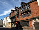
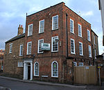
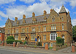
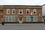
There are 118 Grade II* listed buildings in Taunton Deane.
Buildings
See also
Notes
- ^ The date given is the date used by Historic England as significant for the initial building or that of an important part in the structure's description.
- ^ Sometimes known as OSGB36, the grid reference is based on the British national grid reference system used by the Ordnance Survey.
- ^ The "List Entry Number" is a unique number assigned to each listed building and scheduled monument by Historic England.
References
- ^ "What is a listed building?". Manchester City Council. Retrieved 8 December 2007.
- ^ "Planning (Listed Buildings and Conservation Areas) Act 1990 (c. 9)". Ministry of Justice. Archived from the original on 18 April 2010. Retrieved 17 December 2007.
{{cite web}}: Unknown parameter|deadurl=ignored (|url-status=suggested) (help) - ^ a b "Demographics". Taunton Deane Borough Council. Retrieved 25 April 2009.
- ^ "Area: Taunton Deane (Local Authority): Key Figures for Physical Environment". Neighbourhood Statistics. Office for National Statistics. Retrieved 25 April 2009.
- ^ "1–6, Cheapside". National heritage list for England. English Heritage. Retrieved 14 July 2013.
- ^ "1–5, The Crescent". National heritage list for England. English Heritage. Retrieved 14 July 2013.
- ^ Historic England. "4, Hammet Street (1276877)". National Heritage List for England. Retrieved 3 April 2015.
- ^ Historic England. "5 And 7, The Square (1307465)". National Heritage List for England. Retrieved 3 April 2015.
- ^ Historic England. "9-12, Hammet Street (1060037)". National Heritage List for England. Retrieved 3 April 2015.
- ^ Historic England. "12, Middle Street (1344725)". National Heritage List for England. Retrieved 3 April 2015.
- ^ "13–17, Hammet Street". National heritage list for England. English Heritage. Retrieved 14 July 2013.
- ^ Historic England. "15, The Crescent (1060043)". National Heritage List for England. Retrieved 3 April 2015.
- ^ "16–20, Park Street". National heritage list for England. English Heritage. Retrieved 14 July 2013.
- ^ Historic England. "18, Fore Street (1232670)". National Heritage List for England. Retrieved 3 April 2015.
- ^ "24–28, Silver Street". National heritage list for England. English Heritage. Retrieved 14 July 2013.
- ^ Historic England. "48, East Street (1060057)". National Heritage List for England. Retrieved 3 April 2015.
- ^ Historic England. "115 And 117, Galmington Road (1276934)". National Heritage List for England. Retrieved 3 April 2015.
- ^ Historic England. "Almshouses (1060273)". National Heritage List for England. Retrieved 3 April 2015.
- ^ Historic England. "Bagborough House (1060526)". National Heritage List for England. Retrieved 3 April 2015.
- ^ Historic England. "Balgrove's Farmhouse and Adjoining Walls to North West and South West (1344563)". National Heritage List for England. Retrieved 7 July 2015.
- ^ Historic England. "Bradford Bridge At Ngr St 1719 2299 (1060375)". National Heritage List for England. Retrieved 3 April 2015.
- ^ Historic England. "Buckland Farmhouse (1180164)". National Heritage List for England. Retrieved 3 April 2015.
- ^ Historic England. "Bulford House (1059874)". National Heritage List for England. Retrieved 3 April 2015.
- ^ Historic England. "Chilliswood Farmhouse with horse-engine house and barn (1060445)". National Heritage List for England. Retrieved 3 April 2015.
- ^ Historic England. "Church Of All Saints (1344603)". National Heritage List for England. Retrieved 3 April 2015.
- ^ Historic England. "Church Of All Saints (1060468)". National Heritage List for England. Retrieved 3 April 2015.
- ^ Historic England. "Church Of St Andrew (1177072)". National Heritage List for England. Retrieved 3 April 2015.
- ^ Historic England. "Church Of St Bartholomew (1307395)". National Heritage List for England. Retrieved 3 April 2015.
- ^ Historic England. "St George's Church (1060018)". National Heritage List for England. Retrieved 7 July 2015.
- ^ Historic England. "Church Of St Giles (1060376)". National Heritage List for England. Retrieved 3 April 2015.
- ^ Historic England. "St James Church (1059956)". National Heritage List for England. Retrieved 3 April 2015.
- ^ Historic England. "Church Of St James The Great (1175726)". National Heritage List for England. Retrieved 3 April 2015.
- ^ Historic England. "Church Of St John The Baptist (1059880)". National Heritage List for England. Retrieved 3 April 2015.
- ^ Historic England. "Church Of St Leonard (1344635)". National Heritage List for England. Retrieved 3 April 2015.
- ^ Historic England. "Church Of St Margaret (1180128)". National Heritage List for England. Retrieved 3 April 2015.
- ^ Historic England. "Church Of St Mary (1060508)". National Heritage List for England. Retrieved 3 April 2015.
- ^ Historic England. "Church Of St Mary (1177216)". National Heritage List for England. Retrieved 3 April 2015.
- ^ Historic England. "Church Of St Michael (1060391)". National Heritage List for England. Retrieved 3 April 2015.
- ^ Historic England. "Church Of St Michael (1177574)". National Heritage List for England. Retrieved 3 April 2015.
- ^ Historic England. "Church Of St Nicholas (1060345)". National Heritage List for England. Retrieved 3 April 2015.
- ^ Historic England. "Church Of St Nicholas (1176263)". National Heritage List for England. Retrieved 3 April 2015.
- ^ Historic England. "Church Of St Pancras (1344480)". National Heritage List for England. Retrieved 3 April 2015.
- ^ Historic England. "Church Of St Peter (1060352)". National Heritage List for England. Retrieved 3 April 2015.
- ^ Historic England. "Church Of St Peter And St Paul (1060537)". National Heritage List for England. Retrieved 3 April 2015.
- ^ Historic England. "Church Of The Holy Cross (1060326)". National Heritage List for England. Retrieved 3 April 2015.
- ^ Historic England. "Church Of The Holy Trinity (1344823)". National Heritage List for England. Retrieved 3 April 2015.
- ^ Historic England. "Churchyard Cross, Church Of St Andrew (1177103)". National Heritage List for England. Retrieved 3 April 2015.
- ^ Historic England. "Cross In Churchyard, Church Of St James The Great Cross In St James Churchyard (1059198)". National Heritage List for England. Retrieved 3 April 2015.
- ^ Historic England. "Churchyard Cross About 10 Metres South East Of Chancel, Church Of St John The Baptist (1307462)". National Heritage List for England. Retrieved 3 April 2015.
- ^ Historic England. "Cross In Churchyard, Church Of St Mary (1175069)". National Heritage List for England. Retrieved 3 April 2015.
- ^ Historic England. "Cross, 3 Metres South East Of Porch, Church Of St Peter And St Paul (1059225)". National Heritage List for England. Retrieved 3 April 2015.
- ^ Historic England. "Churchyard Cross In Churchyard About 80 Metres South Of Chancel Church Of St Peter And St Paul (1060411)". National Heritage List for England. Retrieved 3 April 2015.
- ^ Historic England. "Cloth Finishing Works At Tone Mills North Range Including Dyehouse And Reservoirs (1271246)". National Heritage List for England. Retrieved 3 April 2015.
- ^ Historic England. "Coalharbour (1344519)". National Heritage List for England. Retrieved 3 April 2015.
- ^ Historic England. "Conservative Club (1231461)". National Heritage List for England. Retrieved 3 April 2015.
- ^ "Nos 1 and 2 (Conservative Club) (formerly listed as No 1), Church Square (North side), Taunton". Somerset Historic Environment Record. Somerset County Council. Retrieved 16 July 2013.
- ^ Historic England. "Cothelstone Manor (1344838)". National Heritage List for England. Retrieved 3 April 2015.
- ^ Historic England. "County Hotel (1060016)". National Heritage List for England. Retrieved 3 April 2015.
- ^ Historic England. "Fairhouse Farmhouse (1177497)". National Heritage List for England. Retrieved 3 April 2015.
- ^ Historic England. "Fitzhead Court The Manor (1059202)". National Heritage List for England. Retrieved 3 April 2015.
- ^ Historic England. "Garden House, About 50 Metres West Of Poundisford Park (1344593)". National Heritage List for England. Retrieved 3 April 2015.
- ^ Historic England. "Gatehouse And Wall Linking Gatehouse To Manor On South East Side, Cothay Manor (1344803)". National Heritage List for England. Retrieved 3 April 2015.
- ^ Historic England. "Gatehouse at Combe Florey House (1059226)". National Heritage List for England. Retrieved 3 April 2015.
- ^ Historic England. "Gaulden Manor (1307623)". National Heritage List for England. Retrieved 3 April 2015.
- ^ Historic England. "Gazebo And Adjoining Walls, 50 Metres East North East Of Cothelstone Manor (1059193)". National Heritage List for England. Retrieved 3 April 2015.
- ^ Historic England. "Gerbestone Manor (1344582)". National Heritage List for England. Retrieved 3 April 2015.
- ^ Historic England. "Giffords Farmhouse And Barn (1060466)". National Heritage List for England. Retrieved 3 April 2015.
- ^ Historic England. "Hamwood Farmhouse And Wall Abutting North Corner With Gatepiers And Gate (1344504)". National Heritage List for England. Retrieved 3 April 2015.
- ^ Historic England. "Henlade House (1060397)". National Heritage List for England. Retrieved 3 April 2015.
- ^ Historic England. "Hestercombe House (1060513)". National Heritage List for England. Retrieved 3 April 2015.
- ^ Historic England. "Hill Farmhouse (1176991)". National Heritage List for England. Retrieved 3 April 2015.
- ^ Historic England. "Homedale, And Landing Linking Property To Flight Of Steps From Churchyard (1060553)". National Heritage List for England. Retrieved 3 April 2015.
- ^ Historic England. "Kittisford Barton (1307955)". National Heritage List for England. Retrieved 3 April 2015.
- ^ Historic England. "Langford Court (1060351)". National Heritage List for England. Retrieved 3 April 2015.
- ^ Historic England. "Little Court (1176957)". National Heritage List for England. Retrieved 3 April 2015.
- ^ Historic England. "Lodge Farmhouse (1060491)". National Heritage List for England. Retrieved 3 April 2015.
- ^ Historic England. "Lower Stoford Farmhouse, Wall, Gate-Piers And Boundary Wall Running North-South To The Refectory (1308046)". National Heritage List for England. Retrieved 3 April 2015.
- ^ Historic England. "Lower Terhill Farmhouse (1344853)". National Heritage List for England. Retrieved 3 April 2015.
- ^ Historic England. "Lydeard House, Attached Stables And Walls Abutting Entrance To The Latter (1295371)". National Heritage List for England. Retrieved 3 April 2015.
- ^ Historic England. "Manor Farmhouse (1176349)". National Heritage List for England. Retrieved 3 April 2015.
- ^ Historic England. "Manor Farmhouse (1176652)". National Heritage List for England. Retrieved 3 April 2015.
- ^ Historic England. "Manor House (1060535)". National Heritage List for England. Retrieved 3 April 2015.
- ^ Historic England. "The Market House (1059989)". National Heritage List for England. Retrieved 3 April 2015.
- ^ Historic England. "Masonic Hall (1060044)". National Heritage List for England. Retrieved 3 April 2015.
- ^ Historic England. "The Mausoleum In The Grounds Of Hestercombe House (1060461)". National Heritage List for England. Retrieved 3 April 2015.
- ^ Historic England. "Municipal Building (West End) Municipal Buildings (East End) (Incorporating The Old Grammar School) (1060041)". National Heritage List for England. Retrieved 3 April 2015.
- ^ Historic England. "Musgrave Farmhouse (1177045)". National Heritage List for England. Retrieved 3 April 2015.
- ^ Historic England. "Netherfield (1176748)". National Heritage List for England. Retrieved 3 April 2015.
- ^ Historic England. "North Lodge (1059222)". National Heritage List for England. Retrieved 3 April 2015.
- ^ Historic England. "Nynehead Court And Wall Adjoining On North Side Of Forecourt (1307540)". National Heritage List for England. Retrieved 3 April 2015.
- ^ Historic England. "Old Court (1059899)". National Heritage List for England. Retrieved 3 April 2015.
- ^ Historic England. "Outbuilding With Wall Adjoining South East Corner Of Haydon House (1177118)". National Heritage List for England. Retrieved 3 April 2015.
- ^ Historic England. "Poundisford Lodge (1344592)". National Heritage List for England. Retrieved 3 April 2015.
- ^ Historic England. "Poundisford Lodge (1344774)". National Heritage List for England. Retrieved 3 April 2015.
- ^ Historic England. "Pyleigh Manor (1344481)". National Heritage List for England. Retrieved 3 April 2015.
- ^ Historic England. "Pyrland Hall (1176079)". National Heritage List for England. Retrieved 3 April 2015.
- ^ Historic England. "Queens College (1276273)". National Heritage List for England. Retrieved 3 April 2015.
- ^ Historic England. "Remains Of Churchyard Cross In Churchyard About 7 Metres South Of Porch Church Of St George (1060396)". National Heritage List for England. Retrieved 3 April 2015.
- ^ Historic England. "Remains Of Churchyard Cross, About 2 Metres North Of Sandford Chapel, Church Of All Saints (1344597)". National Heritage List for England. Retrieved 3 April 2015.
- ^ Historic England. "Risdons (1060337)". National Heritage List for England. Retrieved 3 April 2015.
- ^ Historic England. "The Roman Catholic Church Of St George (1231201)". National Heritage List for England. Retrieved 3 April 2015.
- ^ Historic England. "Sandhill Park Hospital (1295317)". National Heritage List for England. Retrieved 3 April 2015.
- ^ Historic England. "Sherford House (1233681)". National Heritage List for England. Retrieved 3 April 2015.
- ^ Historic England. "Slough Farmhouse (1344637)". National Heritage List for England. Retrieved 3 April 2015.
- ^ Historic England. "St Joseph's Convent (1276422)". National Heritage List for England. Retrieved 7 July 2015.
- ^ Historic England. "St Margaret's Leper Hospital (1232831)". National Heritage List for England. Retrieved 7 July 2015.
- ^ Historic England. "Summerhouse At Language Centre (1059936)". National Heritage List for England. Retrieved 3 April 2015.
- ^ Historic England. "Tetton House And Terrace To Garden On South Front (1307958)". National Heritage List for England. Retrieved 3 April 2015.
- ^ Historic England. "The Temple North North East Of Hestercombe House (1390976)". National Heritage List for England. Retrieved 3 April 2015.
- ^ Historic England. "The Manor House (1060501)". National Heritage List for England. Retrieved 3 April 2015.
- ^ Historic England. "The Old House (1060552)". National Heritage List for England. Retrieved 3 April 2015.
- ^ Historic England. "The Old Manor House (1059230)". National Heritage List for England. Retrieved 3 April 2015.
- ^ Historic England. "Tonedale Mills (East Complex) (1176514)". National Heritage List for England. Retrieved 3 April 2015.
- ^ Historic England. "Tonedale Mills (West Complex) (1051987)". National Heritage List for England. Retrieved 3 April 2015.
- ^ Historic England. "Trowell Farmhouse (1177577)". National Heritage List for England. Retrieved 3 April 2015.
- ^ Historic England. "Unidentified Chest Tomb In Churchyard, About 3 Metres South Of Porch, Church Of St Auguistine (1307458)". National Heritage List for England. Retrieved 3 April 2015.
- ^ Historic England. "Unitarian Chapel (1060009)". National Heritage List for England. Retrieved 3 April 2015.
- ^ Historic England. "Walford House (1060421)". National Heritage List for England. Retrieved 3 April 2015.
- ^ Historic England. "Washer's Farmhouse (1059205)". National Heritage List for England. Retrieved 7 July 2015.
- ^ Historic England. "Wellington Monument (1060281)". National Heritage List for England. Retrieved 3 April 2015.
- ^ Historic England. "Wheatleigh House (1039998)". National Heritage List for England. Retrieved 3 April 2015.
- ^ Historic England. "Yarde Farmhouse (1344515)". National Heritage List for England. Retrieved 3 April 2015.
External links
![]() Media related to Grade II* listed buildings in Somerset at Wikimedia Commons
Media related to Grade II* listed buildings in Somerset at Wikimedia Commons


