Lake Fork Creek: Difference between revisions
Appearance
Content deleted Content added
m →References: per Wikipedia:Categories for discussion/Log/2016 July 11, replaced: Category:Rivers and streams of → Category:Rivers of using AWB |
Rescuing 1 sources and tagging 0 as dead. #IABot (v1.3) |
||
| Line 13: | Line 13: | ||
| basin_size = |
| basin_size = |
||
}} |
}} |
||
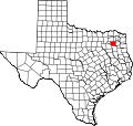
'''Lake Fork Creek''' is a {{convert|78.4|mi|km|adj=mid|-long}}<ref name=NHD>U.S. Geological Survey. National Hydrography Dataset high-resolution flowline data. [http://viewer.nationalmap.gov/viewer/ The National Map], accessed June 20, 2011</ref> river in [[Hunt County, Texas|Hunt]], [[Rains County, Texas|Rains]], and [[Wood County, Texas|Wood]] counties in [[Texas]]. It is a major tributary of the [[Sabine River (Texas–Louisiana)|Sabine River]], and has as its major tributaries Dry Creek, Glade Creek, Caney Creek, Little Caney Creek, [[Rainwater Creek]], and Birch Creek. |
'''Lake Fork Creek''' is a {{convert|78.4|mi|km|adj=mid|-long}}<ref name=NHD>U.S. Geological Survey. National Hydrography Dataset high-resolution flowline data. [http://viewer.nationalmap.gov/viewer/ The National Map] {{webarchive|url=http://www.webcitation.org/66gupqQDM?url=http://viewer.nationalmap.gov/viewer/ |date=2012-04-05 }}, accessed June 20, 2011</ref> river in [[Hunt County, Texas|Hunt]], [[Rains County, Texas|Rains]], and [[Wood County, Texas|Wood]] counties in [[Texas]]. It is a major tributary of the [[Sabine River (Texas–Louisiana)|Sabine River]], and has as its major tributaries Dry Creek, Glade Creek, Caney Creek, Little Caney Creek, [[Rainwater Creek]], and Birch Creek. |
||
In 1980, Lake Fork Creek was impounded, resulting in the formation of [[Lake Fork Reservoir]]. |
In 1980, Lake Fork Creek was impounded, resulting in the formation of [[Lake Fork Reservoir]]. |
||
Revision as of 18:36, 10 May 2017
| Lake Fork Creek | |
|---|---|
| Physical characteristics | |
| Source | |
| • location | Texas |
Lake Fork Creek is a 78.4-mile-long (126.2 km)[1] river in Hunt, Rains, and Wood counties in Texas. It is a major tributary of the Sabine River, and has as its major tributaries Dry Creek, Glade Creek, Caney Creek, Little Caney Creek, Rainwater Creek, and Birch Creek.
In 1980, Lake Fork Creek was impounded, resulting in the formation of Lake Fork Reservoir.
See also
References
- ^ U.S. Geological Survey. National Hydrography Dataset high-resolution flowline data. The National Map Archived 2012-04-05 at WebCite, accessed June 20, 2011
- "An Analysis of Texas Waterways". Retrieved 2006-05-04.
- U.S. Geological Survey Geographic Names Information System: Lake Fork Creek
- USGS Hydrologic Unit Map - State of Texas (1974)
- "Lake Fork Reservoir". Retrieved 2011-01-17.
32°36′33″N 95°20′44″W / 32.60930°N 95.34551°W


