Afon Ysgir: Difference between revisions
m Update parameter syntax per Bot Task 7 |
Rescuing 1 sources and tagging 0 as dead. #IABot (v1.4beta4) |
||
| Line 17: | Line 17: | ||
Its upper reaches are within the military training area of [[SENTA]], the British Army's [[Sennybridge]] Training Area. <ref>Ordnance Survey Explorer map OL12 'Brecon Beacons National Park: western area'</ref> |
Its upper reaches are within the military training area of [[SENTA]], the British Army's [[Sennybridge]] Training Area. <ref>Ordnance Survey Explorer map OL12 'Brecon Beacons National Park: western area'</ref> |
||
Near its mouth is a [[Motte-and-bailey|motte]], the historic church at Aberyscir and east of the river, the [[Roman fort]] of CICVCIVM or [[Y Gaer, Brecon|Brecon Gaer]]. Along with othe tributaries of the Usk, the river is designated as a [[special area of conservation]] or 'SAC' for various species of fish including [[lamprey]], the [[twaite shad]] and the [[European bullhead]]. <ref>http://www.ccw.gov.uk Countryside Council for Wales website</ref> |
Near its mouth is a [[Motte-and-bailey|motte]], the historic church at Aberyscir and east of the river, the [[Roman fort]] of CICVCIVM or [[Y Gaer, Brecon|Brecon Gaer]]. Along with othe tributaries of the Usk, the river is designated as a [[special area of conservation]] or 'SAC' for various species of fish including [[lamprey]], the [[twaite shad]] and the [[European bullhead]]. <ref>http://www.ccw.gov.uk {{webarchive|url=https://web.archive.org/web/20131013234626/http://www.ccw.gov.uk/ |date=2013-10-13 }} Countryside Council for Wales website</ref> |
||
==References== |
==References== |
||
Revision as of 16:01, 27 June 2017
| Afon Ysgir | |
|---|---|
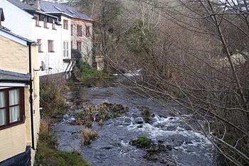
 The Afon Ysgir |
The Afon Ysgir is a river which rises on the southern slopes of Mynydd Epynt in Powys, Wales. The tributaries known as Ysgir Fawr and Ysgir Fechan flow past the hamlets of Pont Rhyd-y-berry and Merthyr Cynog to combine at Pont-faen and continue past the village of Battle to join the River Usk at Aberyscir.
Its upper reaches are within the military training area of SENTA, the British Army's Sennybridge Training Area. [1]
Near its mouth is a motte, the historic church at Aberyscir and east of the river, the Roman fort of CICVCIVM or Brecon Gaer. Along with othe tributaries of the Usk, the river is designated as a special area of conservation or 'SAC' for various species of fish including lamprey, the twaite shad and the European bullhead. [2]
References
- ^ Ordnance Survey Explorer map OL12 'Brecon Beacons National Park: western area'
- ^ http://www.ccw.gov.uk Archived 2013-10-13 at the Wayback Machine Countryside Council for Wales website
