
Alzada, Montana: Difference between revisions
add ref |
Rescuing 1 sources and tagging 0 as dead. #IABot (v1.4) |
||
| Line 77: | Line 77: | ||
==History== |
==History== |
||
Alzada was first established in 1878, by [[9th Infantry Regiment (United States)|9th U.S. Infantry]] soldiers as [[Camp Devin]], on the [[Deadwood, South Dakota|Deadwood, Dakota Territory]] to [[Fort Keogh]], Montana Territory telegraph line. It was called the [[Little Missouri River (North Dakota)|Little Missouri River]] Telegraph Station, and manned by soldiers of the [[7th Cavalry Regiment (United States)|7th U.S. Cavalry]]. Then it was named Stoneville, after the local bartender Lou Stone.<ref name="names">{{cite book|last1=Carkeek Cheney|first1=Roberta|title=Names on the Face of Montana|date=1983|publisher=Mountain Press Publishing Company|location=Missoula, Montana|isbn=0-87842-150-5|page=5|accessdate=19 June 2017}}</ref> It served as a stagecoach stop between Deadwood and [[Miles City, Montana]]. It was the site of a gun battle in 1884 between local authorities and rustlers known as the Exelby gang. The town's name was changed from Stoneville in 1885, because of confusion with another similarly named community. The name "Alzada" came from an early settler named Laura Alzada Shelden.<ref>Aarstad, Rich, Ellie Arguimbau, Ellen Baumler, Charlene Porsild, and Brian Shovers. [http://mhs.mt.gov/pub/press/reference.asp#PlaceNames "Montana Place Names from Alzada to Zortman"]. Montana Historical Society Press.</ref> Later settlers of the area were largely homesteaders. In 1890, Private [[Peter Thompson (Medal of Honor)|Peter Thompson]], a 7th Cavalry survivor and recipient of the [[Medal of Honor]] for the [[Battle of the Little Bighorn]], moved from [[Lead, South Dakota|Lead, Dakota Territory]], with his brother William and homesteaded north of Alzada on the Little Missouri River at Nine Mile Creek. |
Alzada was first established in 1878, by [[9th Infantry Regiment (United States)|9th U.S. Infantry]] soldiers as [[Camp Devin]], on the [[Deadwood, South Dakota|Deadwood, Dakota Territory]] to [[Fort Keogh]], Montana Territory telegraph line. It was called the [[Little Missouri River (North Dakota)|Little Missouri River]] Telegraph Station, and manned by soldiers of the [[7th Cavalry Regiment (United States)|7th U.S. Cavalry]]. Then it was named Stoneville, after the local bartender Lou Stone.<ref name="names">{{cite book|last1=Carkeek Cheney|first1=Roberta|title=Names on the Face of Montana|date=1983|publisher=Mountain Press Publishing Company|location=Missoula, Montana|isbn=0-87842-150-5|page=5|accessdate=19 June 2017}}</ref> It served as a stagecoach stop between Deadwood and [[Miles City, Montana]]. It was the site of a gun battle in 1884 between local authorities and rustlers known as the Exelby gang. The town's name was changed from Stoneville in 1885, because of confusion with another similarly named community. The name "Alzada" came from an early settler named Laura Alzada Shelden.<ref>Aarstad, Rich, Ellie Arguimbau, Ellen Baumler, Charlene Porsild, and Brian Shovers. [http://mhs.mt.gov/pub/press/reference.asp#PlaceNames "Montana Place Names from Alzada to Zortman"] {{webarchive|url=https://web.archive.org/web/20091008060633/http://mhs.mt.gov/pub/press/reference.asp |date=2009-10-08 }}. Montana Historical Society Press.</ref> Later settlers of the area were largely homesteaders. In 1890, Private [[Peter Thompson (Medal of Honor)|Peter Thompson]], a 7th Cavalry survivor and recipient of the [[Medal of Honor]] for the [[Battle of the Little Bighorn]], moved from [[Lead, South Dakota|Lead, Dakota Territory]], with his brother William and homesteaded north of Alzada on the Little Missouri River at Nine Mile Creek. |
||
Alzada was briefly in the news in September 1997, when a [[B-1 Lancer#Accidents and incidents|B-1]] bomber crashed nearby. |
Alzada was briefly in the news in September 1997, when a [[B-1 Lancer#Accidents and incidents|B-1]] bomber crashed nearby. |
||
Revision as of 04:33, 3 July 2017
Alzada | |
|---|---|
 Alzada Post Office | |
| Country | United States |
| State | Montana |
| County | Carter |
| Elevation | 2,828 ft (862 m) |
| Population (2010) | |
| • Total | 29 |
| Time zone | UTC-7 (Mountain (MST)) |
| • Summer (DST) | UTC-6 (MDT) |
| ZIP codes | 59311 |
| Area code | 406 |
Alzada, also Stoneville is an unincorporated community and census-designated place in Carter County in the southeastern corner of the U.S. state of Montana. As of the 2010 census it had a population of 29.[1] It is located at the intersection of U.S. Route 212 with Montana Secondary Highways 323 and 326, near the Wyoming and South Dakota borders. The Little Missouri River flows northwards to the west of the community. Alzada is in the Mountain Time Zone.
History
Alzada was first established in 1878, by 9th U.S. Infantry soldiers as Camp Devin, on the Deadwood, Dakota Territory to Fort Keogh, Montana Territory telegraph line. It was called the Little Missouri River Telegraph Station, and manned by soldiers of the 7th U.S. Cavalry. Then it was named Stoneville, after the local bartender Lou Stone.[2] It served as a stagecoach stop between Deadwood and Miles City, Montana. It was the site of a gun battle in 1884 between local authorities and rustlers known as the Exelby gang. The town's name was changed from Stoneville in 1885, because of confusion with another similarly named community. The name "Alzada" came from an early settler named Laura Alzada Shelden.[3] Later settlers of the area were largely homesteaders. In 1890, Private Peter Thompson, a 7th Cavalry survivor and recipient of the Medal of Honor for the Battle of the Little Bighorn, moved from Lead, Dakota Territory, with his brother William and homesteaded north of Alzada on the Little Missouri River at Nine Mile Creek.
Alzada was briefly in the news in September 1997, when a B-1 bomber crashed nearby.
Climate
According to the Köppen Climate Classification system, Alzada has a semi-arid climate, abbreviated "BSk" on climate maps.[4]

References
- ^ "Geographic Identifiers: 2010 Demographic Profile Data (G001): Alzada CDP, Montana". U.S. Census Bureau, American Factfinder. Retrieved October 8, 2014.
- ^ Carkeek Cheney, Roberta (1983). Names on the Face of Montana. Missoula, Montana: Mountain Press Publishing Company. p. 5. ISBN 0-87842-150-5.
{{cite book}}:|access-date=requires|url=(help) - ^ Aarstad, Rich, Ellie Arguimbau, Ellen Baumler, Charlene Porsild, and Brian Shovers. "Montana Place Names from Alzada to Zortman" Archived 2009-10-08 at the Wayback Machine. Montana Historical Society Press.
- ^ Climate Summary for Alzada, Montana
Municipalities and communities of Carter County, Montana, United States | ||
|---|---|---|
| Town | 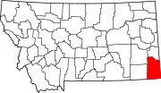 | |
| CDP | ||
| Other communities | ||
| Indian reservation | ||
| Footnotes | ‡This populated place also has portions in an adjacent county or counties | |
45°01′23″N 104°24′45″W / 45.02306°N 104.41250°W
This Montana state location article is a stub. You can help Wikipedia by expanding it. |