Biggleswade Castle: Difference between revisions
Appearance
Content deleted Content added
Convert coords to new parameters. See Wikipedia:Coordinates in infoboxes. |
Rescuing 1 sources and tagging 0 as dead. #IABot (v1.4.2) |
||
| Line 51: | Line 51: | ||
* [http://www.pastscape.org.uk/hob.aspx?hob_id=362741 English Heritage Monument No. 362741] |
* [http://www.pastscape.org.uk/hob.aspx?hob_id=362741 English Heritage Monument No. 362741] |
||
* [http://www.pastscape.org.uk/monumentinfo.aspx?a=0&hob_id=362741 Investigation History] |
* [http://www.pastscape.org.uk/monumentinfo.aspx?a=0&hob_id=362741 Investigation History] |
||
* [http://www.english-heritage.org.uk/caring/listing/showcase/heritage-highlights/cropmarks English Heritage cropmarks 2010] |
* [https://web.archive.org/web/20140804143331/http://www.english-heritage.org.uk/caring/listing/showcase/heritage-highlights/cropmarks English Heritage cropmarks 2010] |
||
Revision as of 01:46, 20 July 2017
| Biggleswade Castle | |
|---|---|
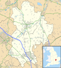
| Biggleswade, Bedfordshire, England | |
| Coordinates | 52°5′10.47″N 0°16′22.94″W / 52.0862417°N 0.2730389°W |
| Type | Castle |
| Site information | |
| Condition | Earthworks |
Biggleswade Castle was a castle in the market town of Biggleswade in Bedfordshire.
The existence of this castle was discovered by aerial photography, in 1954, which showed the remains of a motte and bailey castle with a double ditch around the motte and a single ditch around the bailey.
Some excavation of the site was done in 1962 and 1968. The excavations found evidence of timber structures, as well as pottery.
Currently, only cropmarks and slight earthworks remain. This site is a Scheduled Monument.
See also
References
- Fry, Plantagenet Somerset, The David & Book of Castles, David & Charles, 1980. ISBN 0-7153-7976-3

