Datori: Difference between revisions
Appearance
Content deleted Content added
JJMC89 bot (talk | contribs) Migrate {{Infobox settlement}} coordinates parameters to {{Coord}}, see Wikipedia:Coordinates in infoboxes |
Rescuing 1 sources and tagging 0 as dead. #IABot (v1.5) |
||
| Line 54: | Line 54: | ||
|footnotes = |
|footnotes = |
||
}} |
}} |
||
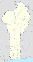
'''Datori''' is a town and [[Arrondissements of Benin|arrondissement]] in the [[Atakora Department]] of northwestern [[Benin]]. It is an administrative division under the jurisdiction of the commune of [[Cobly]] and lies on the border with [[Togo]]. According to the population census conducted by the [[Institut National de la Statistique Benin]] on February 15, 2002, the arrondissement had a total population of 9,615.<ref>[http://www.insae-bj.org/ Institut National de la Statistique Benin], accessed by [http://www.geohive.com/cntry/benin.aspx?levels=Atacora Geohive], accessed January 16, 2010</ref> |
'''Datori''' is a town and [[Arrondissements of Benin|arrondissement]] in the [[Atakora Department]] of northwestern [[Benin]]. It is an administrative division under the jurisdiction of the commune of [[Cobly]] and lies on the border with [[Togo]]. According to the population census conducted by the [[Institut National de la Statistique Benin]] on February 15, 2002, the arrondissement had a total population of 9,615.<ref>[http://www.insae-bj.org/ Institut National de la Statistique Benin], accessed by [http://www.geohive.com/cntry/benin.aspx?levels=Atacora Geohive] {{webarchive|url=https://web.archive.org/web/20091015091515/http://www.geohive.com/cntry/benin.aspx?levels=Atacora |date=2009-10-15 }}, accessed January 16, 2010</ref> |
||
==References== |
==References== |
||
Revision as of 07:16, 5 September 2017
Datori | |
|---|---|
Arrondissement and town | |
| Coordinates: 10°24′6″N 0°46′58″E / 10.40167°N 0.78278°E | |
| Country | |
| Department | Atakora Department |
| Commune | Cobly |
| Population (2002) | |
| • Total | 9,615 |
| Time zone | UTC+1 (WAT) |
Datori is a town and arrondissement in the Atakora Department of northwestern Benin. It is an administrative division under the jurisdiction of the commune of Cobly and lies on the border with Togo. According to the population census conducted by the Institut National de la Statistique Benin on February 15, 2002, the arrondissement had a total population of 9,615.[1]
References
- ^ Institut National de la Statistique Benin, accessed by Geohive Archived 2009-10-15 at the Wayback Machine, accessed January 16, 2010


