Garadag: Difference between revisions
Appearance
Content deleted Content added
TheMagikBOT (talk | contribs) m Added page protection template where none existed |
Rescuing 1 sources and tagging 0 as dead. #IABot (v1.5.6) |
||
| Line 65: | Line 65: | ||
Garadag is located northwest of [[Xudun, Somalia|Xudun]] and east by road from [[War Idaad]].<ref>{{cite map|title=[[Google Maps]]|publisher=Google|accessdate=December 13, 2010}}</ref><ref>{{cite map|title=[[Bing Maps]]|publisher= [[Microsoft]] and [[Harris Corporation]] Earthstar Geographics LLC|accessdate=December 13, 2010}}</ref> |
Garadag is located northwest of [[Xudun, Somalia|Xudun]] and east by road from [[War Idaad]].<ref>{{cite map|title=[[Google Maps]]|publisher=Google|accessdate=December 13, 2010}}</ref><ref>{{cite map|title=[[Bing Maps]]|publisher= [[Microsoft]] and [[Harris Corporation]] Earthstar Geographics LLC|accessdate=December 13, 2010}}</ref> |
||
Local control of the area is disputed between [[Somaliland]], a self-declared independent republic that is internationally [[Diplomatic recognition|recognized]] as an [[States and regions of Somalia|autonomous region]] of Somalia, the autonomous [[Puntland]] region in northeastern Somalia, and HBM-SSC (Hoggaanka Badbaadada iyo Mideynta SSC), a local unionist group whose goal is the creation of its own regional administration (Sool, Sanaag and Cayn or SSC).<ref name="Sqfirhbmsscf">[http://wardheernews.com/Articles_2010/June/Buh/29_Somaliland_recognition_&_the_HBM-SSC_Factor.html Somaliland’s Quest for International Recognition and the HBM-SSC Factor]</ref> |
Local control of the area is disputed between [[Somaliland]], a self-declared independent republic that is internationally [[Diplomatic recognition|recognized]] as an [[States and regions of Somalia|autonomous region]] of Somalia, the autonomous [[Puntland]] region in northeastern Somalia, and HBM-SSC (Hoggaanka Badbaadada iyo Mideynta SSC), a local unionist group whose goal is the creation of its own regional administration (Sool, Sanaag and Cayn or SSC).<ref name="Sqfirhbmsscf">[http://wardheernews.com/Articles_2010/June/Buh/29_Somaliland_recognition_&_the_HBM-SSC_Factor.html Somaliland’s Quest for International Recognition and the HBM-SSC Factor] {{webarchive|url=https://web.archive.org/web/20120528122058/http://wardheernews.com/Articles_2010/June/Buh/29_Somaliland_recognition_%26_the_HBM-SSC_Factor.html |date=2012-05-28 }}</ref> |
||
==Notes== |
==Notes== |
||
Revision as of 21:57, 10 October 2017
Garadag | |
|---|---|
district | |
| Coordinates: 9°29′15″N 46°52′1″E / 9.48750°N 46.86694°E | |
| Country | |
| Region | Sanaag |
| District | District |
| Population | |
| • Total | 17,400 |
| Time zone | UTC+3 (EAT) |
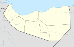
Garadag ([Gar Adag] Error: {{Lang-xx}}: text has italic markup (help)) is the District district of the northern Sanaag region of Somaliland. the city is primarily inhibited by biciide subclan of reer iidle
Overview
Garadag is located northwest of Xudun and east by road from War Idaad.[1][2]
Local control of the area is disputed between Somaliland, a self-declared independent republic that is internationally recognized as an autonomous region of Somalia, the autonomous Puntland region in northeastern Somalia, and HBM-SSC (Hoggaanka Badbaadada iyo Mideynta SSC), a local unionist group whose goal is the creation of its own regional administration (Sool, Sanaag and Cayn or SSC).[3]
Notes
- ^ Google Maps (Map). Google.
{{cite map}}:|access-date=requires|url=(help) - ^ Bing Maps (Map). Microsoft and Harris Corporation Earthstar Geographics LLC.
{{cite map}}:|access-date=requires|url=(help) - ^ Somaliland’s Quest for International Recognition and the HBM-SSC Factor Archived 2012-05-28 at the Wayback Machine
References
External links

