Geography of South Australia: Difference between revisions
Appearance
Content deleted Content added
m (GR) File renamed: File:SouthAustralia koppen.svg → File:South Australia Köppen.svg Criterion 3 (obvious error) · Correction of the spelling of the name. |
just for fun Tags: blanking Visual edit |
||
| Line 16: | Line 16: | ||
|largest lake = [[Lake Eyre]]<br />9690 km² |
|largest lake = [[Lake Eyre]]<br />9690 km² |
||
}} |
}} |
||
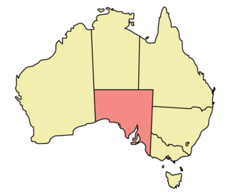
'''The geography of South Australia''' incorporates the south central part of the continent of [[Australia]]. It is one of the six [[states and territories of Australia|states of Australia]]. [[South Australia]] is bordered on the west by [[Western Australia]], to the north by the [[Northern Territory]], [[Queensland]] to the northeast, and both [[New South Wales]] and [[Victoria (Australia)|Victoria]] to the east. South Australia's south coast is flanked by the [[Great Australian Bight]] and the [[Indian Ocean]],<ref name="SouthernOcean">Most Australians describe the body of water south of the continent as the [[Southern Ocean]], rather than the [[Indian Ocean]] as officially defined by the [[International Hydrographic Organization]] (IHO). In 2000, a vote of IHO member nations defined the term “Southern Ocean” as applying only to the waters between Antarctica and [[60th parallel south|60 degrees south]] latitude.</ref> although it is referred to locally as the [[Australia and the Southern Ocean|Southern Ocean]]. |
|||
The [[Far North (South Australia)|northern]] and western parts of the state are extremely arid, in [[central Australia]], dominated by [[Lake Eyre]] and [[Lake Torrens]], mostly dry salt lakes. This arid area is sparsely populated, with many large [[cattle station]]s, and [[Protected areas of South Australia|significant areas protected]] as national parks, or as Aboriginal lands. The only significant roads through these areas are the [[Stuart Highway]] north from [[Port Augusta, South Australia|Port Augusta]] to the Northern Territory, the [[Eyre Highway]] across the [[Nullarbor Plain]] to Western Australia, and the [[Barrier Highway]] east to [[Broken Hill, New South Wales|Broken Hill]] in New South Wales. These highways have corresponding railways: the [[Trans-Australian Railway]] going west and east, and the [[Adelaide–Darwin railway]] going north. |
|||
The coastline includes cliffs against the [[Great Australian Bight]] including the western side of [[Eyre Peninsula]]. The coast is less rugged on [[Spencer Gulf]] and [[Gulf St Vincent]] (separated by [[Yorke Peninsula]]), [[Fleurieu Peninsula]], [[Encounter Bay]] and [[The Coorong]]. |
|||
[[File:Eastern South Australia Satellite Photo.jpg|thumb|right|Satellite image of eastern South Australia. Note the dry lakes (white patches) in the north]] |
|||
The highest point in the state is [[Mount Woodroffe]] at 1,435 metres (4,708 ft) in the [[Musgrave Ranges]] in the northwest corner of the state.<ref>{{cite web|url=http://www.ga.gov.au/education/facts/landforms/highmtns.htm#state |title=Highest Mountains |publisher=[[Geoscience Australia]] |accessdate=2007-09-26 |archiveurl=https://web.archive.org/web/20070922220924/http://www.ga.gov.au/education/facts/landforms/highmtns.htm#state |archivedate=2007-09-22 |deadurl=yes |df= }}</ref> The main range is the [[Mount Lofty Ranges]] and [[Flinders Ranges]] extending approximately {{convert|800|km|mi|0}} from [[Fleurieu Peninsula]] along the eastern sides of [[Gulf St Vincent]] and [[Spencer Gulf]] respectively. About half the state is less than 150 m above sea level.<ref name="ca">{{Cite book |title=Celebrating Australia |last=Slater |first=Pat |author2=Steve Parish |year=2000 |publisher=Steve Parish Publicating |isbn=1-74021-447-1 |pages=29 }}</ref> |
|||
The arid north is delineated from the more fertile southeast by [[Goyder's Line]], first surveyed in the 1860s, and which has proven to be a remarkably accurate northern boundary marking where sustainable agriculture can be carried out. Three deserts are contained within South Australia's borders: [[Great Victoria Desert]], [[Strzelecki Desert]] and [[Sturt Stony Desert]].<ref>{{cite web |url=http://www.ga.gov.au/education/geoscience-basics/landforms/deserts.html |title=Deserts |accessdate=22 May 2010 |publisher=[[Geoscience Australia]] }}</ref> |
|||
East of the Mount Lofty Ranges, the [[Murray River]] flows west from New South Wales and Victoria, then south adjacent to the ranges. The Murray River is the only large, permanent river in the state.<ref name="ca"/> |
|||
==Climate== |
|||
[[File:South Australia Köppen.svg|left|thumb|Köppen climate types in South Australia]] |
|||
The state's mean temperature range is 29 °C in January and 15 °C in July. Daily temperatures in parts of the state in January & February can be as high as 48 °C. The highest maximum temperature in that state 50.7 °C (123.3 °F), was recorded at [[Oodnadatta, South Australia|Oodnadatta]] on 2 January 1960. This is also the highest official temperature recorded in the whole of Australia.<ref>{{cite web |url=http://reg.bom.gov.au/announcements/media_releases/highesttemp.shtml |title=50.5°C - W.A.'s Highest Ever Temperature |accessdate=22 May 2010 |date=20 February 1998 |work=[[Bureau of Meteorology (Australia)]] |publisher=Commonwealth of Australia }}</ref> The lowest minimum temperature recorded in South Australia was -8.2°C (17.2°F), at [[Yongala, South Australia|Yongala]] on 20 July 1976.<ref>{{cite web|url=http://www.bom.gov.au/climate/extreme/records/national.pdf|title=Rainfall and Temperature Records: National|publisher=[[Bureau of Meteorology (Australia)|Bureau of Meteorology]]|accessdate=14 November 2009|format=[[PDF]]}}</ref> |
|||
==References== |
|||
{{reflist|30em}} |
{{reflist|30em}} |
||
Revision as of 04:54, 1 May 2018
 | |
| Continent | Australia |
|---|---|
| Coordinates | 30°S 135°E / 30°S 135°E |
| Area | Ranked 4th among states and territories |
| • Total | 1,043,514 km2 (402,903 sq mi) |
| Coastline | 3,816 km (2,371 mi) |
| Borders | Land borders: Western Australia, Northern Territory, Queensland, New South Wales, Victoria |
| Highest point | Mount Woodroffe 1,435 m (4,708 ft) |
| Lowest point | Lake Eyre -15 m (49 ft) |
| Longest river | Murray River 683 km (424 mi) |
| Largest lake | Lake Eyre 9690 km² |
