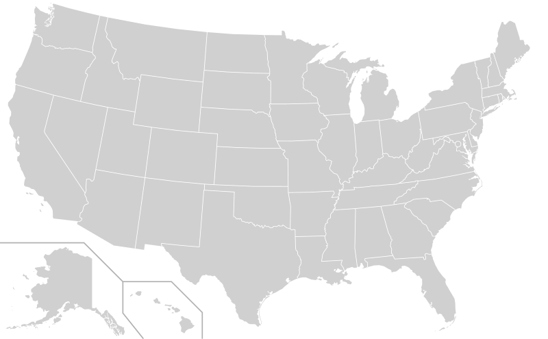
File:Blank US Map (states only).svg
Appearance

Size of this PNG preview of this SVG file: 800 × 495 pixels. Other resolutions: 320 × 198 pixels | 640 × 396 pixels | 1,024 × 633 pixels | 1,280 × 791 pixels | 2,560 × 1,583 pixels | 959 × 593 pixels.
Original file (SVG file, nominally 959 × 593 pixels, file size: 57 KB)
File history
Click on a date/time to view the file as it appeared at that time.
| Date/Time | Thumbnail | Dimensions | User | Comment | |
|---|---|---|---|---|---|
| 13:13, 25 November 2018 |  | 959 × 593 (25 KB) | Newfraferz87 | Correct size | |
| 03:14, 20 November 2018 |  | 1,020 × 593 (25 KB) | Newfraferz87 | Group style | |
| 18:36, 15 November 2018 |  | 959 × 593 (26 KB) | Crazytonyi | Tag states with "state" class and move fill to style block. Makes this easier to reuse as base for similar maps. | |
| 11:59, 19 January 2017 |  | 959 × 593 (32 KB) | Newfraferz87 | Restore geographic DC shape; DC circle can now be hidden in favor of it | |
| 14:20, 18 January 2017 |  | 959 × 593 (32 KB) | Newfraferz87 | Using User:Karlfk's updated map from here, with better defined state borders | |
| 07:01, 12 July 2016 |  | 959 × 593 (32 KB) | Newfraferz87 | Slight inward shift of Alaska | |
| 12:16, 11 July 2016 |  | 959 × 593 (32 KB) | Newfraferz87 | Adjust TX, DC and frames | |
| 12:48, 10 July 2016 |  | 959 × 593 (32 KB) | Newfraferz87 | Correct WA, MI; other slight adjustments | |
| 11:34, 10 July 2016 |  | 959 × 593 (32 KB) | Newfraferz87 | Reorder states following Alaska & Hawaii --> abbreviation order --> DC | |
| 11:12, 10 July 2016 |  | 959 × 593 (32 KB) | Newfraferz87 | Removed all superfluous header codes; reset coordinates of all states |
File usage
More than 100 pages use this file. The following list shows the first 100 pages that use this file only. A full list is available.
- Alabama Miss Basketball
- Alabama Mr. Basketball
- California Mr. Basketball
- Florida Mr. Basketball
- Illinois Mr. Basketball
- Indiana Miss Basketball
- Indiana Mr. Basketball
- Iowa Miss Basketball
- Iowa Mr. Basketball
- Kentucky Miss Basketball
- Kentucky Mr. Basketball
- List of place names of Czech origin in the United States
- List of place names of French origin in the United States
- Louisiana Mr. Basketball
- Michigan Miss Basketball
- Minnesota Miss Basketball
- Minnesota Mr. Basketball
- Miss Basketball
- Miss Georgia Basketball
- Miss Kansas Basketball
- Miss Maine Basketball
- Miss New York Basketball
- Miss Show-Me Basketball
- Mississippi Miss Basketball
- Mississippi Mr. Basketball
- Mr. Basketball
- Mr. Basketball USA
- Mr. Basketball of Arkansas
- Mr. Basketball of Michigan
- Mr. Colorado Basketball
- Mr. Football Award (Alabama)
- Mr. Football Award (Florida)
- Mr. Football Award (Indiana)
- Mr. Football Award (Kentucky)
- Mr. Football Award (Louisiana)
- Mr. Football Award (Michigan)
- Mr. Football Award (Minnesota)
- Mr. Football Award (Ohio)
- Mr. Football Award (South Carolina)
- Mr. Football Award (Texas)
- Mr. Football USA
- Mr. Georgia Basketball
- Mr. Kansas Basketball
- Mr. Maine Basketball
- Mr. New Hampshire Basketball
- Mr. New York Basketball
- Mr. Pennsylvania Football
- Mr. Show-Me Basketball
- North Carolina Miss Basketball
- North Carolina Mr. Basketball
- North Dakota Miss Basketball
- North Dakota Mr. Basketball
- Ohio Mr. Basketball
- South Carolina Miss Basketball
- South Carolina Mr. Basketball
- Tennessee Miss Basketball
- Tennessee Mr. Basketball
- Texas Miss Basketball
- Texas Mr. Basketball
- Utah Mr. Basketball
- Vermont Miss Basketball
- Vermont Mr. Basketball
- Washington Mr. Basketball
- Wisconsin Miss Basketball
- Wisconsin Mr. Basketball
- User:Alam567
- User:AtTheNecropolis
- User:BK2011
- User:CanonLawJunkie/Userboxes/Archive
- User:Corei7Maniac
- User:Crimefighter1991
- User:DJC PDX
- User:Faustus37/Userboxes
- User:JimmySand9/SandboxUser
- User:Jlhcpa/sandbox/Other Miss Basketball
- User:Jlhcpa/sandbox/Other Mr. Basketball
- User:Leobold111/userboxes
- User:Macwhiz
- User:Necropolis Hill
- User:Nightenbelle/Userboxes
- User:Ric36/Sandbox
- User:Ric36/sandbox
- User:Rocketmaniac/Sandbox17
- User:SFGiants2012
- User:Sgt. R.K. Blue/Userboxes/State Constitution
- User:Tech77
- User:The Obento Musubi/Sandbox 3
- User:Vanished user 7b1215e7ef746ac20682e3dbe03f5b84/UBX
- User talk:24.193.77.43
- Wikipedia:Graphics Lab/Illustration workshop/Archive/Sep 2015
- Wikipedia:Graphics Lab/Image workshop/Archive/May 2009
- Wikipedia:Graphics Lab/Images to improve/Archive/Aug 2007
- Wikipedia:Graphics Lab/Images to improve/Archive/Mar 2008
- Wikipedia:Graphics Lab/Map workshop/Archive/2017
- Wikipedia:Graphics Lab/Map workshop/Archive/Apr 2011
- Wikipedia:Graphics Lab/Map workshop/Archive/Aug 2009
- Wikipedia:Graphics Lab/Map workshop/Archive/Feb 2012
- Wikipedia:Graphics Lab/Map workshop/Archive/Mar 2012
- Template:Miss Basketball Award
- Template:Mr. Basketball Award
View more links to this file.
Global file usage
The following other wikis use this file:
- Usage on bg.wikipedia.org
- Usage on bs.wikipedia.org
- Usage on es.wikipedia.org
- Usage on eu.wikipedia.org
- Usage on frr.wikipedia.org
- Usage on fr.wikipedia.org
- Usage on fr.wikibooks.org
- Usage on hu.wiktionary.org
- Usage on id.wikipedia.org
- Usage on ja.wikipedia.org
- アメリカ合衆国の州
- Category:アラバマ州の都市
- Category:カリフォルニア州の都市
- Category:ミシシッピ州の都市
- Category:ニューヨーク州の都市
- Category:カンザス州の都市
- Category:テネシー州の都市
- Category:インディアナ州の都市
- Category:ワシントン州の都市
- Category:ケンタッキー州の都市
- Category:オハイオ州の都市
- Category:サウスダコタ州の都市
- Category:ユタ州の都市
- Category:ルイジアナ州の都市
- Category:ミズーリ州の都市
- Category:ミシガン州の都市
- Category:ネブラスカ州の都市
- Category:ジョージア州の都市
- Category:ニューメキシコ州の都市
- Category:アラスカ州の都市
- Category:フロリダ州の都市
- Category:オクラホマ州の都市
- Category:アイオワ州の都市
- Category:メリーランド州の都市
- Category:テキサス州の都市
View more global usage of this file.

